Good afternoon, folks. Our cold start to November produced a few flakes very early this morning and now we have the return of the 20s for the next several mornings. This means a hard freeze is upon us. Let’s talk about that and where the pattern goes from here.
Our cold front continues to slide to the east and south of us, but it did manage to bring some chilly showers to the region last night and this morning. Some folks even saw the first wet flakes of the season mixing in during the early morning hours…
A little rain/snow mix to kick off your Tuesday in Clark Co. #ChrisWasRight @Kentuckyweather @allyblakewx @JimWKYT @AdamBurnistonWX pic.twitter.com/vxwCxSdQCz
— PLPhoto2015 (@PPhoto2015) November 2, 2021
Lingering moisture may still produce some showers across the far southeast and those high mountains may even see some flakes mixing in. Here are your radars…

Temps this afternoon stay in the 40s for many and we are likely in the 40s for highs for most of the rest of the week.
Lows by Wednesday morning reach the upper 20s to low 30s with those numbers likely to drop even more Thursday and Friday mornings. That means the numbers will be deep in the 20s. That’s right, the roaring 20s are back baby!!

The next system skims southeastern Kentucky the next few days, but this is a mainly dry pattern through the weekend and into early next week. Temps will slowly moderate during this time, but a big change is already showing up later next week. Watch this deep trough digging in…
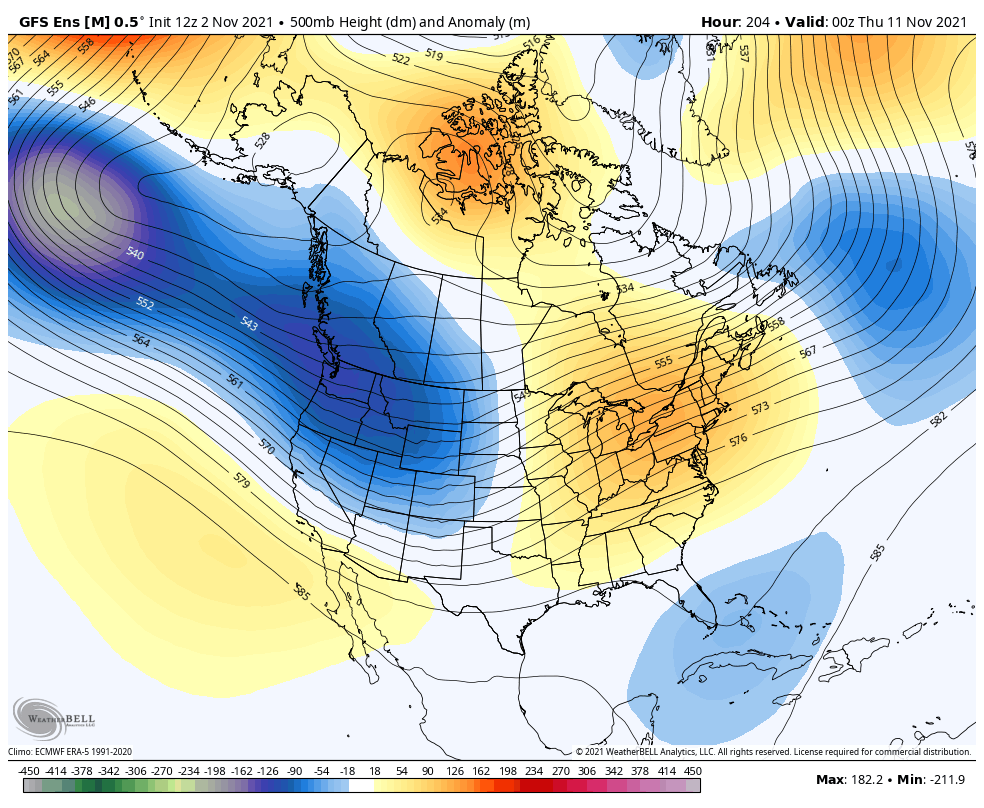
I see that kind of setup and wonder if that’s one that goes from strong storms to a winter look in a matter of days.
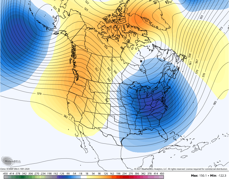
Speaking of a winter look, you know my thoughts on a cold first half of winter and the latest GFS Extended likes that. Check out the November 5-December 5 average 500mb height anomalies…
Much more winter talk coming in the days ahead. Enjoy the evening and take care.
