Good Tuesday, everyone. A cold front continues to work across the state allowing much colder temps to set up shop around here for the next several days. This is kicking off what is likely to be a colder than normal month and that should flow right into a colder than normal start to the traditional winter season.
The front moving through today has some very chilly showers with it and there’s the outside chance for a morning wet flake or two showing up somewhere. The best chance will be across the high ground of southeastern Kentucky. Here are your radars for the day…

Temps this afternoon range from the middle 40s to lower 50s depending on where you are. Gusty winds will certainly add more of a chill to the air.
The numbers from this point are solidly below normal through the upcoming weekend. Highs in the 40s and lows in the 20s may not sound “cold” by the middle of winter standards, but normal highs right now are still in the 60-65 degree range across the state.
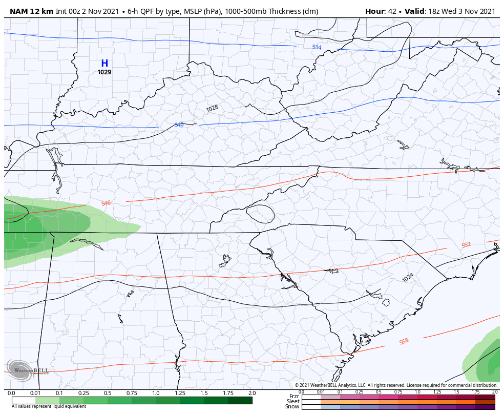
The system coming in by Thursday continues to look like it stays largely to our south, but it may get close enough to the southeastern corner of the state to produce a little rain or mixed rain and snow for a time. Here’s the NAM…
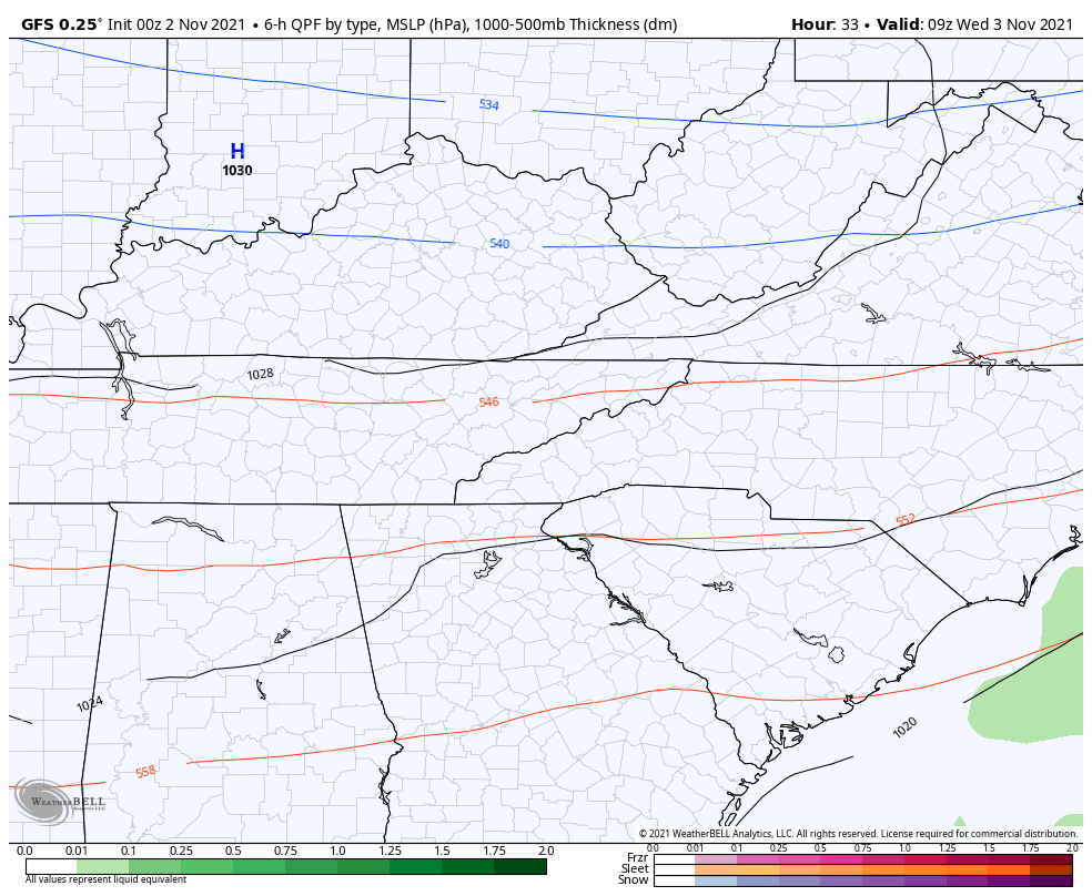
The GFS actually shows a touch of a mix along the Tennessee border Wednesday before that glancing blow in the southeast on Thursday…
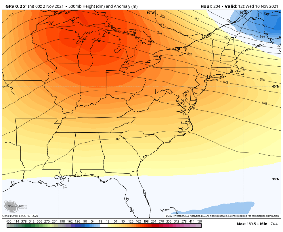
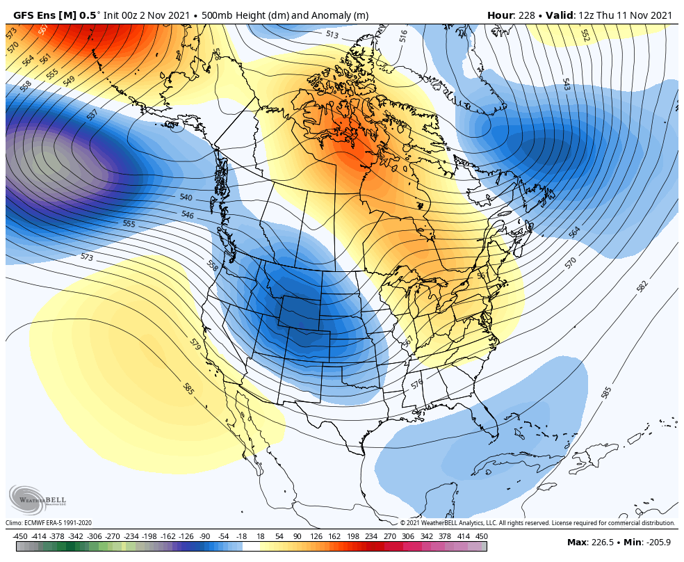
The pattern next week looks to moderate, but there’s a strong indication of another deep trough developing late in week two and continuing from there…
GFS
GFS Ensembles
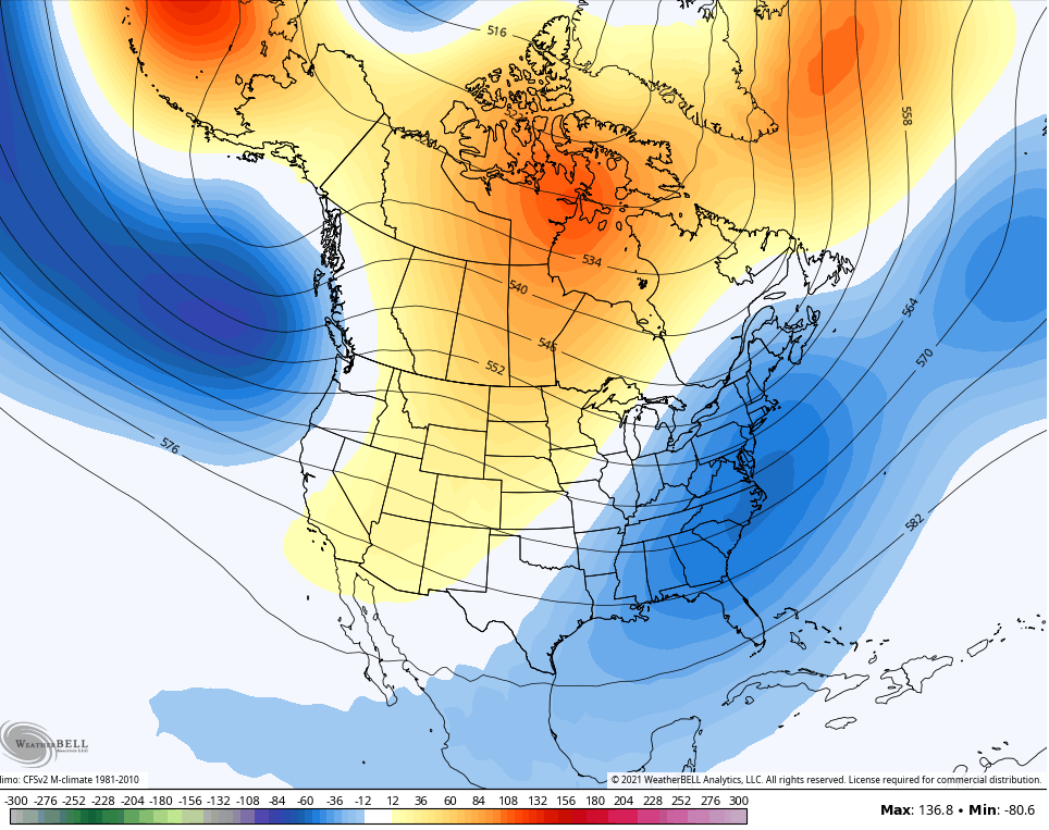
The latest CFS seasonal forecast is out and shows a continuation of an eastern trough on average through November…
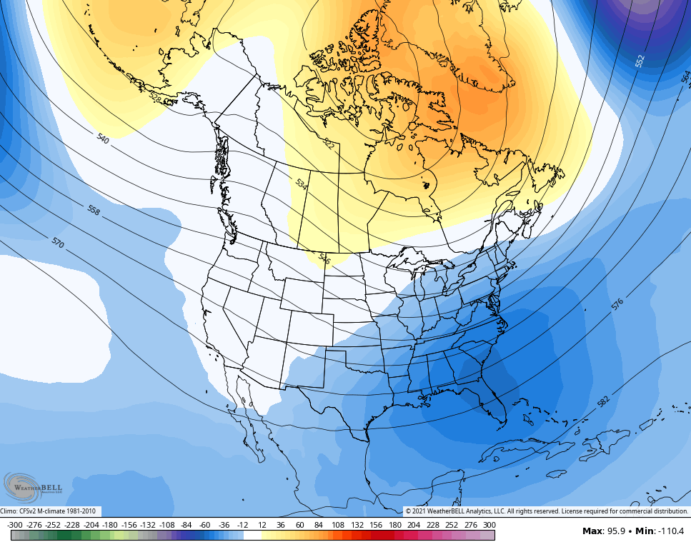
It keeps that trough rolling into December…
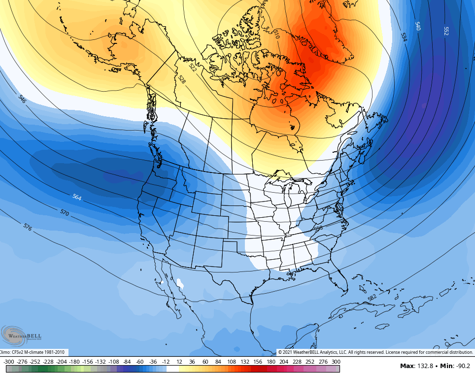
January shows the trough becoming more of a coast to coast variety…
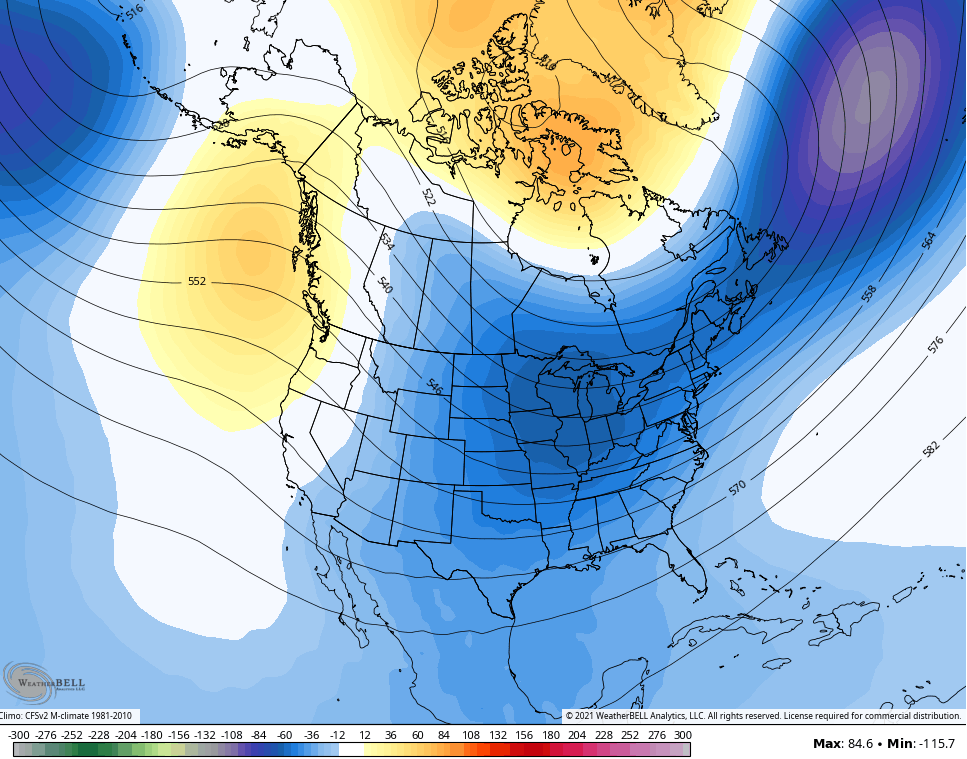
And this run really drops the February hammer across the country…

Thanks Chris, looks like strong blocking in the North Atlantic would cause the NAO to go very negative and that would give us here in the Ohio Valley a very cold and Snowy Winter ? We will find out in May for sure.
Alaska is forecasts to have record snow for the next 7 days and if I’m correct the last couple winters in Alaska been very warm. Maybe this is a sign of getting back what winter should be in the states.
For your information, Alaska and the West Coast had a record warm and almost Snow-less Winters in the years 1976 through 1978. I remember Alaska canceling the ” Dog sled races.”
The PDO teleconnection was in the warm or positive phase those years with a weak ENSO.
Interesting, the harsh Winter of 1917-18 the Great State of Alaska had a very frigid Winter with a weak La Nina in place, but the NAO was very strongly negative.
I study the Arctic Region quite a bit along with the Polar Low (Polar Vortex) and currently most of the Arctic air is over Siberia and with the advancement of the Ventusky weather site through the eleven November shows the Arctic air moving into Alaska. From there it may well make it South into the US, but this depends on the teleconnections. The EPO, AO and the NAO all going very strongly negative and the PNA going strongly positive ?
Looking at next Fall and Winter 2022-23 indicates ENSO may form in the Tropical Pacific and if that happens we may have that Cold and Snowy Winter then ??? But lets not get ahead too quickly. LOL