Good Friday, folks. As we head into the first weekend of November, our weather pattern remains colder than normal and pretty darn calm. This calm weather will take us into early next week before big changes show up. Those changes will likely bring a much colder pattern and bring some winter weather potential in here.
Let’s kick this party off with the weekend outlook: It’s awesome!
Ok, that’s out of the way. 😁
Temps into early next week will warm into the 60s as winds begin to come at us from the southwest. Things remain very pleasant through Tuesday so get out there and enjoy it.
The pattern then features a big dip in the jet stream working from the west and then that rolls east and likely becomes a major cutoff low in our region by late next week into the weekend. Here’s how the GFS sees the upper levels coming together…
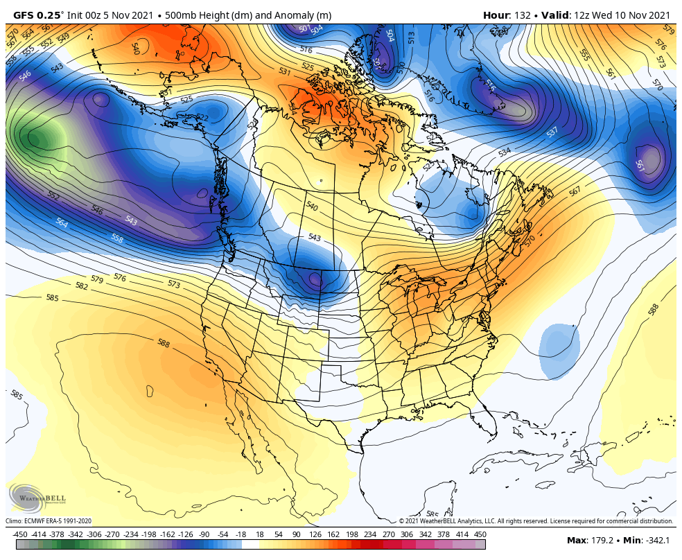
That type of a setup can take us from the 60s to showers and thunderstorms, to a temp crash and some winter weather…
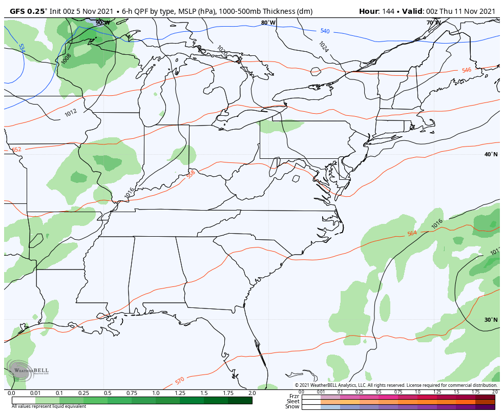
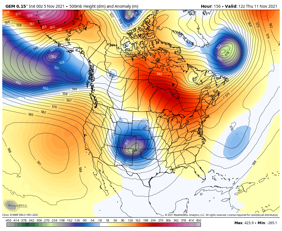
All the models will differ with the details from run to run. That’s a 100% fact, so it’s all about taking the trends of the models instead of getting stuck on any one run.
The Canadian Model differs from all the models and it’s last run with a farther south cutoff…
The coolest animation comes from the GFS Ensembles. Watch how this HUGE trough in the Gulf of Alaska splits with one part going back toward the Aleutians and the other essentially spilling into the US and rapidly deepening into our region…
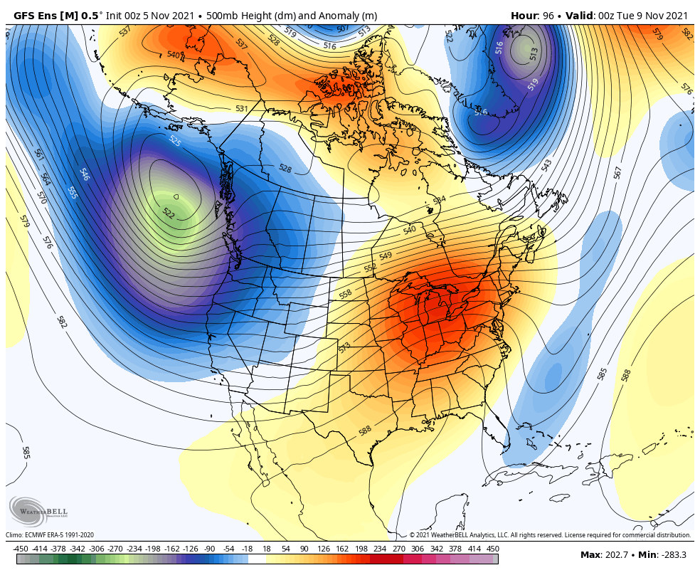
That’s literally mother nature “pouring” a trough into the country.
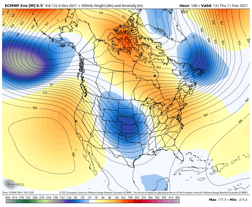
The EURO Ensembles continue to show the trough becoming more established near the Aleutian Islands with a ridge going up the west coast. That helps push those troughs deeper into the eastern part of the country through the middle of the month…
I will have another update for y’all later today. Make it a fantastic Friday and take care.

Here’s a link to an awful weather event I will never forget as I was living in Vanderburgh County, Indiana in 2005.
https://www.weather.gov/pah/2005EvansvilleTornado#PATHMAP