Good Thursday, folks. It’s a windy day as a strong cold front moves across the Commonwealth. This is bringing rain and much colder air back in here and this continues to look like a signal for what’s to come. A very cold setup is still taking shape for turkey week.
Today’s showers sweep quickly across the state from west to east and should be out of the state by late afternoon. The window for rain is generally 3-6 hours for any one location with some clearing showing up once the rain ends where you are. Here are your radars…

Much colder air comes in behind this with temps staying generally in the 40s this afternoon and then dropping into the 20s overnight. Friday looks good, but seasonably cold with highs ranging from the upper 30s to middle 40s. Gusty winds make it feel colder than that.
Saturday looks seasonable with 20s to start and 50s to end with a mix of sun and clouds.
The next system continues to look potent for early next week. Rain develops ahead of this on Sunday and then the cold air crashes into the region from the northwest. The latest GFS is back to a deeper and farther west solution and would give us some northwest flow flakes on Monday…
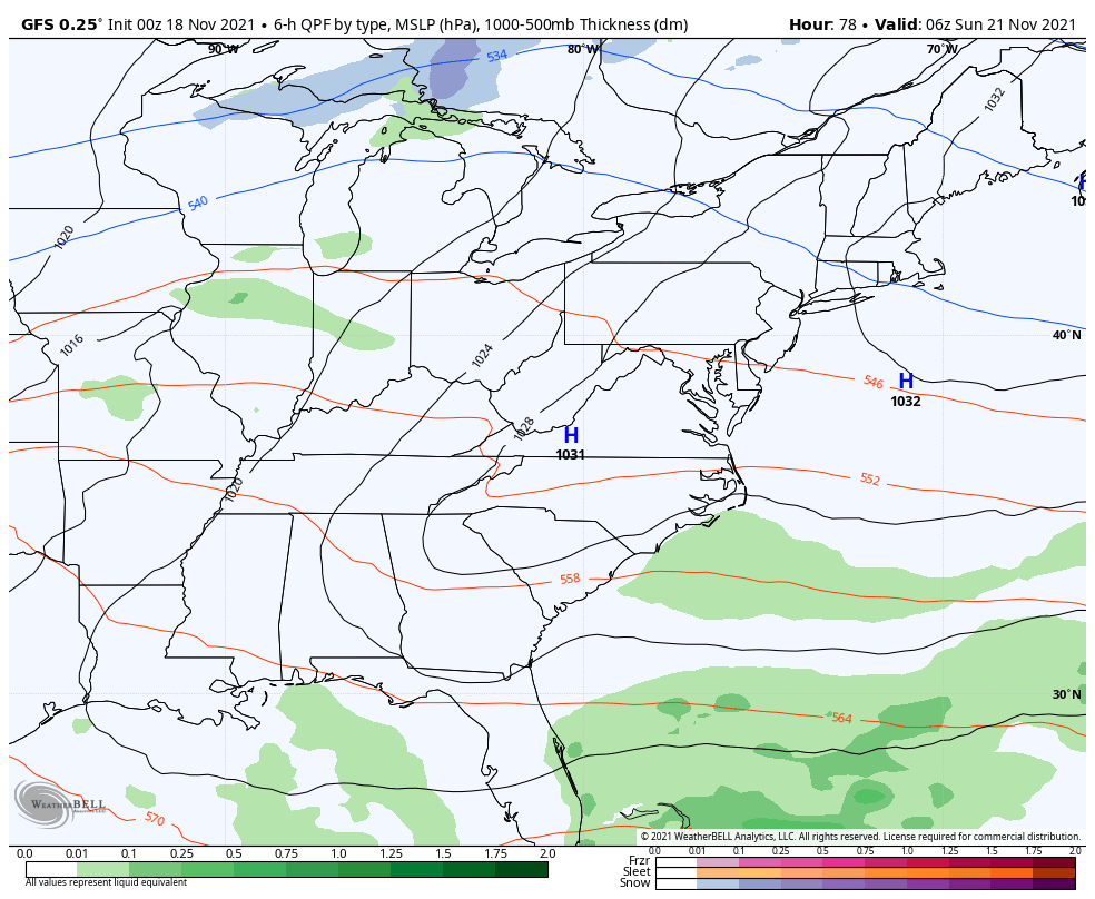
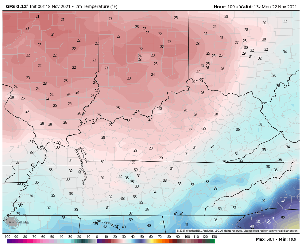
With the deeper system, the temps are much colder than earlier runs. Check out the GFS temp animation from 8am through 11pm Monday…
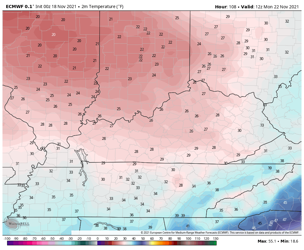
The EURO temps are very similar. Here’s the animation from 7am Monday through 7am Tuesday…
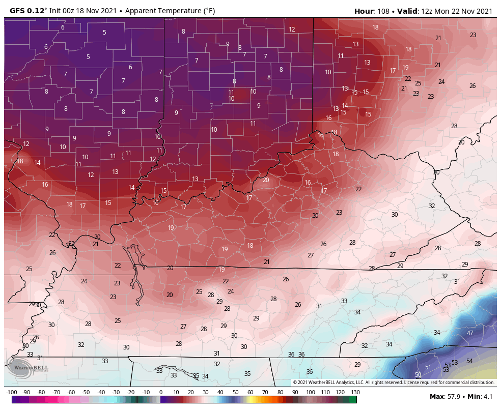
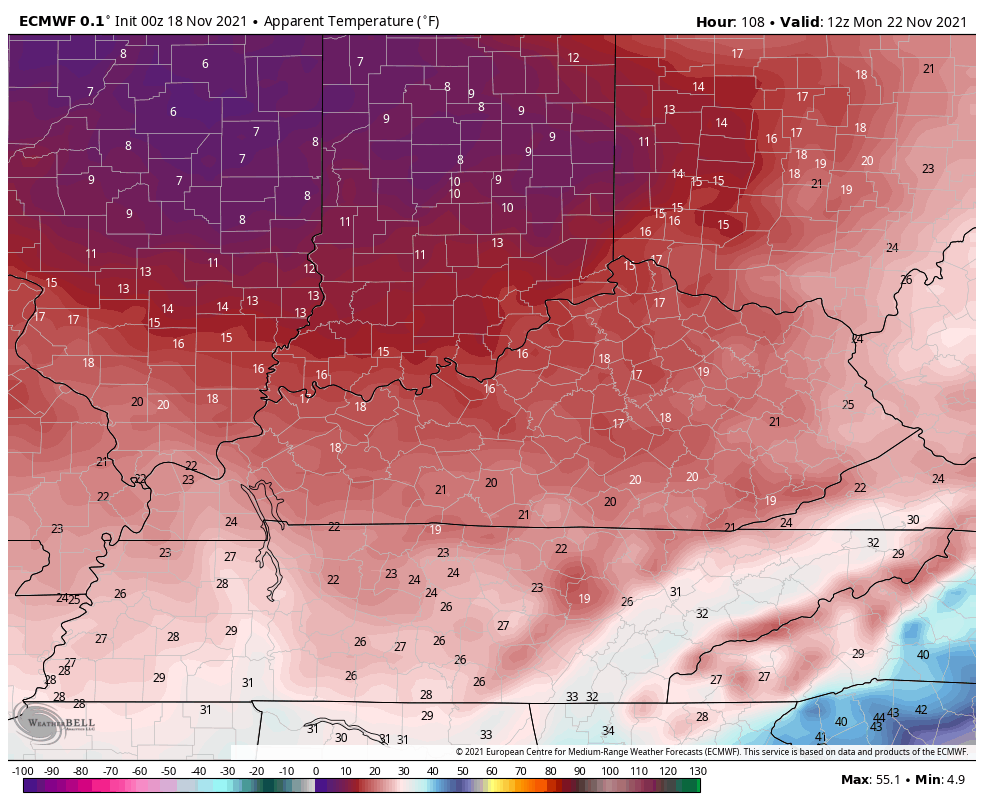
Wind chills on this run are brutal for this time of year.
GFS
EURO
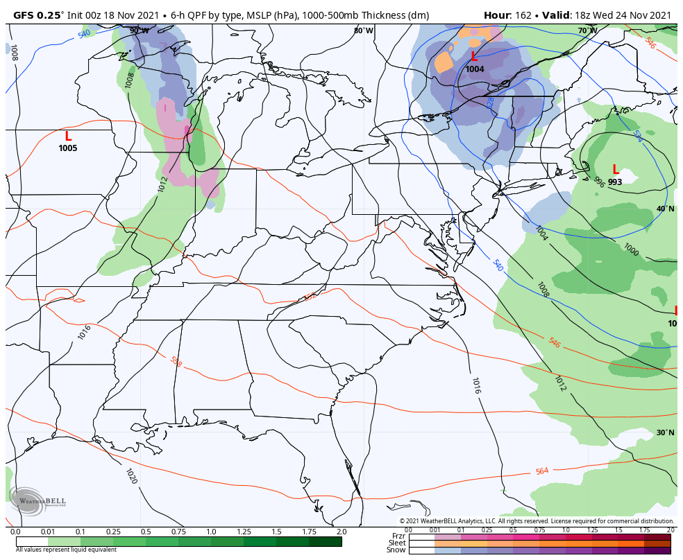
The late week system, as expected, is all over the place on the models. You’re going to see lots of extreme back and forth in the coming days, so just understand that going in.
The GFS looks totally different from the last run…
The Canadian had a monster storm with the last run, but the newest run has a setup that looks like the Monday system…
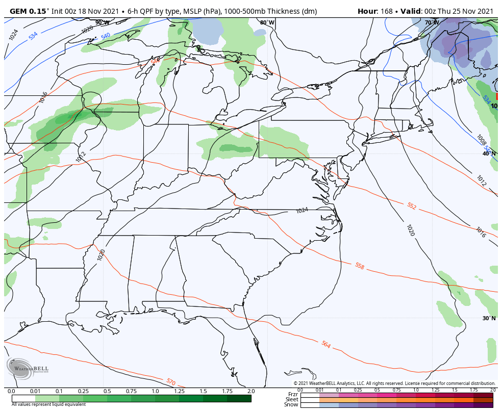
The EURO still has a storm system, but is different than the last run…

If we look at the period from Thanksgiving through December 2nd, we find the EURO Ensembles with blocking over the top and a trough showing up across the eastern half of the country…
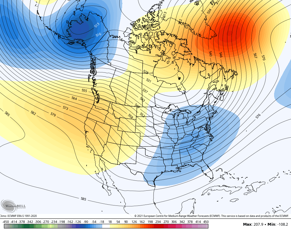
Remember, that’s a 5 day average of 51 members of the EURO Ensembles. If we look at the 5 day average of the single run of the EURO Ensembles, we see an even deeper trough with extreme blocking over the top…
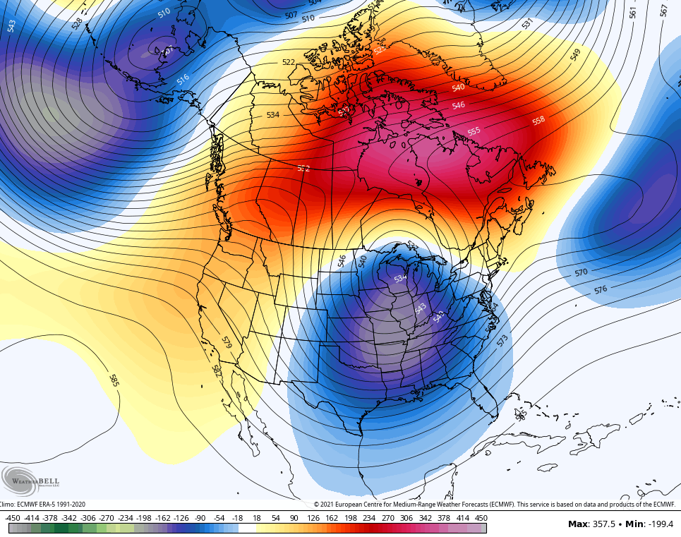
Dang!
Don’t forget tonight’s the night…
I will have updates later today, so check back. Have a good one and take care.

Looks like we may endure an early January type weather next week.