Good afternoon, everyone. We continue to watch a little bit of light snow working into the region tonight and early Wednesday. This can put down light accumulations for SOME areas of the state. The system after this continues to get my attention for the weekend as it may produce severe storms, flooding rains and a big temp swing.
Snow lovers continue to be hugging the GFS for tonight’s streaks of light snows because it’s the most widespread of the bunch. Here’s the current view from the GFS…
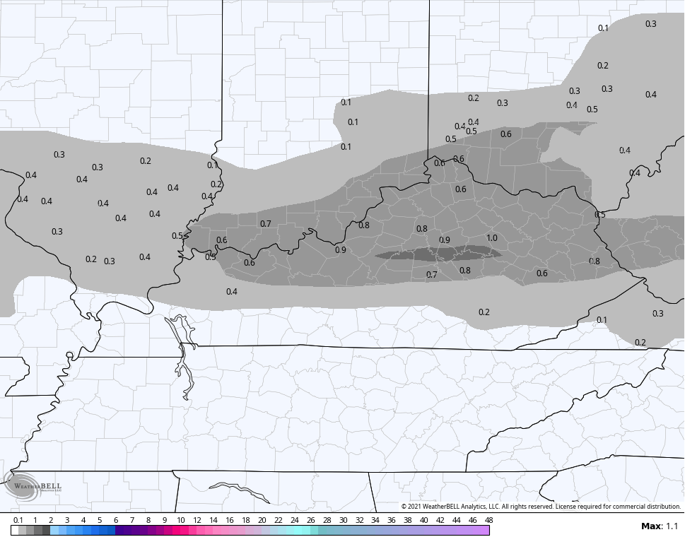
Other models like the NAM are much skimpier with the light snows with one streak in the north and another in the southeast…

That’s a pretty drastic difference, even for a very light event.
I’ll hold with what I’ve got out there…

I might expand that to include more of the southeast and will have a new map on WKYT-TV starting at 4pm then on KWC later today.
Again, if you’re expecting a lot from this, that’s on you. 😜😁
The weekend system will bring all kinds of wild weather to the region. Here’s a quick recap:
- Strong to severe storms are possible Friday into Saturday.
- With or without severe storms, high winds may become a problem.
- Heavy rainfall of 1″-3″ may cause flooding issues for central and eastern Kentucky.
- Record highs are possible Friday into early Saturday.
- Temps crash from west to east Saturday and there’s the chance for some flakes to show up as the rains end late Saturday.
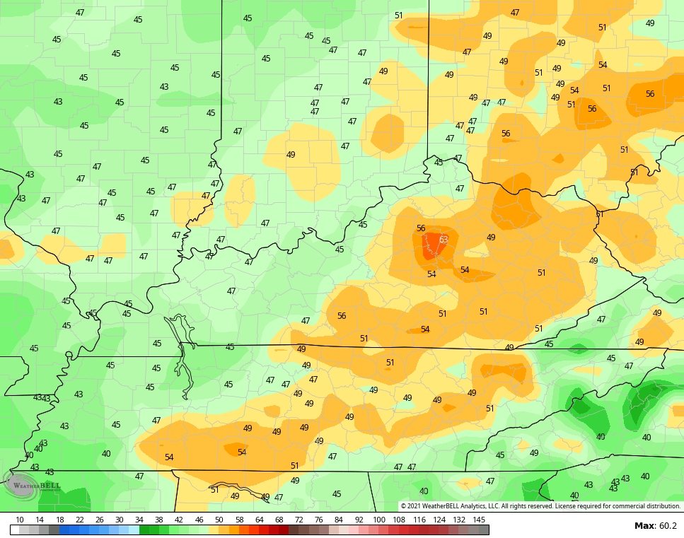
Here’s the area I’m most concerned with in terms of possible flooding…

The GFS rainfall forecast…

Check out the current wind gust forecast…
Check back later today for those updates.
Until then, let’s watch for those bands of light snow to try and show up on our radars…

Have a great day and take care.

Not much to get all excited about.
Rarely is. Rarely!
There won’t be until the big chill comes later this month or January, that is if it comes to frustration what Chris is forecasting.