Good Wednesday to one and all. Our middle of the week is starting with just a touch of light snow for some areas, but the focus going forward is on a big storm system ready to impact the state this weekend. More wind, heavy rain and strong storms look to be in the cards.
Let’s kick things off with what’s happening out there today. We start things out with a few streaks of light snows across central and eastern Kentucky, but this stuff winds down this morning. Some minor accumulations are possible, especially on grassy and elevated surfaces. Can a few spots squeeze out a half to one inch of snow? The chance isn’t great, but it’s not zero.
Here are your radars to find the festive flakes…

Watch for a few slick spots early this morning.
Skies become partly to mostly sunny this afternoon with temps ranging from the upper 30s to near 50, depending on where you live.
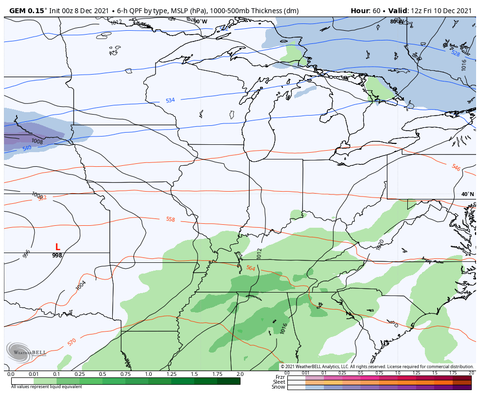
Now it’s time to concentrate on the weekend storm system. Here’s a breakdown:
- The system is speeding up in arrival time and duration with the bulk of the action coming Friday into the first half of Saturday.
- Scattered showers and storms will be noted from Thursday evening into Friday.
- A powerful cold front sweeps in Friday night and brings a line of heavy rain producing thunderstorms with it.
- Some of those storms may be strong or severe and the greatest threat may come during the overnight hours Friday into early Saturday.
- Damaging winds will be possible during this time. Can we get another spin up or two?
- The faster moving system decreases the general flooding risk, but we still have a flash flood risk.
- 1″-3″ of rain may show up during this time.
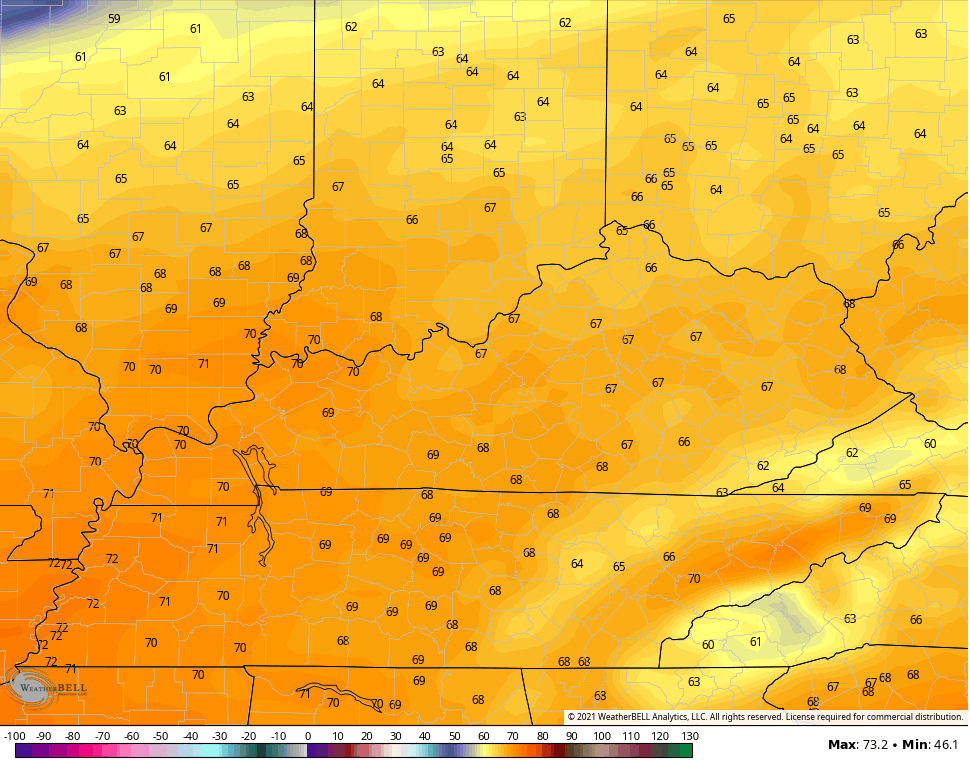
- Temps may flirt with record highs from Friday afternoon into the wee hours of Saturday.
- Temps Saturday crash quickly with temps falling into the 30s in the late afternoon. Wind chills make it feel much colder.
- Can we get some flakes to fly behind this?
Here’s a look at how the overall progress of the system looks…
High temps ahead of this system may flirt with records…
Those wind gusts will be way up there and may approach 50mph at times with locally higher gusts possible with storms. The GFS wind gust forecast…

After a seasonably cold Sunday, temps take off again early next week as a massive ridge of high pressure builds in across the eastern half of the country…
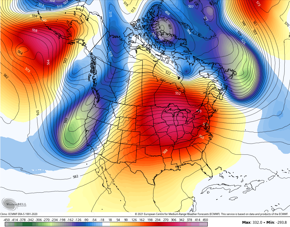
That’s gonna set some record highs across different parts of the country. The above map is the EURO for next Wednesday, but the model breaks it down pretty quickly. Here’s how things look just 2 days later by next Friday…

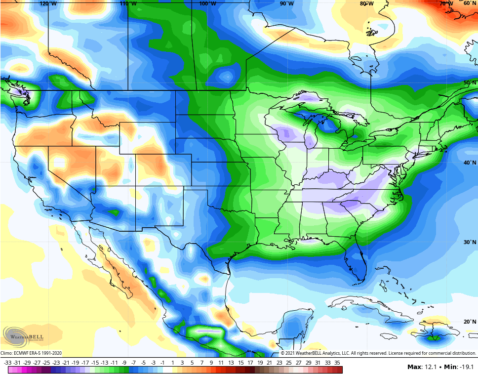
That’s quite the change as that trough digging into the plains looks to surge toward the east and southeast with much colder air.
I’ve been highlighting a pattern change for the second half of December into January since my winter forecast in early November. Recent posts have focused on how the major indices we look at are pointing toward this flip taking place.
Some of the recent seasonal models have been indicating this change pretty well on certain runs. The CFS is showing the change starting in the days leading up to Christmas and then kicking into high gear Christmas week through the first half of January.
Here’s the CFS ensembles showing the well below normal air for the final week of the year…

The operational for that same week is even colder…

Here’s the first week of January…
The control run for the first week of January is much colder…

Again, some of the recent analog years like 1984 and 1978 both saw major flips to cold in late December and early January. Is that where we go from here? Time will tell, but that’s an option on the table.
I will have updates later today. Have a good one and take care.

I’m beginning to get in the ‘Spring Mode.’ It would be the earliest Spring sense the years 1974-75.
Not looking forward to the severe weather predicted this weekend. Last weeks severe weather brought down a dead tree across my driveway.
I’m thinking now that some Winter weather will come at the time we don’t want it. In late April 1975 we had a hard freeze along with Snow squalls resulting in the lost of much of my nursery stock. Had to start over again. Bummer !
(since not sense), sorry my spelling is terrible.