Good afternoon, everyone. Our focus going forward is now on the increasing potential for strong to severe storms and flash flooding late Friday into early Saturday as another potent storm system moves in. This setup has been well advertised here on KWC, so now we just try to nail down the specifics.
Before looking ahead to that, let’s look back at our light snowfall of this morning. Here are a few of the snow tweets I got…
https://twitter.com/dowdypfootdoc/status/1468549308744183810?s=20
❄️ @Kentuckyweather pic.twitter.com/GLzcruXdg4
— Kim (@blufeatherz) December 8, 2021
@Kentuckyweather Florence KY this morning was very slick on the roads pic.twitter.com/daqngMoHvG
— Michael Warren Hamilton (@MWHamilton9292) December 8, 2021
@Kentuckyweather greenup ky pic.twitter.com/vviRp0m112
— Corey Hall (@coreyfromtheky) December 8, 2021
https://twitter.com/MaryReedRunyon1/status/1468579184733794304?s=20
From snow back to severe storms. The Storm Prediction Center already has much of the region in a Marginal to Slight Risk for severe weather late Friday…

That will likely expand east Friday night and Saturday morning as the line of storms races through. Here’s what to watch for:
- Damaging winds of 50mph or higher
- A few tornadoes
- Small to medium sized hail
- Heavy rainfall of 1″-3″ may cause flash flooding
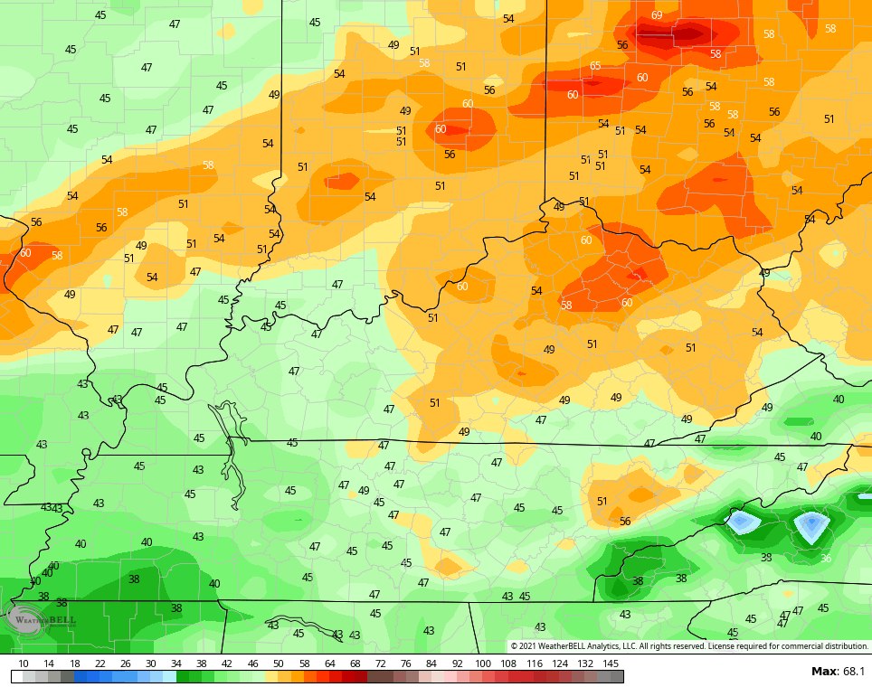
One of the severe factors I’m looking at is the high dewpoints. Watch how these numbers spike deep into the 60s, which is absurd for this time of year, before crashing behind the cold front…

Storms will have plenty of fuel, folks.
Winds are a major player and gusts of 50mph or higher will be possible. The GFS has some 60mph gusts…
The NAM isn’t far behind…

The longer range pattern continues to skew warmer than normal next week, but those changes we talked about continue to show up from late next week into Christmas week. Watch how one trough swings in by next Friday with a deeper system trying to take over Christmas week…

Enjoy the rest of your day and take care.

I will stay tuned to your upcoming forcasts.