Good afternoon, folks. For this December, today is a brutally cold one across the Commonwealth with temps ranging from the upper 30s to low 40s. As we head into Christmas week, temps look rather seasonable for the next several days before bouncing up ahead of a series of storm systems leading to a pattern change.
Our Sunday morning snowflakes showed up right on cue this morning across eastern Kentucky…
Snowing on the top of Pine Mountain above Whitesburg. #kywx @Kentuckyweather @JimWKYT @allyblakewx @AdamBurnistonWX @EvanWYMT @brobwx @cameronwymt pic.twitter.com/bXbVUhPdTH
— Shane Smith (@ShaneSmithMedia) December 19, 2021
Rain and snow mix in Powell Co on the Mountain Parkway @Kentuckyweather @JimWKYT @kywatchman pic.twitter.com/jHFUlWVGMm
— Regina Thomas (@ReginaT248818) December 19, 2021
Slade KY snow showers @JimWKYT @brobwx @Kentuckyweather @nwsjacksonky pic.twitter.com/v9EkSj2iLJ
— Johnny Ray Feltner (@JohnnyRayFeltn1) December 19, 2021
Festive flakes!!! ❄️🎄🎅
A few of those may still hang around the east into part of the afternoon…

Near normal temps are with us through Thursday, but southwest winds boost temps ahead of our next storm system. That boost in temps coincides with Christmas Eve and Day.
This first system moves in with some showers Christmas Day and sets the stage for a much bigger system to come in a few days later. Here’s how the models see this playing out…
CANADIAN

GFS

EURO

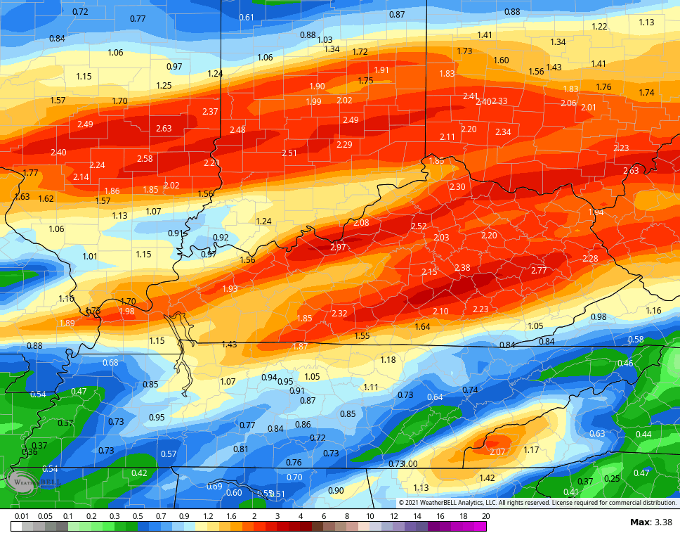
I’m concerned this pattern is setting us up for one more strong thunderstorm and heavy rain event before the pattern fully changes. The models are showing my concern with the heavy rain potential…
EURO

CANADIAN
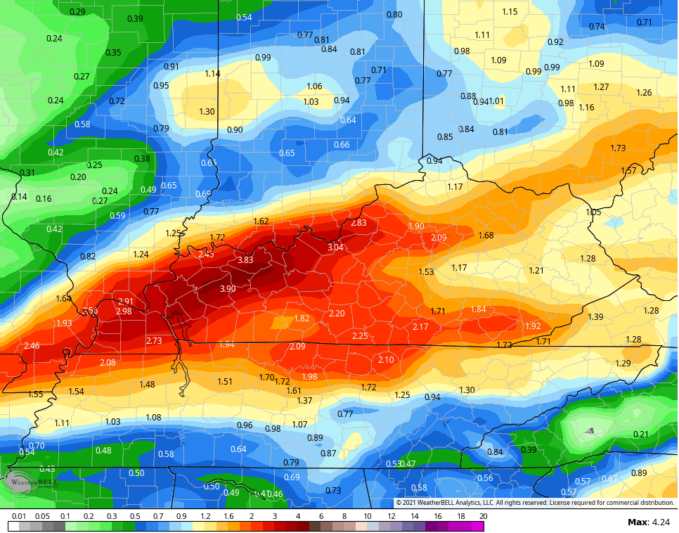
GFS
Folks, we REALLY need this pattern to go ahead and take control…

We know this is a warm December and will be the warmest since 2015, but folks need to be focusing on the consequences of this above normal setup with this type of pattern. We’ve seen those consequences play out in recent weeks and my fear is we aren’t totally done in paying a price.
Enjoy the rest of your day and take care.

If it is not going to snow. I rather have a mild Christmas.
I hope the Southeast ridge weakens in the coming days and the troughs move farther south and La Nina would trend more towards neutral phase plus the MJO goes to phases 7 and 8 and the PDO trends positive and NAO goes strongly negative. Will this happen ? It would be a nice gift for all the Snow Lovers out there if it did !!!