Good evening and Merry Christmas, folks. Y’all just lived through history as we just wrapped up the warmest Christmas Day in recorded history here in Kentucky. The pattern ahead remains unchanged and it’s one that can get is in some trouble.
Before we take a quick look ahead, let my tweets sum up today’s record warmth…
Folks, you just lived through the warmest Christmas on record in Kentucky.
Record Highs:
Bowling Green: 76
Louisville: 75
Paducah: 74
Frankfort: 72
Lexington: 70 (Ties)
Covington/Cincy: 69#kywx— Chris Bailey (@Kentuckyweather) December 25, 2021
Some perspective on today's record-tying warm Christmas in Lexington:
Today was warmer than every day from this November.
Today was warmer than the high temp from 14 days this past May.
Today was 60 degrees warmer than the 10 degree low temp from last Christmas. #kywx
— Chris Bailey (@Kentuckyweather) December 25, 2021
The amount of “firsts and worsts” continue to add up, my friends.
We do have a weak cold front dropping in from the north and it’s bringing a line of showers and maybe a few storms. The best chance is across the central and east and our radars have you all see to track…

The pattern for the closing days of the year is one that features several systems rolling across the region…
GFS

CANADIAN

EURO
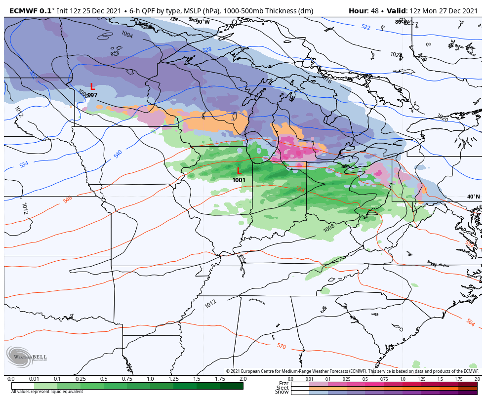
Locally heavy rains and some thunderstorms will likely fire up during this time.
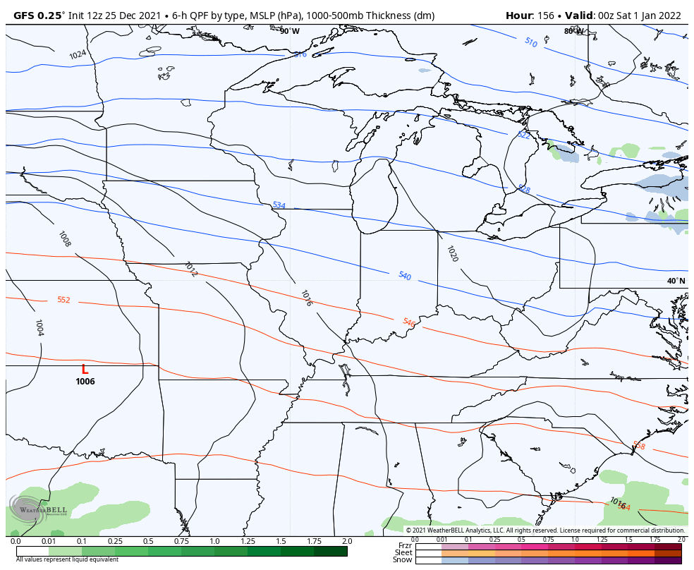
Once we hit the New Year, the potential is there for a major storm system to rumble across the region. This has an ugly look to it…
GFS
CANADIAN

EURO

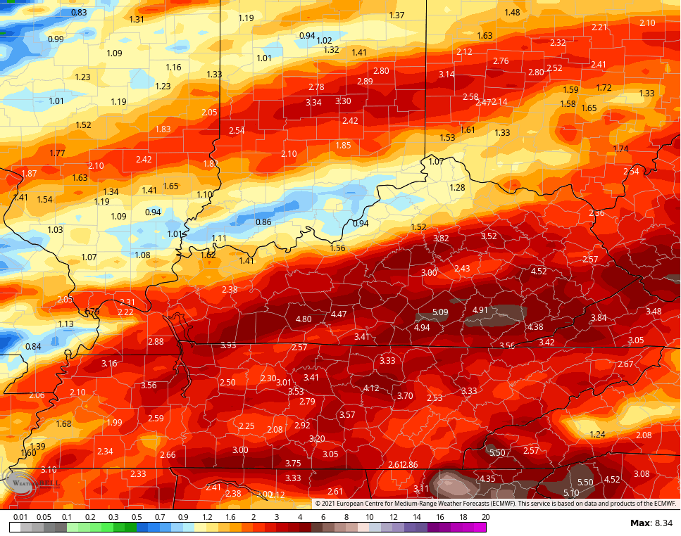
The heavy rain potential is getting most of my attention with this type of pattern. Here’s the GFS from earlier today…

The late day GFS looks like this…

The EURO rainfall forecast looks like this…
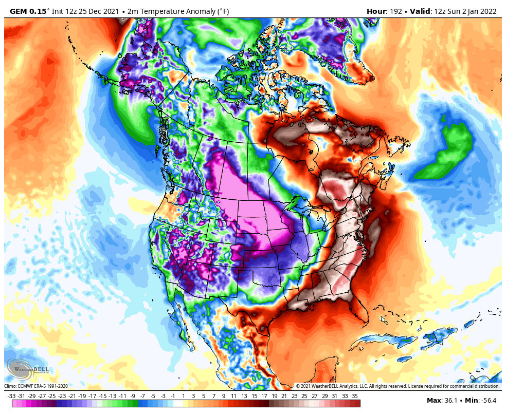
You can see how all the above models do bring the cold in here with that storm system that starts 2022. Here’s a better look at that…
Enjoy the rest of your Christmas and take care.
