Good Sunday, everyone. It’s the day after Christmas and this is normally a down day for your friendly weatherdude, but this year didn’t feel much like Christmas. So, let’s get on with flipping the calendar! 🙃 I know a lot of folks agree with me on flipping the calendar to winter and that’s on the way over the next week or so.
Unfortunately, we have a lot of ugly weather to go through before we can get there.
Let’s start things out with what’s going on out there today. We have a cooler day in store, but the numbers still run above normal with 50s for many. Skies will feature a mix of sun and clouds and there’s the chance for a shower or two. Here are your radars…

As mentioned, this is a very busy pattern ahead of us. This comes from a stubborn front draped across the region with waves of low pressure rolling along it. Just look at the temp gradient we are working with in the next few days. This animation goes from 7am Monday through 7am Wednesday…

That’s from the GFS and it continues to show our systems very well…

The Canadian looks similar…

What all this tells me is we are dealing with rounds of showers and thunderstorms that can put down heavy rains for the week ahead. Gusty winds will also be an issue.
The next system looks to be the one that could become a big problem for a lot of folks and be a pattern changer. This arrives right on cue with the time we’ve talked about to flip things to cold… Right as the calendar flips to 2022.
This storm may bring strong storms, heavy rain, gusty winds and be followed by a temp crash and winter weather threat. The GFS is seeing this well…

The Canadian is in lock step…

Here’s the EURO for the same time…

I continue to be worried about the potential for too much rain over the next week or so. The models are consistently spitting out some worrisome totals. Here’s the latest GFS…

The EURO numbers are up there…

This run of the Canadian isn’t as wet, but it still has quite a bit…

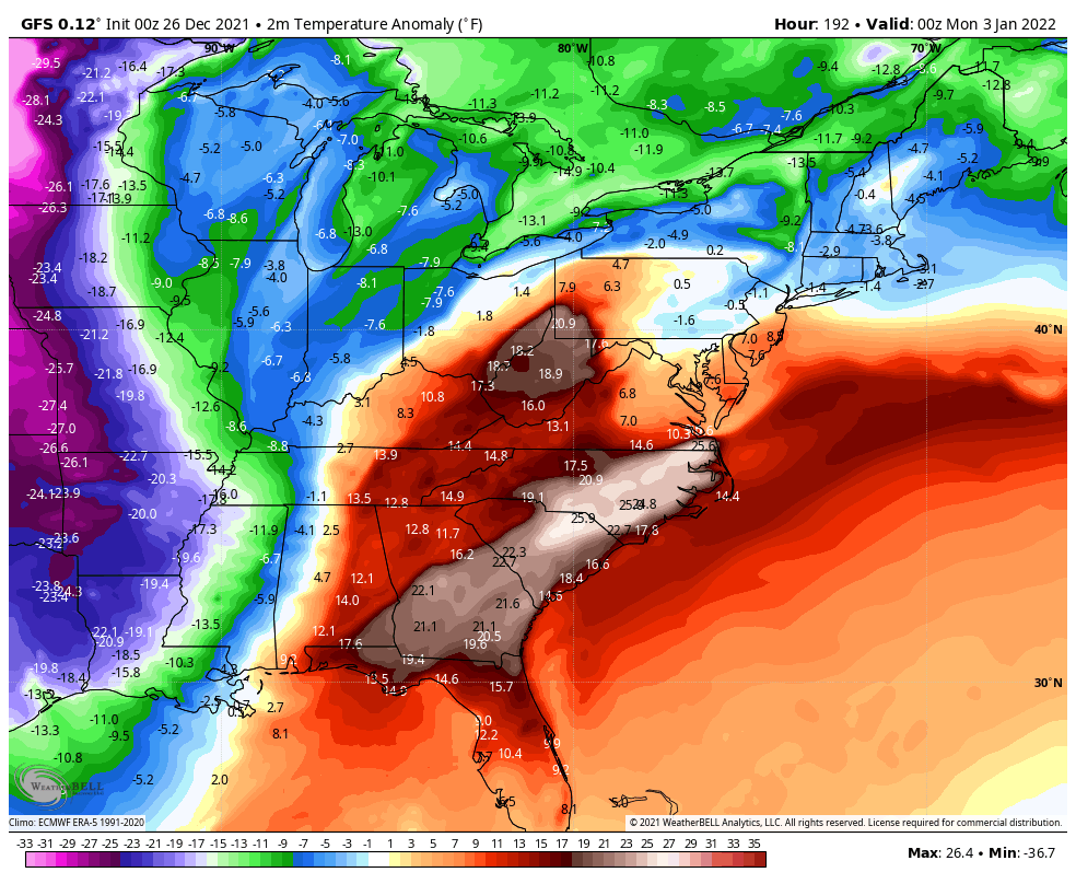
In terms of the cold coming in to start January, the models continue to see it a little better. The latest GFS shows the much colder than normal numbers taking over…
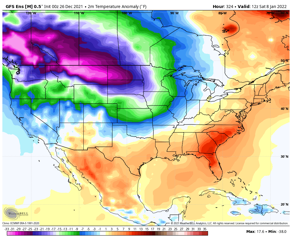
Beyond that, we may very well see temps go into the tank for much of the country. The Ensembles are about as cold looking as you will ever see them…
Canadian

GFS
From one extreme to the other across the country? The 1984/85 winter analog is strong with this one.
I will have another update later today. Make it a good one and take care.

Thanks Chris, Not sure, but I think the high temperature on Christmas was 73 degrees in Maple. Probably the warmest I’ve seen in 50 years.
The year/Winter 1985 was brutal across the South and Southeast. Florida’s citrus crops completely froze out and Texas had lots of Snow.
All three computer models are showing significant snow over Northern IL and the Chicago area for next weekend. I’ll be following that with great interest all this week to see if the models remain consistent with that outlook.
The historic snow drought here may finally be coming to an end!
Yep, I just got done checking the possibility of Snowfall and looks promising in Northern Illinois. Looks like a large swath of Snow up your way Mike.
Here in Kentucky maybe some light Snow around the 7th of January ?
With cloudy skies today were struggling to hit 50 degrees after yesterday brief spring like 72 degrees.
We had an afternoon of Sunshine and Springtime temperatures in the mid 60’s. Now the skies have clouded over and looks like Rain.