Good afternoon and Happy New Year’s Eve. Rounds of strong to severe storms begin to target the region shortly and these will carry us into New Year’s Day. These storms will likely cause flooding issues to develop through Saturday night. From there, we track a light snow maker for some later Sunday.
In the overall scheme of things, I have no changes to my thoughts from earlier.
Here’s the latest Severe Weather Outlook from the Storm Prediction Center for this evening…

The New Year’s Day threat focuses farther north and east and the SPC now has the Enhanced Risk into southern Kentucky…

Damaging winds and a few tornadoes are possible tonight through Saturday evening.
I remain VERY concerned about the threat for flooding and flash flooding with a large swath of 2″-4″ of rain showing up…

Some 4″+ totals will show up and this will enhance the threat for flash flooding and general flooding. Please stay alert!
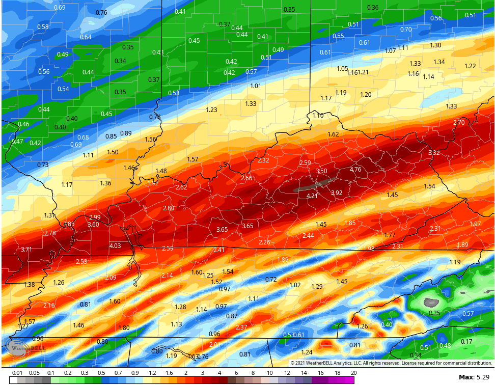
In terms of what the models are saying in terms of the flooding potential, the numbers are way up there.
The NAM has some nasty looking totals…

The HI RES NAM isn’t as crazy, but it’s still way up there…

Another Hi Res model known as the WRF looks like this…
Canadian

GFS

EURO
The system coming in behind this can drop some light snow Sunday into Sunday evening, especially across the south and southeast. Here’s how the Canadian sees this…

The GFS…

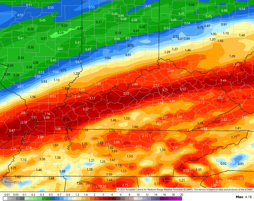
And the EURO…

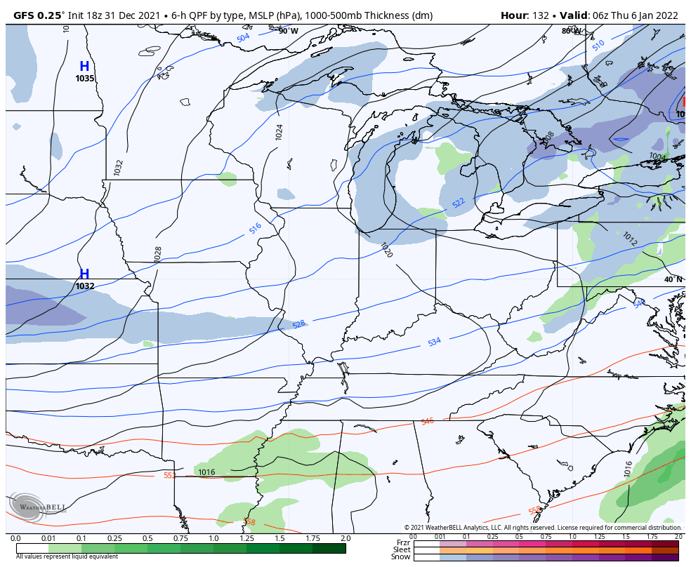
The next system is along an arctic front moving in here on Thursday and may deliver another shot at snow…
GFS
EURO

I will have additional updates later this evening and through the night. I will also have the continuing coverage as needed on WKYT-TV.
As usual, I have you all set to track the severe weather. Our exclusive interactive radar also features live storm chaser video streams, so be sure to check that out…

Current watches

Possible Watch Areas

Have a great and safe New Year’s Eve and take care.
