Good Friday and Happy New Year’s Eve! We have a nasty setup to end 2021 and begin 2022 with rounds of strong to severe storms, heavy rains that may cause flooding and some late weekend snows on tap for the region.
Let’s break down the threats:
Severe Storms
- We are likely to see, at least, two waves of strong to severe storms. The first wave develops this evening in the west and rolls northeastward overnight and early Saturday.
- The next wave of strong to severe storms comes Saturday afternoon and evening from west to east.
- Damaging wind is the main threat but a few tornadoes will be possible. Large hail will also show up in a few of the bigger storms.
Flooding
- A general 1″-3″ of rain will show up for the entire region.
- A corridor of 2″-4″ of rain is likely within this and should be oriented from southwest to northeast. Locally higher amounts will be possible.
- All modes of flooding will be possible.
Light Snow
- A period of light snow develops from west to east Sunday into Sunday night.
- This comes from a wave of low pressure working across the Tennessee Valley into the Carolinas.
- Light accumulations are possible for much of the region.
Now that you have the general idea of the possibilities, let’s get into the specifics.
The Storm Prediction Center has much of the state in the Marginal to Slight Risk for severe weather this afternoon and evening. Here’s a look at the current threat map…

The New Year’s Day severe weather threat then expands to include more of the state with the greatest risk for severe storms across the southern half of the Commonwealth…

The Hi Res NAM shows several thunderstorms with rotation…

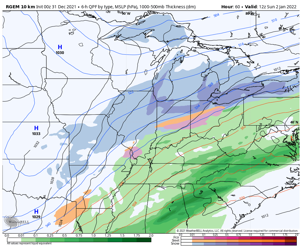
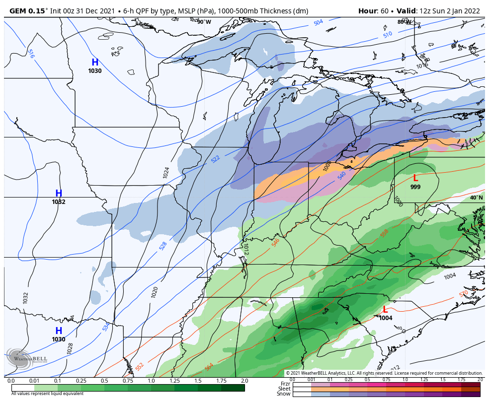
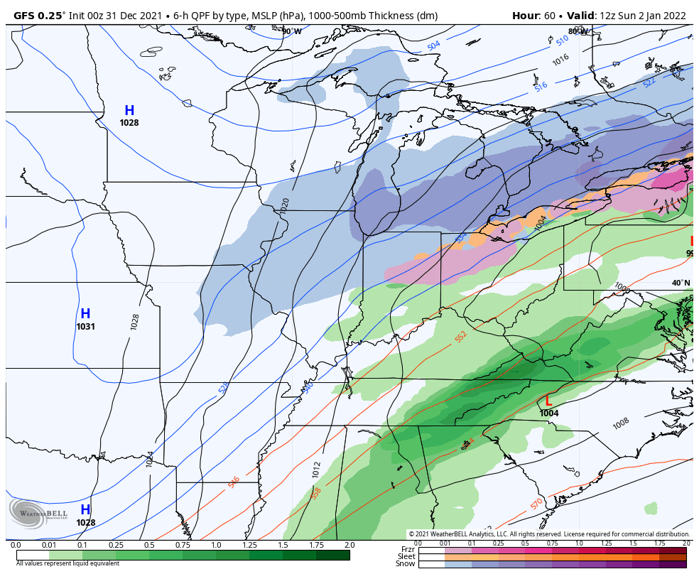
In addition to the severe threat, the potential for flooding and flash flooding is way up there. This should be a widespread 1″-3″ heavy rain event for the entire state, but a corridor of up to 4″ is likely to show up from southwest to northeast. Pinpointing where this is the challenge of the next 24 hours because that area could really see some ugly flooding issues.
Here’s my current thought on where that sets up…

Again, let’s stay alert to the flood threat!
A second area of low pressure develops along our boundary on Sunday. Where this low develops and just how strong it gets are the main factors on how much light snow you can get in on. As of now, I do expect many folks to see some snow out of this with light accumulations a good bet into Sunday night.
This setup may take accumulating snow as far south as Mississippi, Alabama and Georgia.
Snow lovers around here should be cheering on the Short Range Canadian as it is the most aggressive…
The normal run of the Canadian isn’t quite as robust…
Here’s the EURO…

The GFS is likely too weak and too progressive with this system…
Temps rebound behind all this but a much stronger arctic front looks too arrive around here by Thursday. This too should have an area of low pressure developing along it and that can become a snow maker in our region. Here’s the current look of the models for this system…
GFS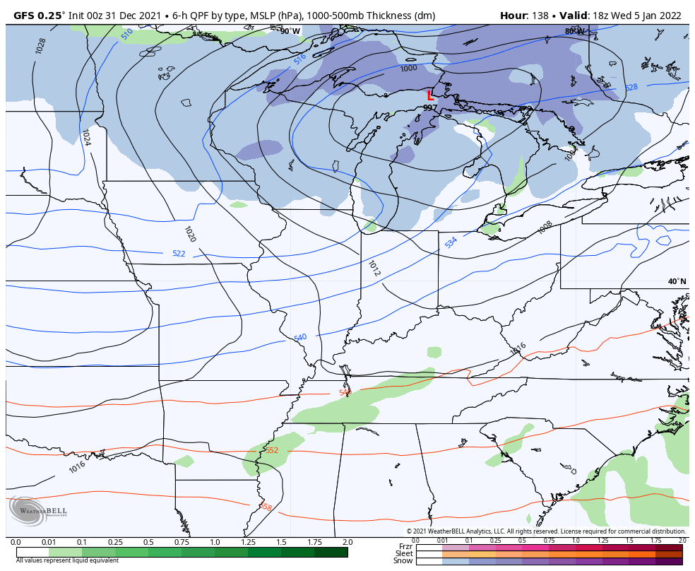
CANADIAN

EURO

The potential is there for bitterly cold temps to follow behind that setup.
I will have additional updates later this evening and through the night. I will also have the continuing coverage as needed on WKYT-TV.
As usual, I have you all set to track the severe weather. Our exclusive interactive radar also features live storm chaser video streams, so be sure to check that out…

Current watches

Possible Watch Areas

Enjoy the final day of the year and take care.

It seems more and more likely that South Central Kentucky will end up in this system’s warm sector. With dewpoints in the mid to upper 60’s and a +60 mph lower level SW to NE jet stream amping up the shear, the potential for rotating mesocyclones has increased. It’s likely that the Storm Prediction Center will move the “Enhanced Severe” area into SOKY. Also, adding 2 to 4 inches of rain onto ground in Warren County that is already saturated, plus +60 mph winds gusts, increases the potential for uprooting of trees, which also increases the likelihood of power outages.
With December11th still fresh in the minds of Bowling Green residents, this is getting ominous!
Great post Joe and in detail we all need to know. The cape is forecast to go up to 800 J/Kg for my area of Kentucky. South into Tennessee, the cape is forecast to go up to 1700 J/Kg. I’m beginning to get concerned.
Thanks Chris, so much uncertainty in the forecast until Monday. I hope you and other weather forecasters are stating the “worse case scenario.” The odds of repeating what we had on December 10 and 11th would be off the calculating scale. However, we should all have a place to go to be safe and prepare for a long power outage.
I can’t believe we are discussing severe weather and tornadoes on New Years Eve and New Years Day. It’s INSANE !!! I would like to be in a “way back machine” and go back to a New Years Eve party in 1969 in South Central Indiana where heavy Snow was falling all night long. STAY SAFE EVERYONE !!!
I think we have a better chance for an accumulating snowfall with the second system next week.
Happy New Years!
HAPPY NEW YEAR TO ALL !!!
Happy New Year everyone! Stay safe and may 2022 be a good one for you all!
good afternoon.