Good evening, folks. It’s full steam ahead toward a wild holiday weekend of weather in our part of the world. I continue to track the potential for severe storms, flooding rains and some snow. 2022 ain’t holding back as it gets off to a fast start out of the gate.
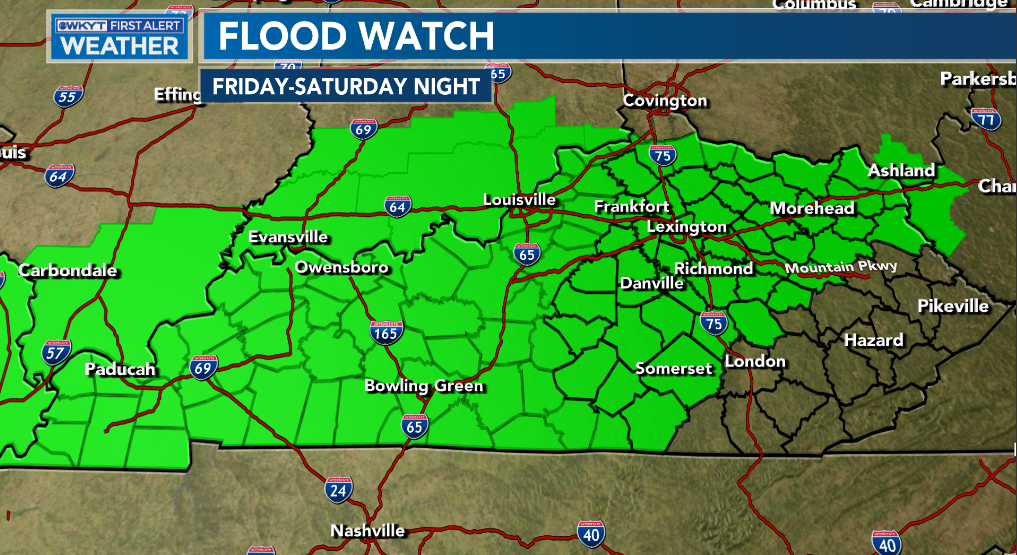
Much of the state is now under a Flood Watch from Friday through Saturday night. Here’s a look…
Let’s give you a breakdown of how things may play out:
- Low pressure works into the region New Year’s Eve and Day.
- This brings rounds of showers and storms working from southwest to northeast.
- Some of the storms may be strong or severe Friday evening into Saturday.
- Damaging wind is the main threat, though there is a low tornado threat across the west and south. This tornado threat is conditional.
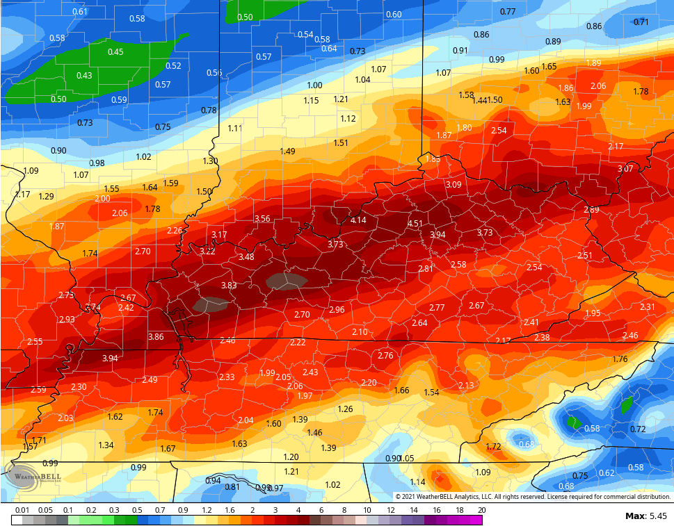
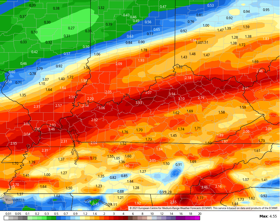
- A corridor of torrential rains will set up and we have to be on guard for training of storms. This may setup from western into central parts of the state. Some areas may see up to 4″ of rain out of this.
- Flooding and flash flooding will be possible in the areas getting the heaviest rains.
- Colder air surges in from west to east Saturday night and Sunday. The timing on this cold air will, obviously, vary from one part of the state to the other.
- Low pressure develops along our front and is likely to produce a swath of light snow for much of the area. The intensity of this remains to be seen, but there’s a real chance for the first accumulating snowfall for many. It’s all about where this low develops and how strong it gets.
The Storm Prediction Center has much of Kentucky in the risk for severe weather on New Year’s Eve…

This threat continues into New Year’s Day…

You can see how the greatest risk is across the southern half of the state.
In addition to the severe threat, the flooding potential is elevated. The forecast models vary on the placement of the heaviest rains, but you can see the southwest to northeast corridor I’m talking about…
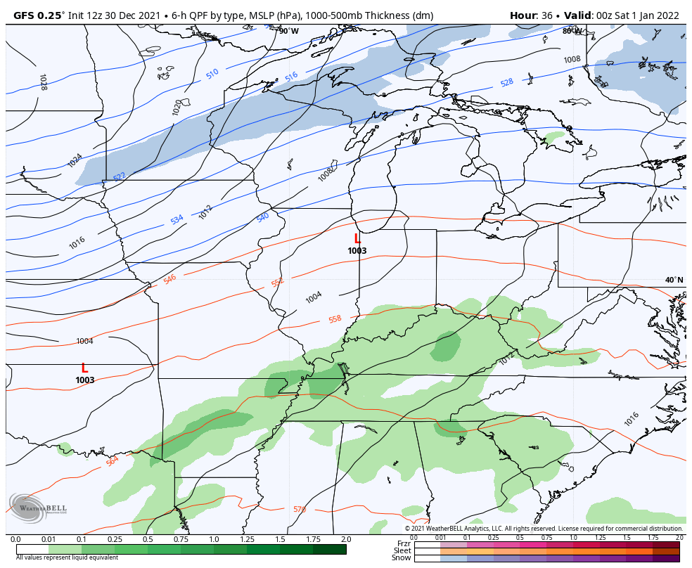
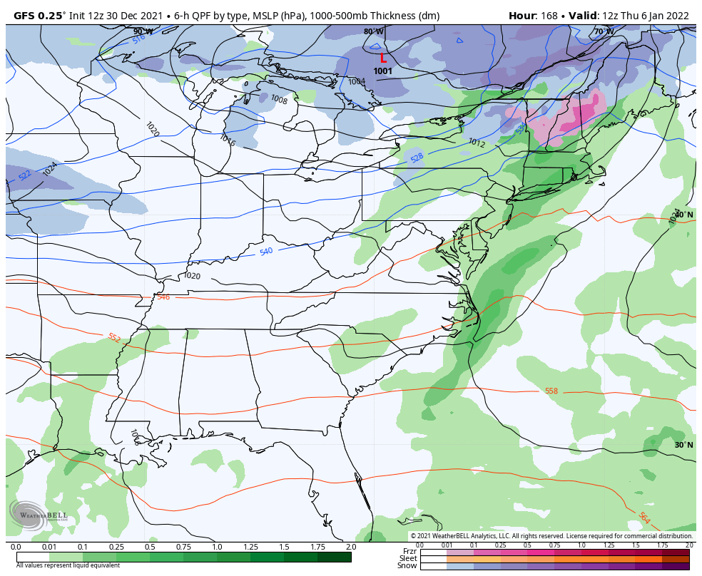
GFS

CANADIAN

SHORT RANGE CANADIAN
EURO
ICON
![]()
![]()
The case for snow on Sunday is literally all about a wave of low pressure and where it develops, and how strong it is. The models handle this differently still, but you’re definitely seeing the trend of this other low…
GFS
Short Range Canadian

EURO

NAM

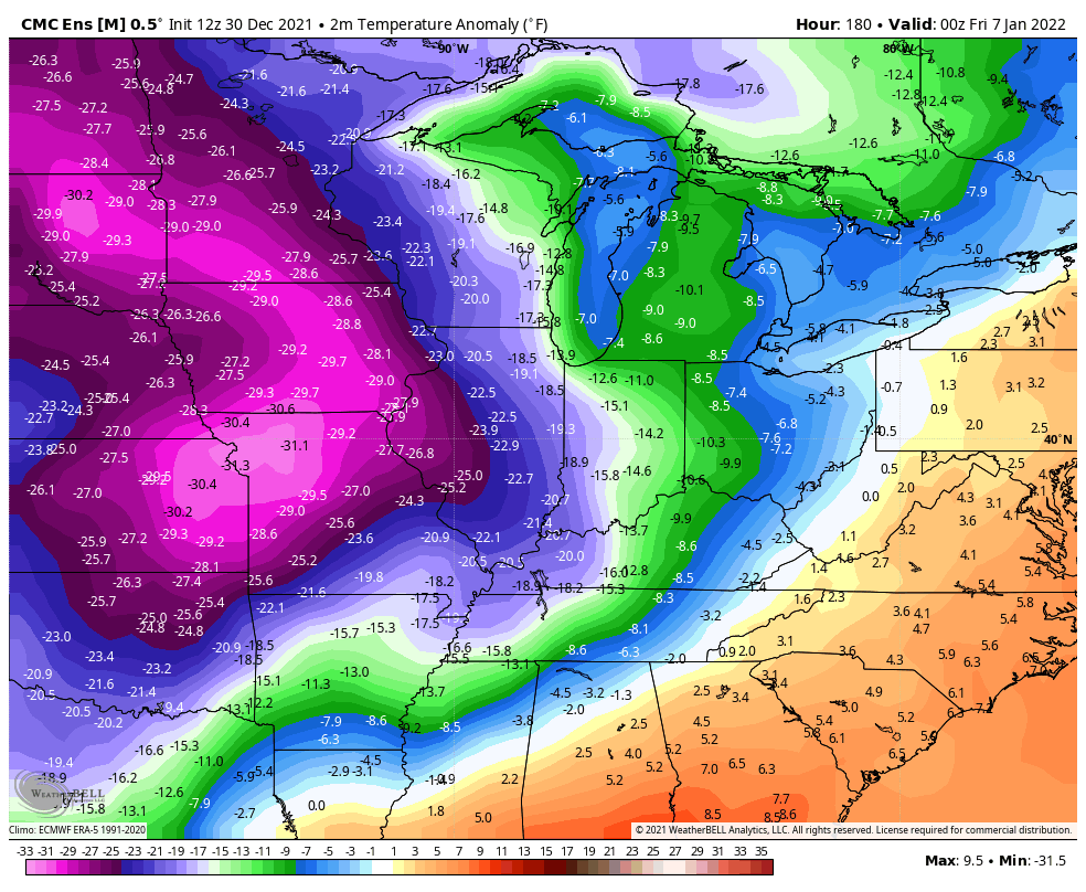
Temps rebound by the middle of the week, but an arctic front looks to slam in here on Thursday and may have another wave of low pressure along it. Here’s how the GFS sees it…
And the EURO…

This introduces cold air and then we see reinforcing blasts of cold controlling the pattern from there. Temps look well below normal…
GFS Ensembles
Canadian Ensembles

I will have an update on WKYT this evening and with the “full” post later tonight. Have a great evening and take care.

Storms are going to fire well south of Kentucky, take it to the bank this saps energy needed for Severe Storms in Kentucky.
We probably won’t see supercell development unless the system’s warm sector manages to push into Kentucky. Regardless, we will still see a potent line of thunderstorms push through, with the potential for +60 mph wind gusts. This is definitely cause for concern here in South Central Kentucky, where many of the trees that weren’t uprooted were heavily damaged, and other trees could be toppled due to the very soft ground from recent rains. Just make sure to keep flashlights and portable radios near at hand, if the power should fail. Also, if you own a PC, it might be a good idea to run a backup, just in case!
Good advice Joe ! Convective available potential energy is forecast to go above 600 J/Kg in my area of Kentucky, so it looks like we may be in for another severe weather event. Hoping Virgil is right that most of the energy will be robbed to the south, but I pray that no one has severe weather.
I’m sure the flooding Rains will happen because we are well entrench in a La Nina and that brings a warm and wet pattern to the Ohio Valley.
I notice that accumulating Snow models on the Ventusky weather site for the next 10 days are not there for Kentucky. All the accumulating Snow is forecast to fall to our northwest. The mild weather is predicted to return by Tuesday the fourth followed by another cold front later in the week. Rinse and repeat.