Good evening and Happy New Year! Severe storms and flooding caused a lot of damage across the state today, but the action is winding down out there this evening. Now our attention turns toward the increasing threat for the first snowfall of the season for parts of the state Sunday and Sunday night.
Before we get to the snow threat, let’s talk about the leftover rains that can still cause some issues. The severe threat is ending across southeastern Kentucky, but more rain will fall through tonight. This is falling on areas that have picked up 2″-6″ of rain since Friday with flooding issues already a problem.
It won’t take much more rain to cause renewed high water issues, so stay alert. Here are your radars to follow along this evening…

All week, I’ve been selling this weekend as a three-pronged attack from Mother Nature. Severe storms, flooding and light snow are the headline makers to kick off the brand new year.
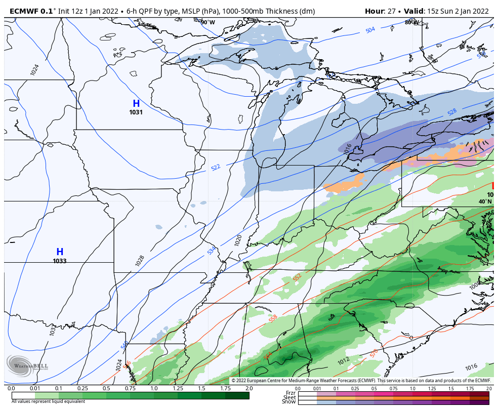
As a cold front moves through Sunday, low pressure develops along this boundary and brings snow to parts of Kentucky into the Tennessee Valey. Accumulating snow may fall all the way into northern parts of the southern states.
Where this low develops and how strong it gets are still the determining factor on how much snow you get where you live. In this setup, the southern half of the state has a much better chance for accumulating snow during this time.
Here’s my first blush map on who has the best shot…

This is a setup where I will have a First Call For Snowfall map later today and, believe it or not, there’s even a chance I have to go straight to a Winter Storm Alert for some. Notice I say a “chance” for that happening. A lot depends on those late evening models.
The afternoon model trend is going back toward a more developed and farther north system.
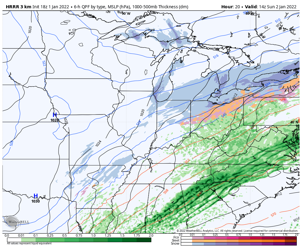
Here’s the HRRR…
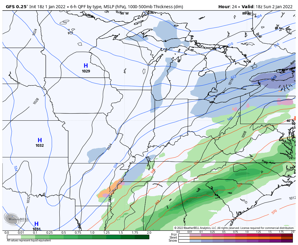
The GFS looks similar…
So does the Short Range Canadian…
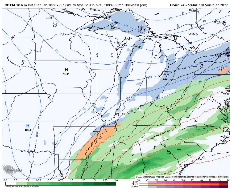
The RAP is also on board for a nice system…
The EURO is just a bit farther south and east…
As you can see, this has the potential to be a nice event for parts of southern and southeastern Kentucky. On the flip side, there’s still a chance for a farther south trend which would lower the snows in Kentucky.
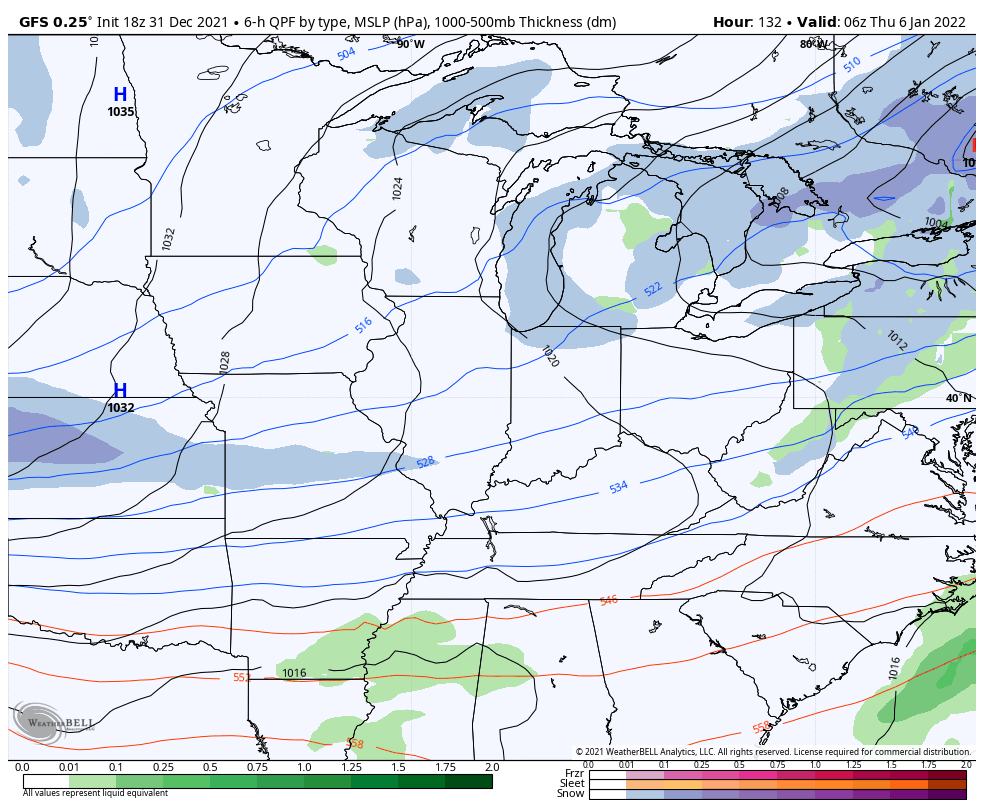
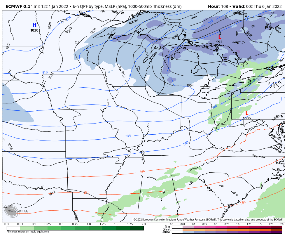
The next snow maker is showing up better and better as we get closer to late Wednesday and Thursday as a wave of low pressure develops along an arctic front working in here.
The GFS produces a nice swath of accumulating snow…
The EURO has an even stronger looking snow system…
I continue to be amazed at how closely this winter is following the winter of 1984/85.
I will probably throw out a First Call For Snowfall out late this evening. If not, it won’t be too long after that with my normal update later tonight.
Enjoy the rest of your New Year’s Day and take care.

Go get some sleep!
Thanks Chris, I found out that a Tornado touchdown in Taylor county this afternoon and did quite a bit of damage ? Didn’t really get all the details on the structural damage. The odd thing about this storm is that it touchdown a few miles from where the last one hit on December 11th’s tornado outbreak.
Snow showers and some freezing rain is in our local forecast for Thursday the 6th. In my opinion, I think East Kentucky and especially the Mountains of Southeastern Kentucky into West Virginia will have the best chance for the most accumulating Snow. The rest of the state will have to wait a little longer for that first “big time Snowstorm.”
Happy New Year!
It’s been a wild day in the Bowling Green area. At 11:30 am, my PWS recorded a temperature of 76°, with a muggy dewpoint reading of 66.6°! Only 5 minutes later, the tornado warning sirens went off, and an estimated EF-1 tornado touched down only 1¼ miles from my. All told,, we picked up 3.65″ of rain, and it’s still raining as I write this.
I’m sort of in shock, seeing that my section of Warren County is in the area labeled “Greatest Risk” for snow, which would the first measurable snow in the past two years for my area!