Good afternoon, folks. As promised, your friendly weatherdude is dropping by for another update on the developing winter storm. This system is bringing snow from the deep south all the way into the Mid-Atlantic states and is the first of two snow makers I’m tracking.
The first system impacts southern and, especially, southeastern Kentucky through tonight. I’m rolling with the First Call still…

The 4″+ area may see some spots over 6″.
A Winter Storm Warning is now out for those counties along the Virgnia border…
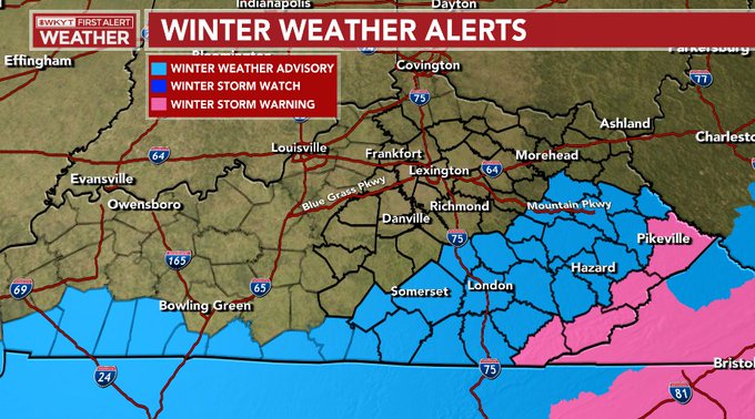
This will be a wet snow, but as temps fall below freezing later tonight we might see roads become slick or snow-covered.
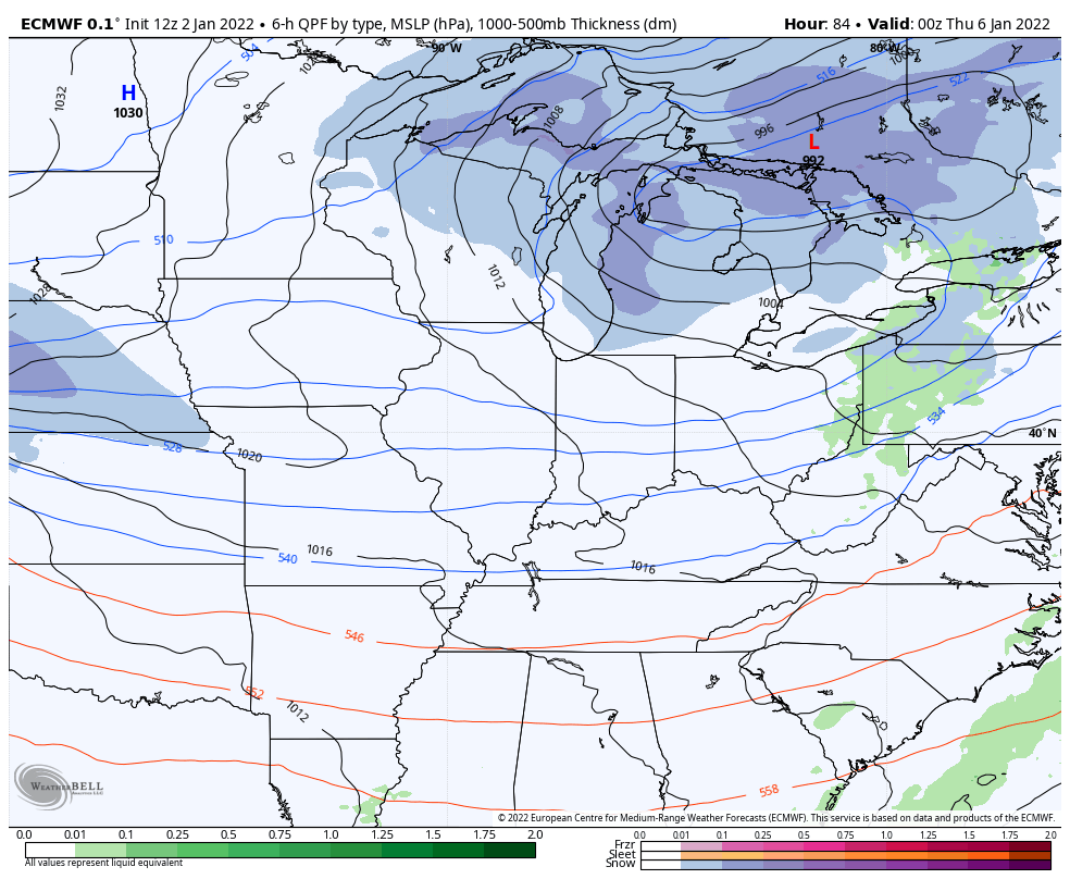
Once this moves away, we quickly turn our attention to an arctic front arriving later Wednesday as a system sweeps in behind it for Thursday. This has the look of a very sharp and deepening system with snow developing on top of us. You can see this well on the models…
EURO
CANADIAN
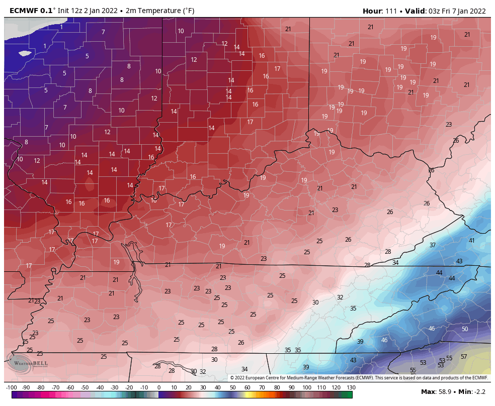
With arctic air behind that, snow ratios can be up there and that’s something for us to watch.
Speaking of arctic air. Here are the temps from the EURO from Thursday evening through Saturday morning…
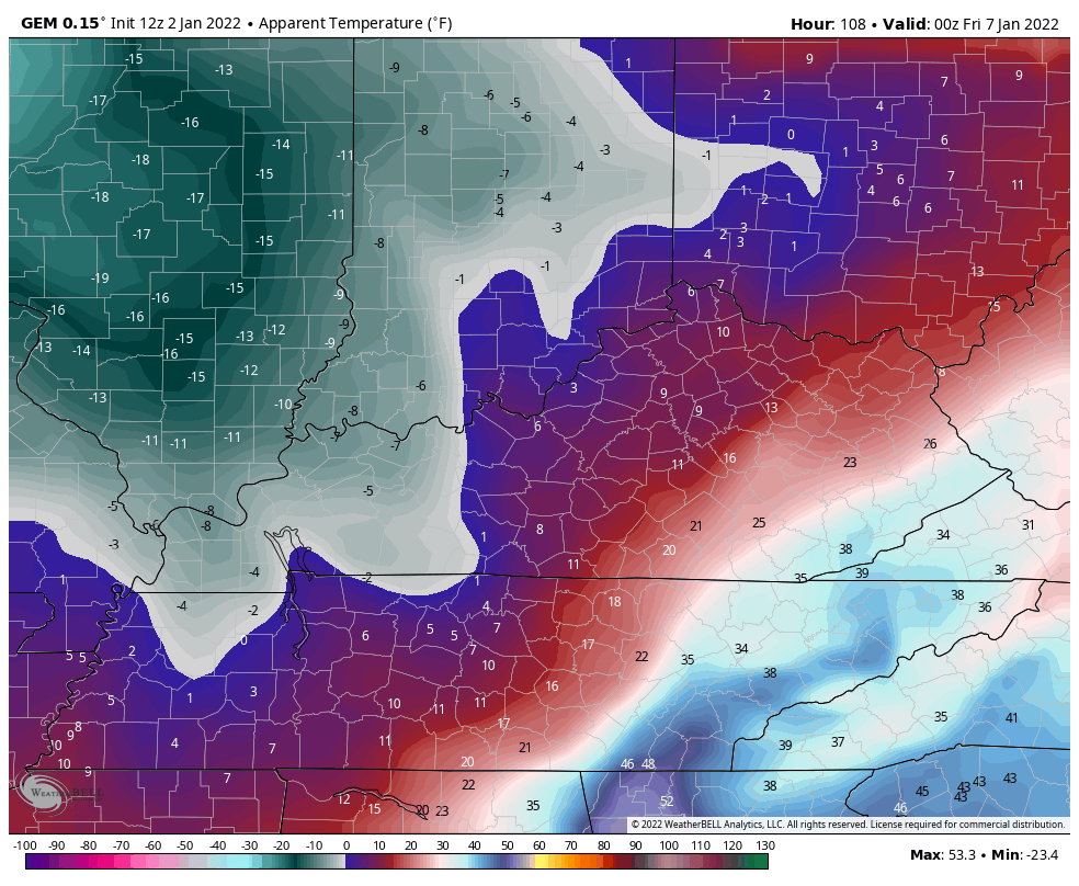
Check out the wind chills for the same time…

The Canadian wind chills are even colder during this same time…
I’ll see you with another update later this evening. Here are your radars to track the increasing areas of light to moderate snow…

Have a great evening and take care.
