Good afternoon, folks. My time for this post is rather limited, but today is a day of multiple updates as we track a developing winter storm set to impact parts of the region.
A Winter Weather Advisory is out for areas of southern and southeastern Kentucky with a Winter Storm Warning just across the border in Virginia…
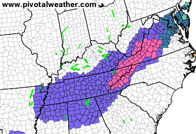
I would expect our far southeastern Kentucky counties to be upgraded at some point. Notice how far south those Winter Weather Advisories go? After a quick glance at weather twitter this morning, it appears there’s a lot of “suprise” with this. 🤔🤷♂️
I’m going to keep the snow forecast the same until I can a deeper look at things shortly…

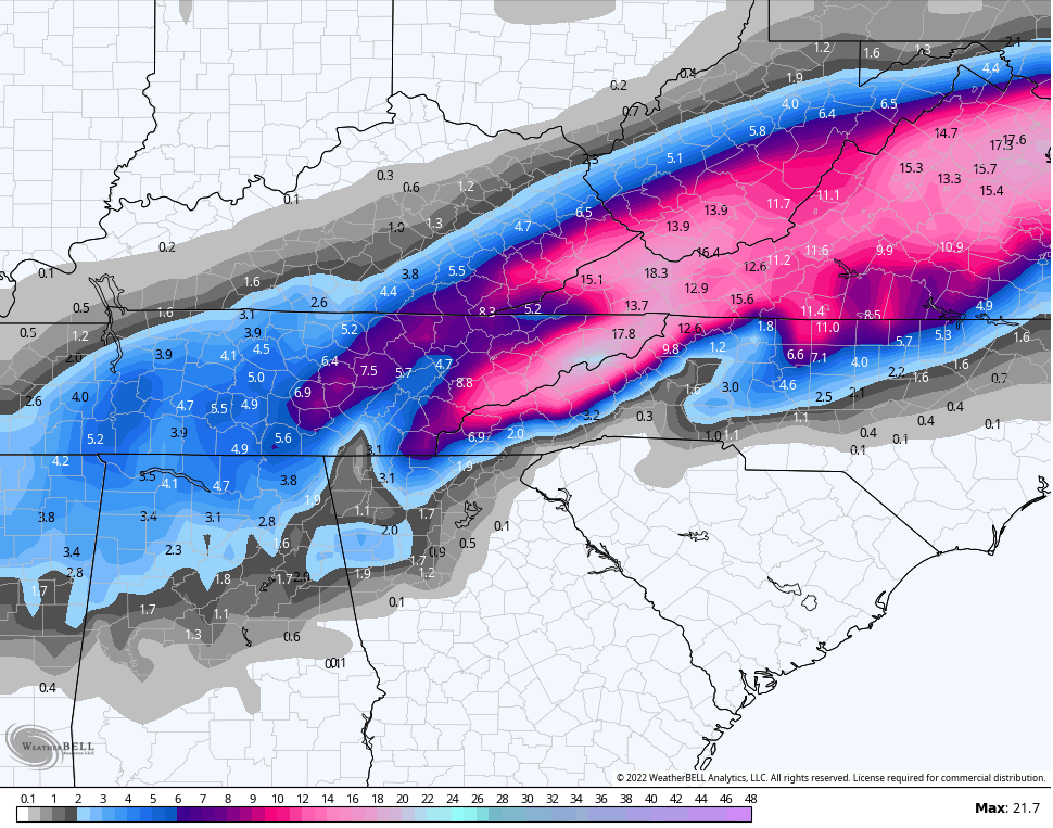
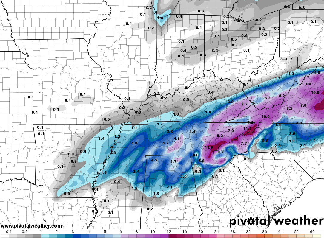
We have the GFS being steady with a more widespread event…
The GFS Ensembles…
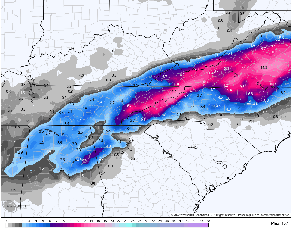
The HRRR…
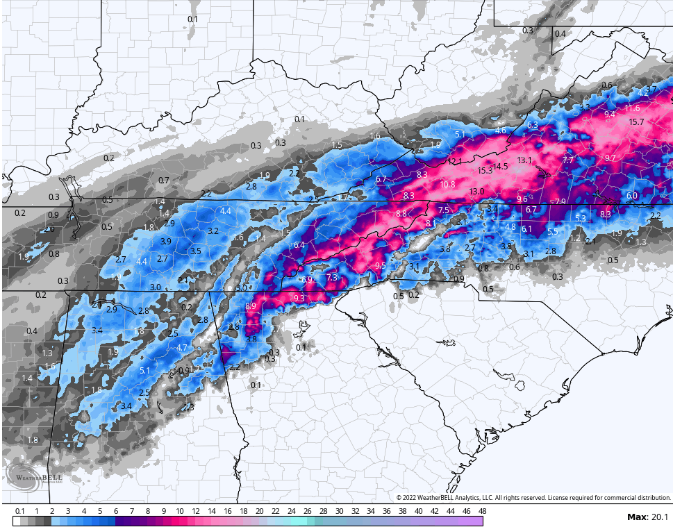
The SREF…

The RAP…
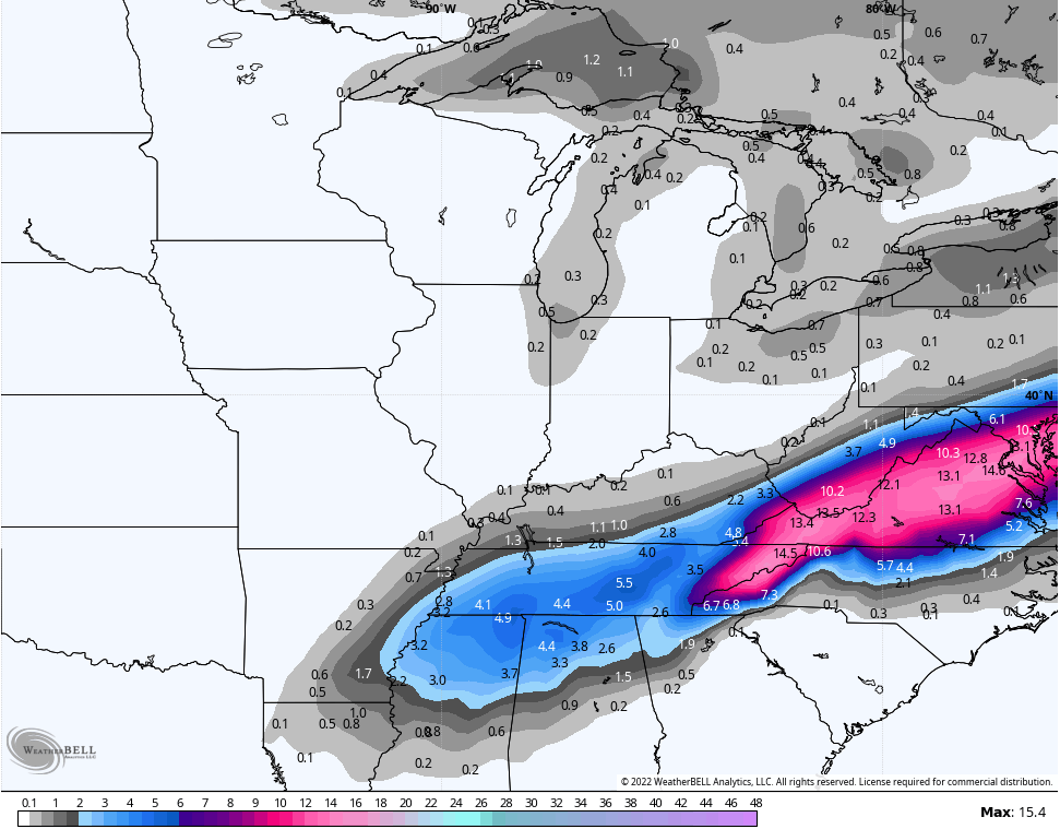
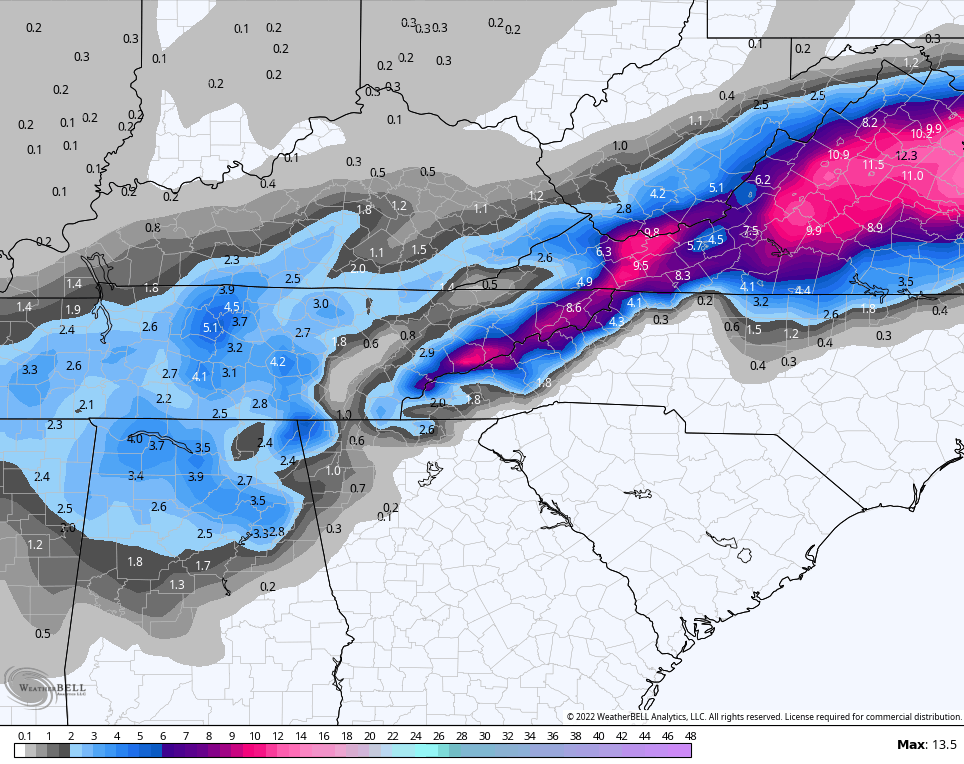
On the other side of the spectrum, we have models like the NAM fam that are much lighter with amounts…
NAM
HI RES NAM
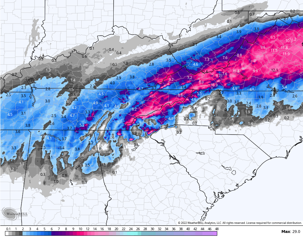
CANADIAN
I will updater things later today, so check back. Until then, follow the flakes on our radars…

Have a great day and take care.

Really good agreement on all weather models. Glad we are finally tracking a real Snowstorm !
hang in there bailey boy!!!!!!
Hi all. Chris don’t you think it will be too warm for the change over to snow in eastern Kentucky?? I will take anything after all the rain we have had.
I am tracking a few flakes in the Louisville area. LOL. I hope the next system will provide the whole state a chance for a decent snowfall.