Good Monday to one and all. Wet snow is blanketing the ground across parts of southern and southeastern Kentucky to start the first work week of 2022. It’s a week that will likely feature a more widespread snow system by Thursday and it’s one that might be a THREAT.
Let’s kick things off with what’s going on out there this morning. Heavy wet snow will taper off quickly across the southeast, but it’s leaving behind anywhere from a coating to several inches. Counties along the Virginia/Tennessee border are likely waking up to a thumper of a snow. With the wet nature of the snow, some power issues may even be possible in a few spots.
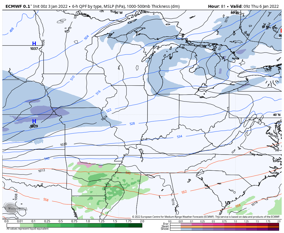
Here are your radars to follow along…

Temps this morning are around 20 with a wind chill ranging from the high single digits to the low teens. Afternoon temps hang around freezing, but those with snow on the ground likely stay upper 20s. Winds make it feel colder.
Tuesday is a seasonable day with a mix of sun and clouds.
Wednesday is a VERY windy day as an arctic front drops in late day. There’s the outside chance for a rain or snow shower ahead of this, but most look to stay dry.
A potent system then dives in behind this on Thursday and has the look of a widespread, potentially significant, snowfall in our region.
The EURO continues to be a heavy hitter…
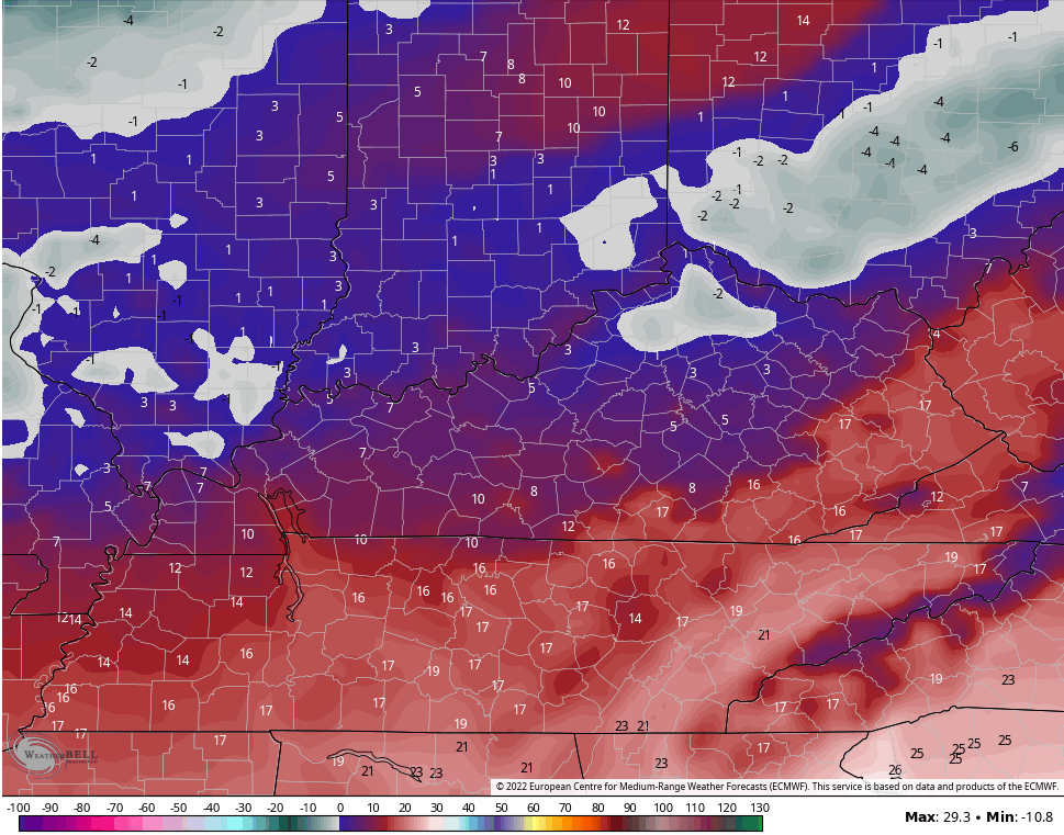
The Canadian Model has a stout look to it…

With arctic air coming in on the backside of this system, snow ratios will be very high.
The GFS has been slow to the party, but it’s correcting toward what the other models are showing and will continue to look stronger and stronger…

Temps in this setup can absolutely tank, especially with snow on the ground. The EURO is taking the numbers below zero for some…
If we just take a look at the Friday morning temps from the Ensembles, we find the average of 27 members in the single digits…
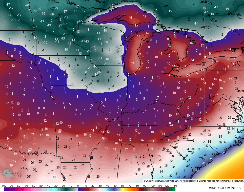
Considering that’s the average of that many runs, it’s impressive and suggests snow on the ground.
The Canadian Ensembles look very similar…
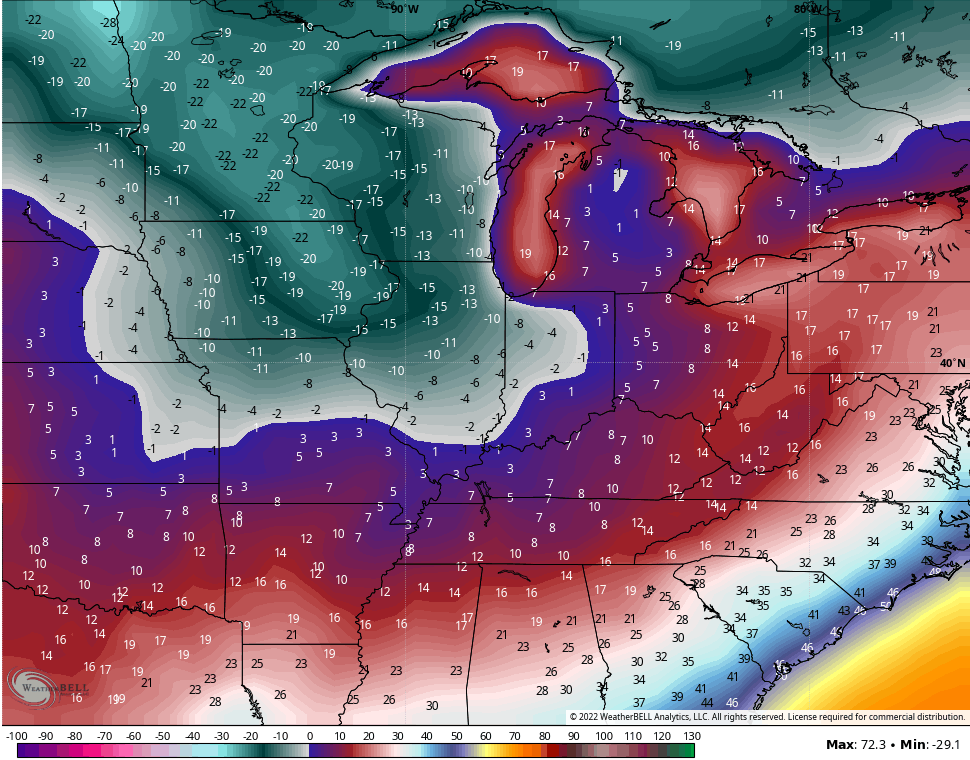
Below zero wind chills are likely late this week.
And you guys thought we wouldn’t have any fun this winter. The winter of 84/85 would like to have a word with you. 😜🥶❄️
Updates come your way later today. Have a good one and take care.

Chris – not surprised… It’s too bad we didn’t have a white Christmas and have had basically no winter so far….it’s not surprising though that things do a flip flop…..
I can see Chris having 3 updates per day this week. This website is probably going to be shut down at times due to heavy traffic.
Not even tornadoes can over match the thought of snow in the peoples psychic.
Thanks Chris, This Snowstorm was interesting as it developed very quickly and spread in those areas you said it would. Looking at the radar I wouldn’t be surprised if there is Thunder Snow, which is always fun to experience.
Taylor County again has miss out on the Snow, but I will enjoy looking at all the Snow scenes on your twitter feed.
Bring it!!! Way over due.
You nailed it, CB.
Just about a half inch of snow here in Perry County, but it was absolutely stunning to see about 2am. It looked like a snow globe.
Looking forward to the potential for more substantial snow later this week! While it would’ve been nice to have this weather for Christmas, it’s just as nice to have it now. Better late than never.
Here’s to some winter in the weeks ahead. We need it for so many reasons (nobody wants mosquitoes the size of small birds come spring!)
Best wishes to all here at KWC, and May the servers hold up to the traffic coming Wednesday and Thursday.