Good afternoon, folks. A southern and eastern winter storm delivered accumulating snow to areas of southern and eastern Kentucky last night and this morning, but that system is now a thing of our past. The next system rolling in for Thursday and Friday has the look of becoming more of a widespread snow maker.
The potential is there for this to become a significant system.
An arctic front slides in here and puts the brakes on Wednesday night. At the same time, a system develops and rolls across the lower Ohio Valley/Tennessee Valley along the front on Thursday. This brings an increasing swath of snow along and north of the track.
Several models are showing just how big of a system this could be.
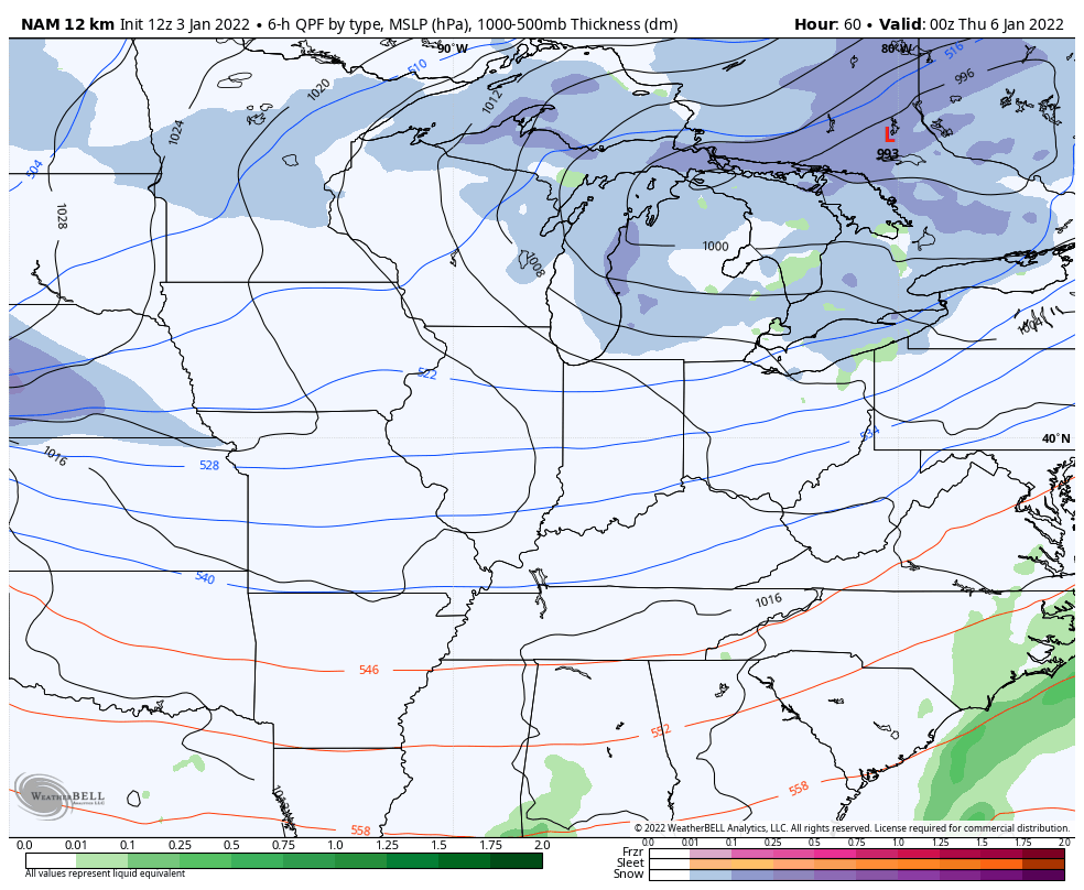
The NAM only goes through 7pm Thursday, but is picking up on it well…
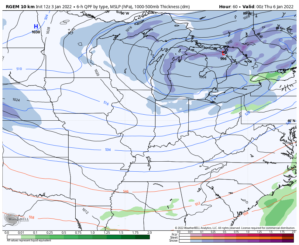
The Short Range Canadian also shows this well…
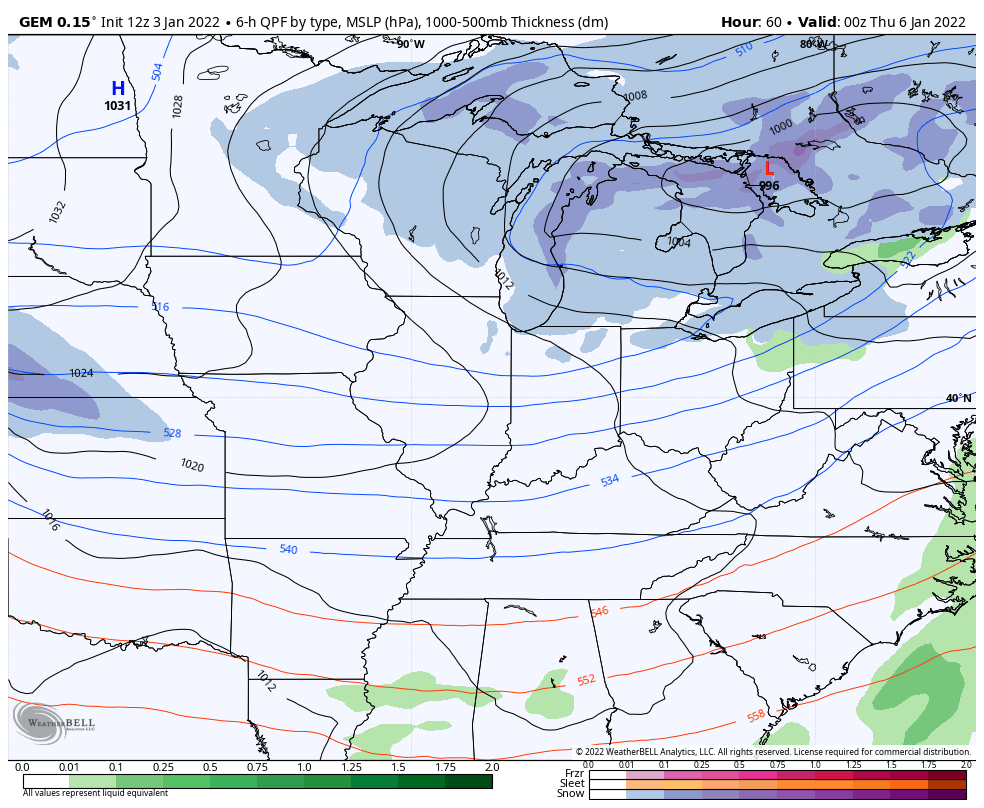
The regular Canadian takes us through the entire system…
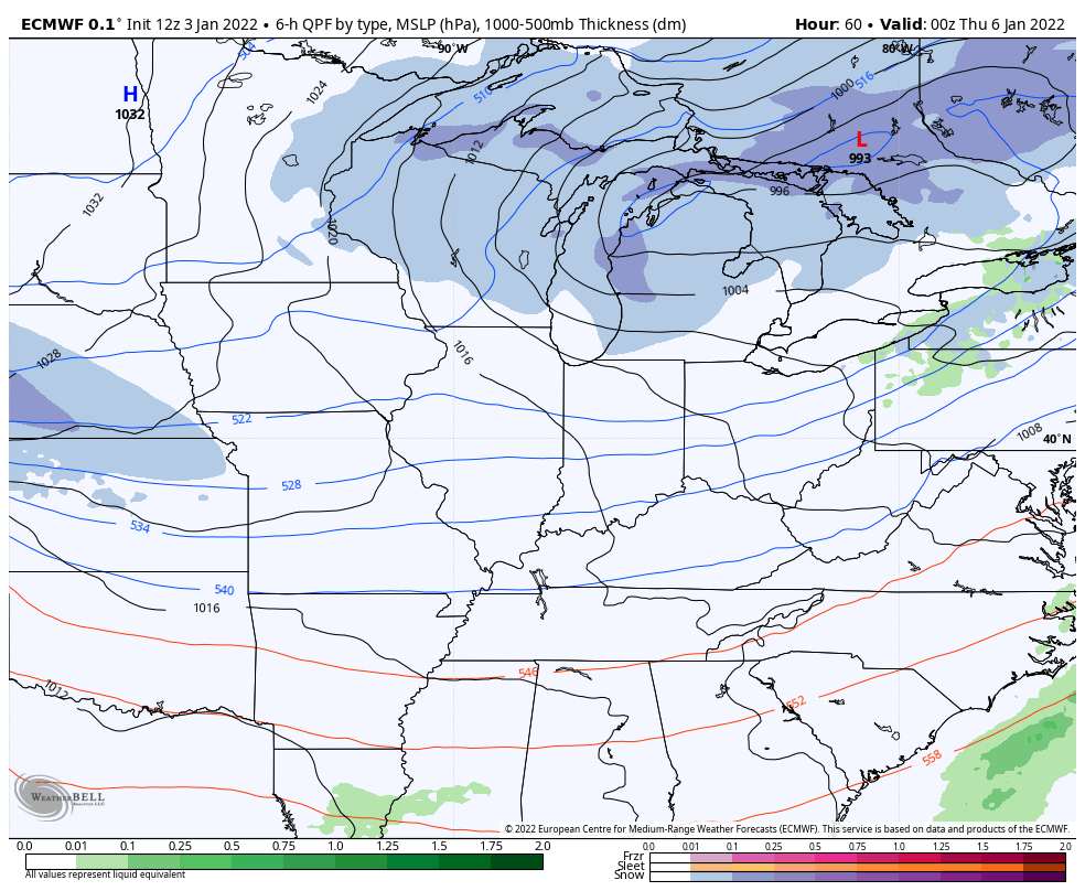
Here’s the new EURO…
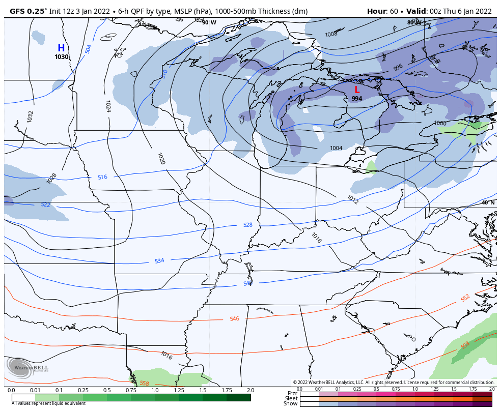
Then we have the GFS which is a world all it’s own…
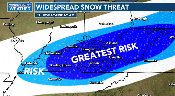
Here’s my early threat area…
The bias of the GFS is strong with this one as it crushes southern stream energy by being way too progressive with the northern stream. Watch this model throw a lot of people for a loop when it catches up over the next few days.
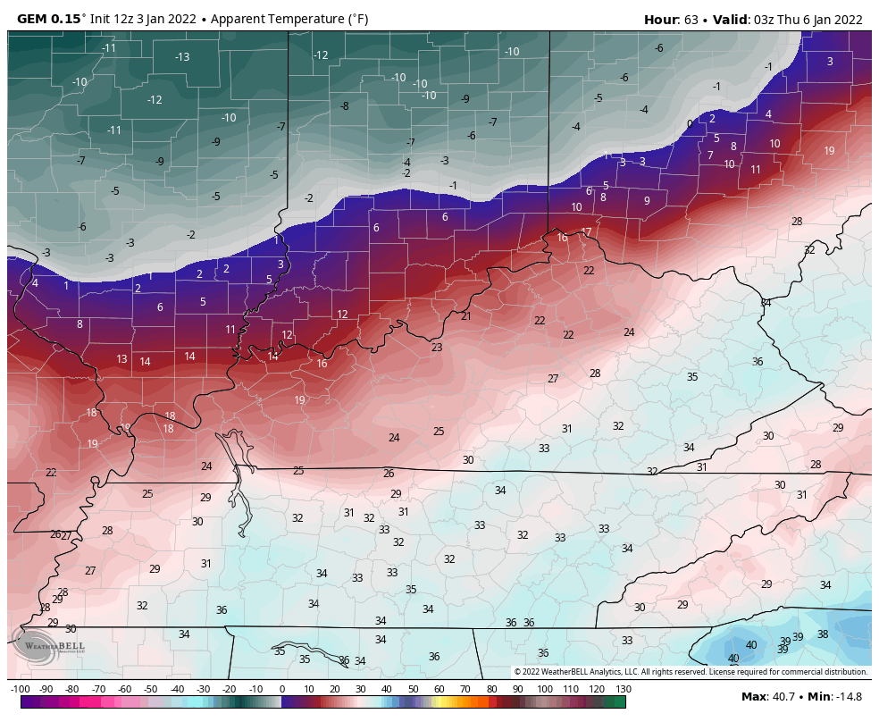
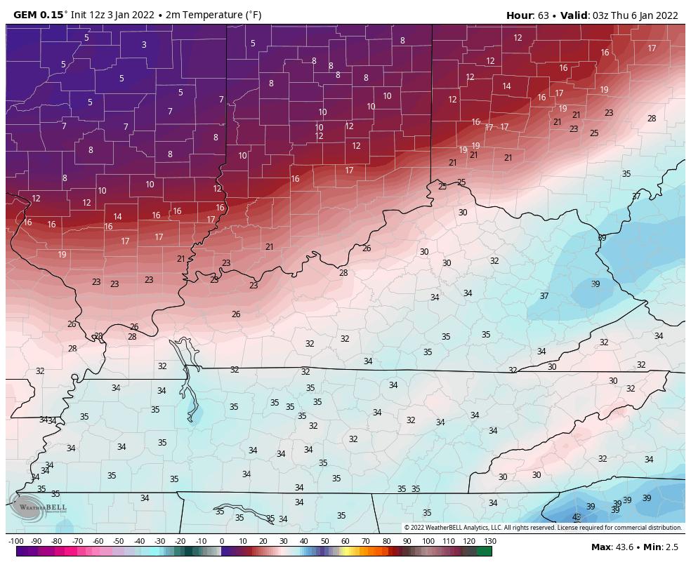
The temps coming in behind this can be brutal. Here’s the Canadian numbers from 11pm Wednesday through 7am Saturday…
And those wind chills…