Good evening, folks. It’s back to wintertime across the Commonwealth as we have a frigid night ahead. This comes on the heels of some parts of the state getting in on some snow. Can we get the rest of the state to pick up snow this week? I like our odds!!
Here’s the map I made earlier in the day…
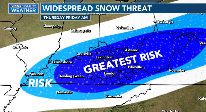
The Weather Prediction Center is highlighting our region for the best chance for accumulating snows on Thursday…

Their hazards map points to the potential for heavy snow during this time and it matches up with the map I put out earlier…

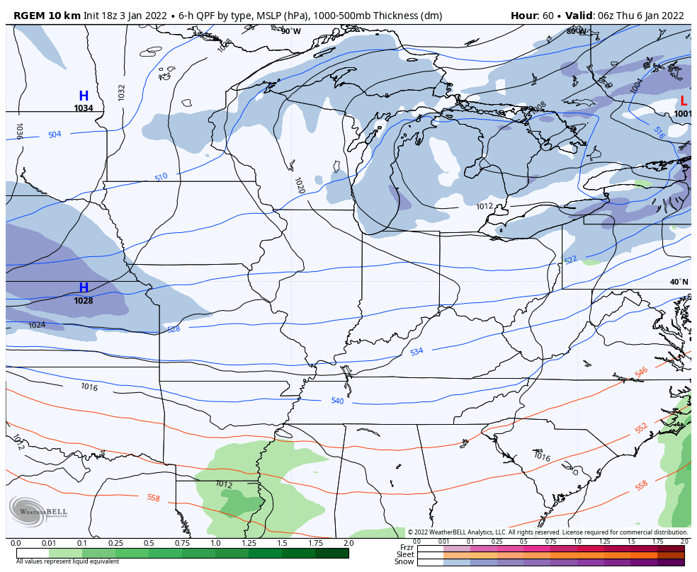
The late afternoon run of the short range Canadian continues to be very enthusiastic
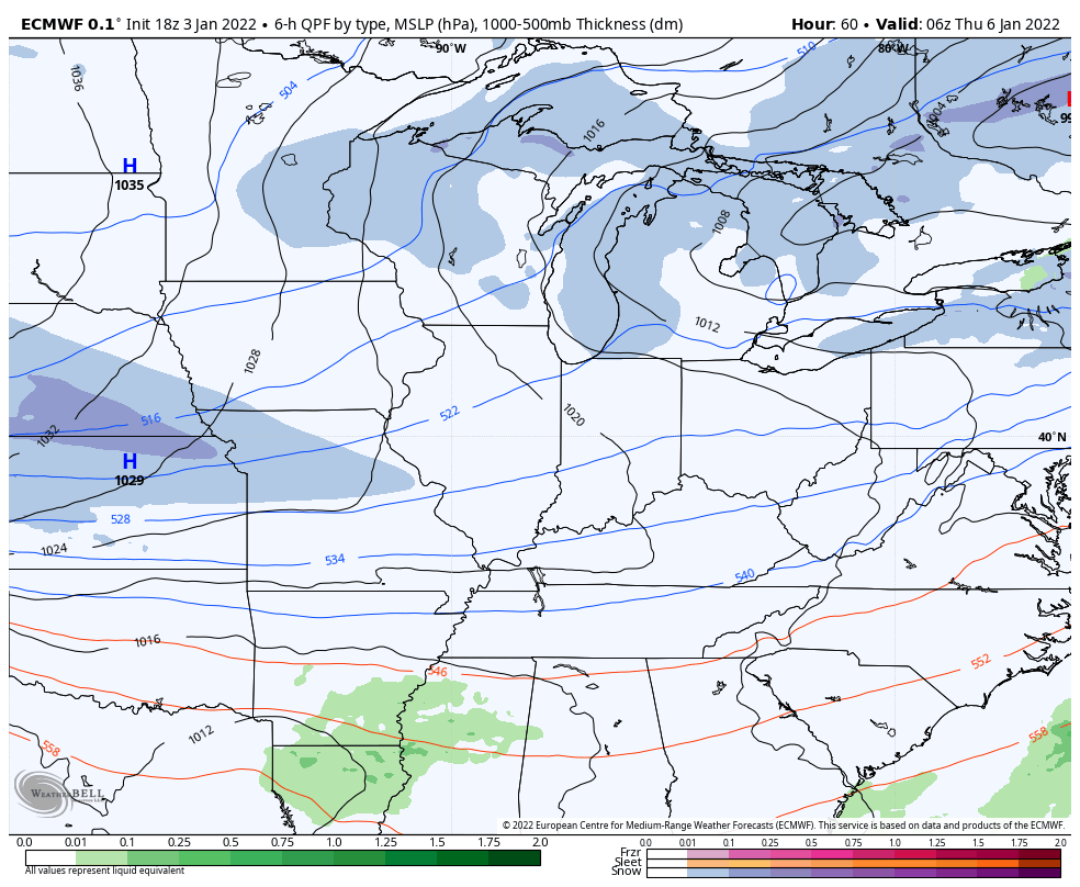
The late day run of the EURO matches up well with that…
Then we have the GFS that has nothing… literally nothing.
I will have an update tonight on the new 10pm WKYT News on the CW Lexington and on WKYT at 11. Of course, you will get your usual late night post here on KWC, too.
Enjoy the evening and take care.

Wow, it’s been so long since Warren County has had ANY measurable snow, so I’m not sure if I’ll know how to react if it actually materializes. Still, 3 days away in our current weather universe is forever!
And the poor GFS…that model is in need of some serious help!