Good Thursday, everyone. Our Winter Storm ALERT rolls on as moderate to heavy snow moves into the region early today. As snow overspreads the state from southwest to northeast, travel issues will become a major issue.
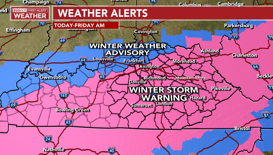
Much of the state is under a Winter Storm Warning or Winter Weather Advisory. That Winter Storm Warning was expanded to include areas from Lexington to Etown and we may see a few more counties added early today. Here was what the map looked like at the time of this update…
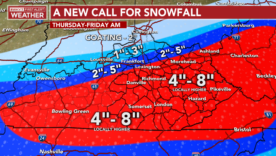
I continued to pull the axis of heaviest snow a bit farther north and here’s where we stand…
It’s going to snow hard for several hours!
With very cold air firmly in place as the snow moves in, it won’t take long for roads to become snow-covered and this will likely lead to significant travel issues. Keep this in mind if you’re going to be traveling.
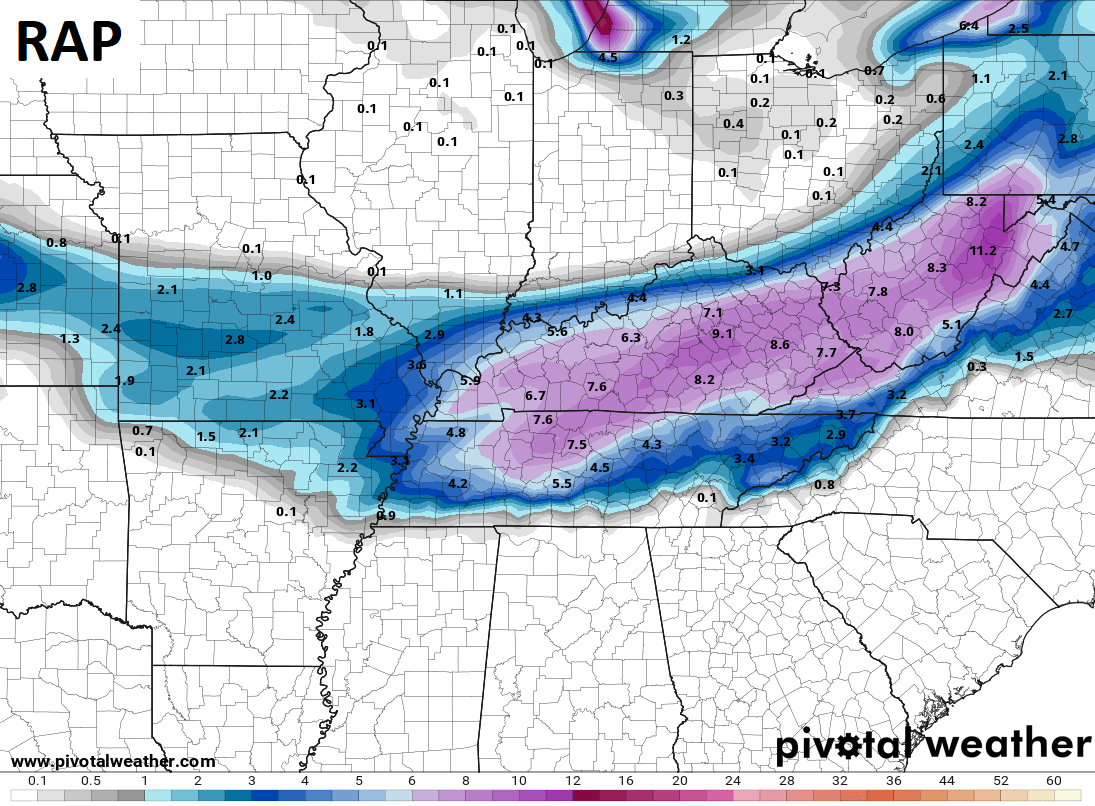
The late evening forecast models all had a similar look to them, but with the typical variations…


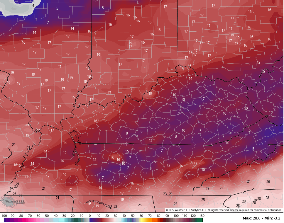
The snows will quickly taper off from west to east this evening as absolutely frigid air moves in. Overnight lows will likely reach the single digits in many areas…

Can a few spots hit zero or below? I think that’s possible. Wind chills will be below zero.
Highs Friday may not get out of the upper teens and that sets the stage for another night in the single digits…
I will have updates through the day and on WKYT-TV. Your radars are going to be very busy as the snow increases rapidly this morning…

PADUCAH

FORT CAMPBELL

BOWLING GREEN


E-TOWN


LOUISVILLE


Stay safe and make it a great snow day. Take care!

good work bailey.
Thanks Chris, Glad to see the web cams are up and running on the KWC ! I will report my Snowfall totals tomorrow for my area of Taylor county.
With temperatures in the mid to low 20’s, the snowfall should be more of a powder, instead of the heavy, wet variety. That’s fine with me; I’ll probably leave the snow shovel in the shed, and reach for my leaf blower instead! Tonight, with clear skies and a thick layer of snow on the ground, I expect that we’ll hit 0° or below here in the Bowling Green area.
Everyone stay safe!!