Good afternoon, everyone. Bitterly cold temps and a few snow showers continue across the Commonwealth on this Friday. As we head into the weekend, we have a pretty ugly setup on the way. It’s one that brings heavy rain, gusty winds and a possible freeze up.
It was, by far, the coldest morning of the winter…
As expected, several areas saw thermometers drop below zero this morning. Here’s a look at the top 10 coldest temps from the Kentucky Mesonet. #kywx pic.twitter.com/6CYA6aDNXG
— Chris Bailey (@Kentuckyweather) January 7, 2022
Some flurries and snow showers will continue to add some very light accumulations across areas of central and eastern Kentucky, but most of that won’t show up on radar…

Temps tonight are back into the single digits for many, but winds shift a bit on Saturday and will become very gusty. Highs will be in the 30s for many, but will rise further during the evening hours.
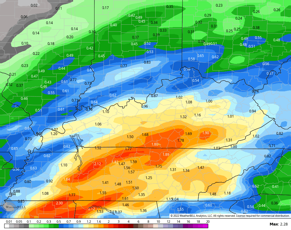
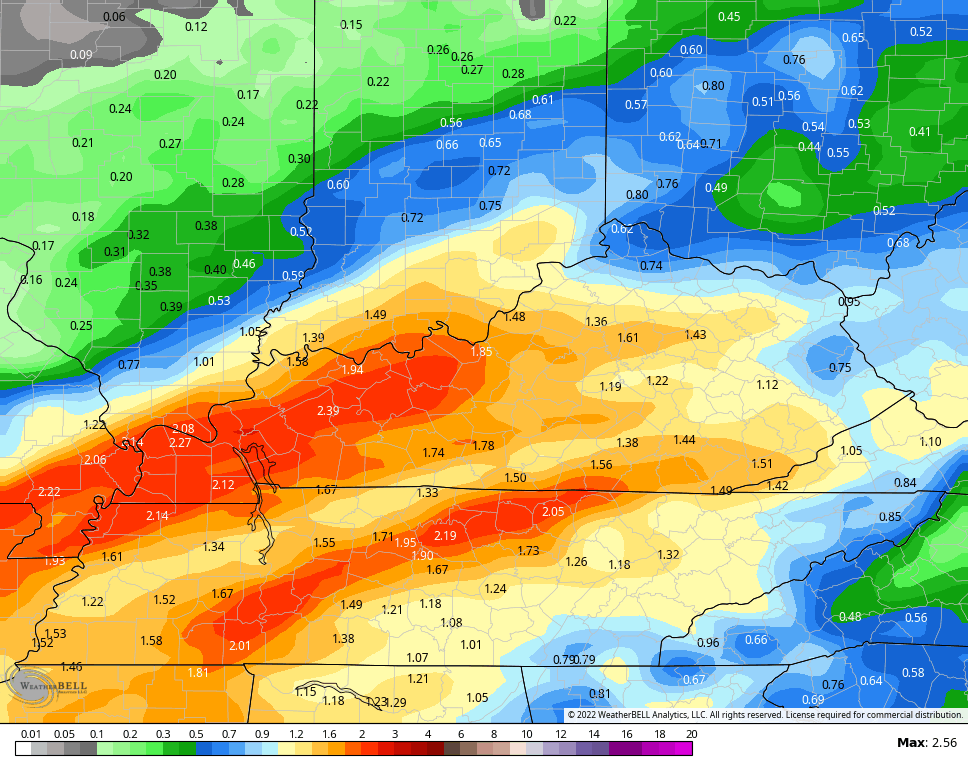
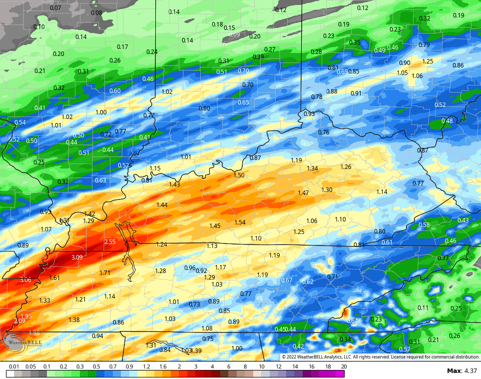
That’s ahead of a system set to bring some heavy rains for Saturday night and Sunday. This will be followed by a blast of colder air late Sunday…
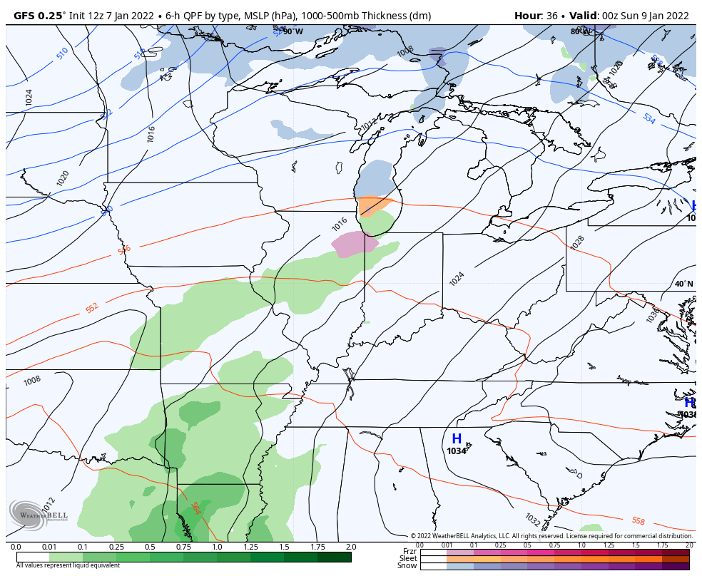
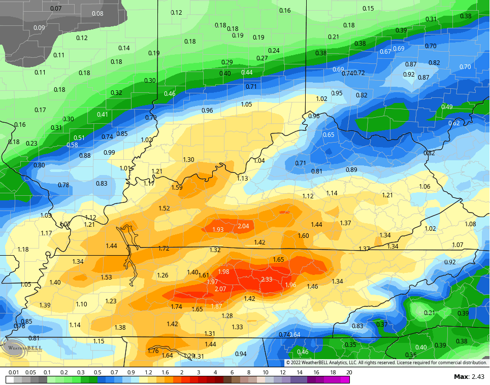
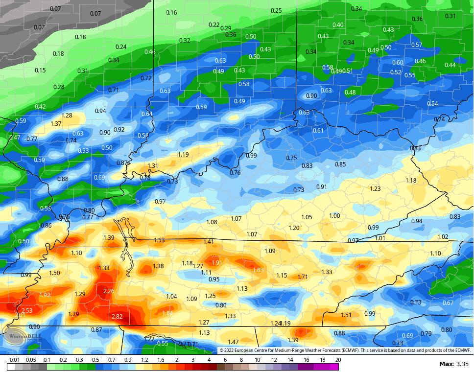
Rainfall numbers from the models might be enough to combine with snow melt to cause local high water issues…
GFS
NAM
Hi Res NAM
CANADIAN
EURO
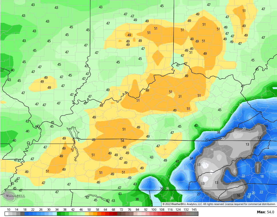
Winds will be super gusty Saturday night and early Sunday. Gusts of 40mph or greater will be possible…
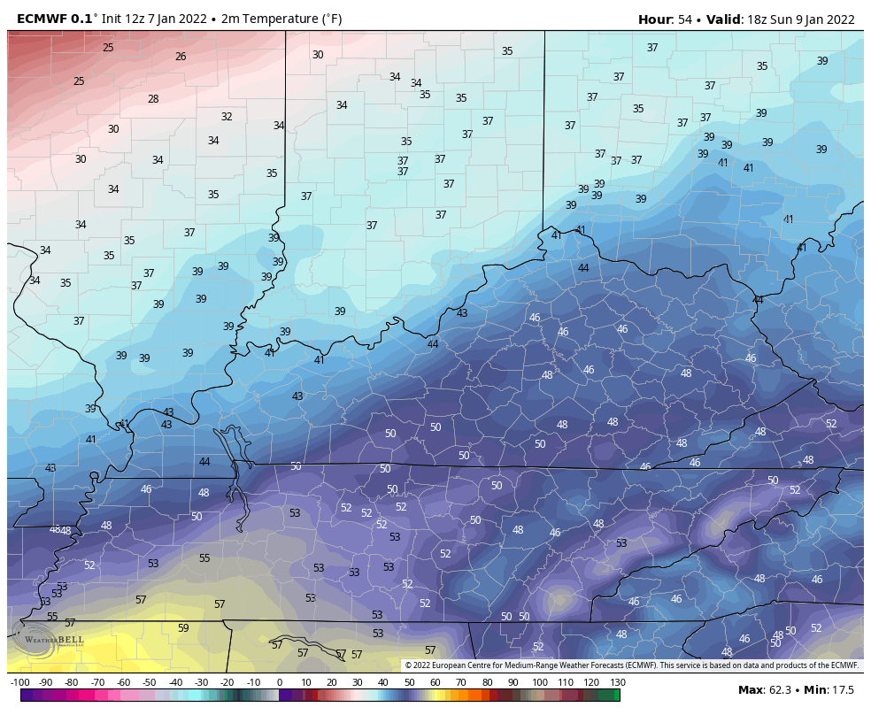
Temps crash late Sunday as arctic air returns. Here’s the EURO temp drop from 1pm Sunday through 7am Monday…
The Canadian is even colder…
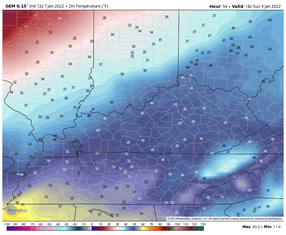
With a lot of water around, plan on a quick freeze up and this may cause travel issues Sunday night and Monday morning.
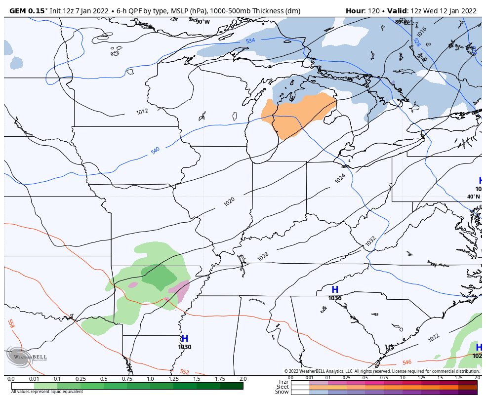
From there, it’s VERY cold into the first half of the week. The models are trying to spin up a couple of systems of interest later next week…
Canadian
GFS
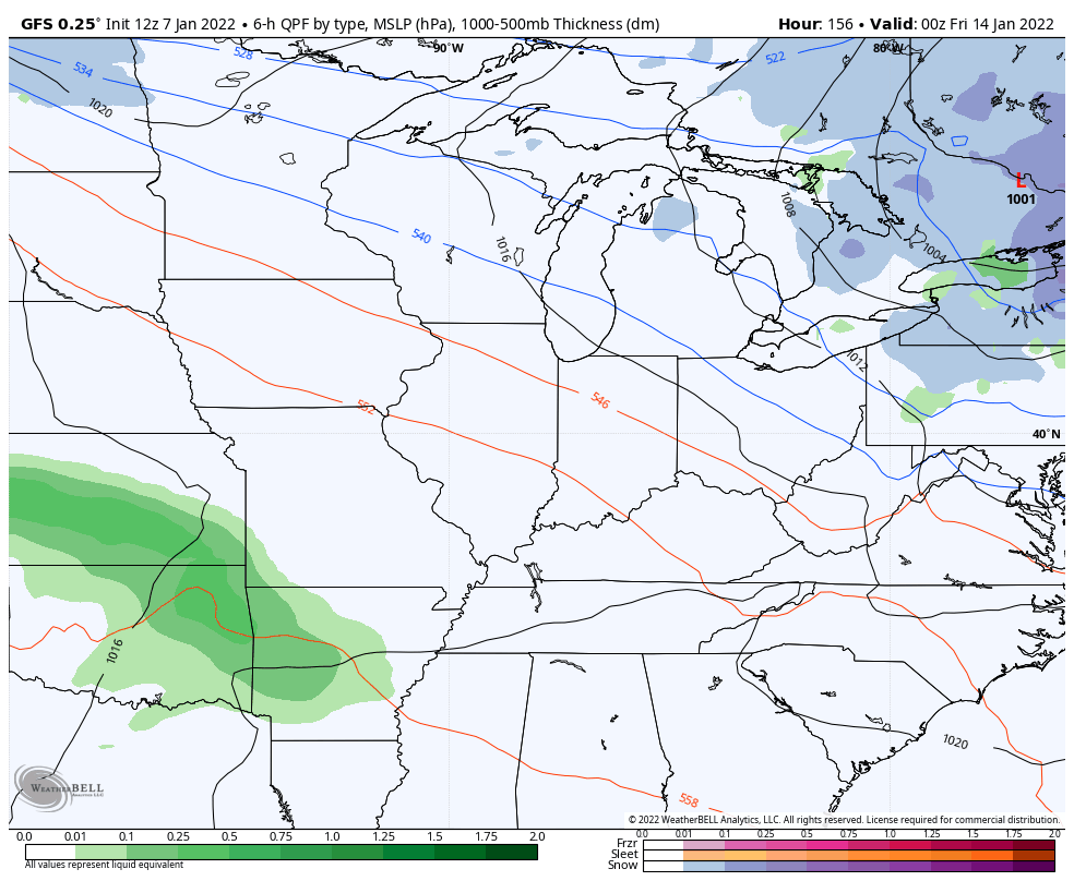
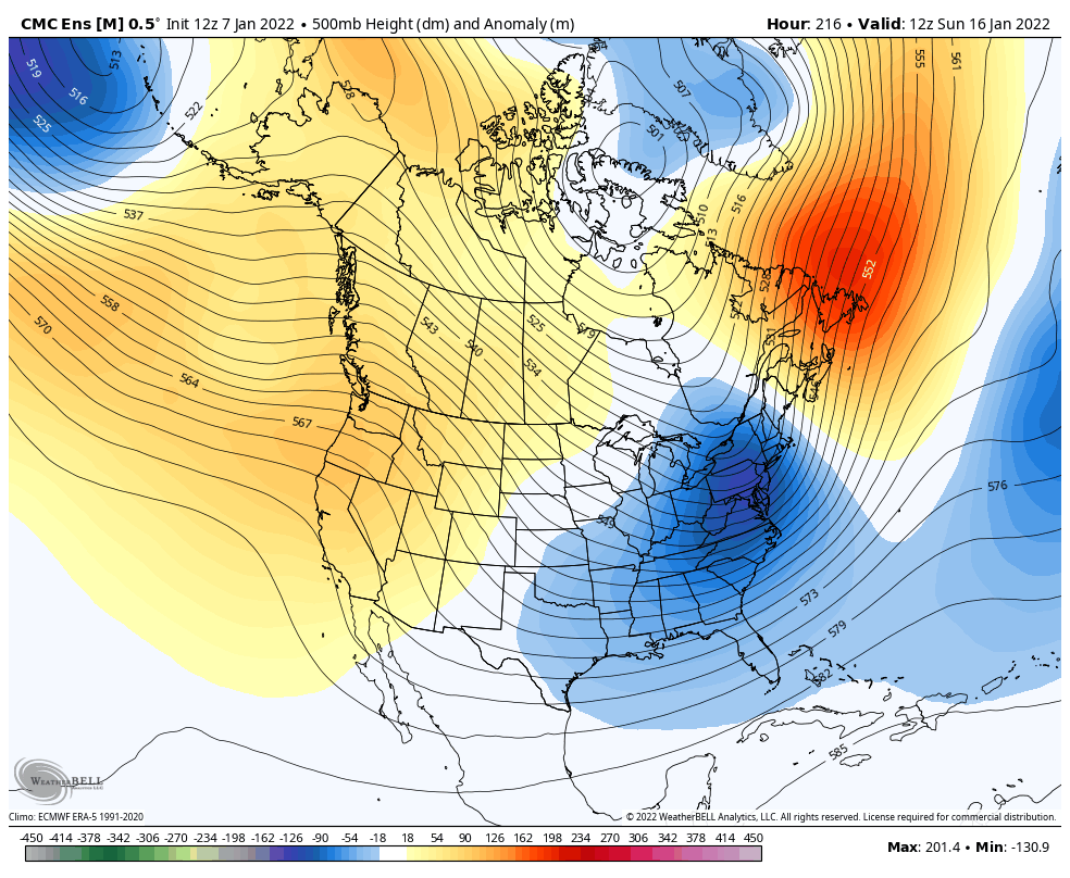
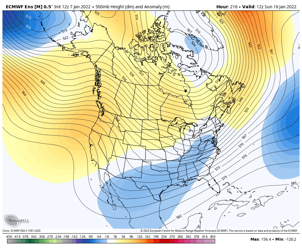
The pattern continues to look frigid for the middle and end of the month…
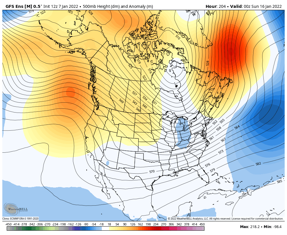
GFS Ensembles
Canadian Ensembles
Euro Ensembles
There’s a lot of winter on the way, folks.
Have a good one and take care.

Clipper season is upon us.
Thanks Chris, looking now like a lot more Snow chances through the rest of the Winter.