Good Saturday, folks. After a frigid and snowy start to the weekend, our focus is now on the potential for high water and high winds. There’s even a very low risk for a few strong/severe storms in the far west later today. Oh yea… Arctic air returns late Sunday with a freeze up possible.
Ok, let’s get into what we’re facing this weekend.
- Temps today start to slowly climb into the 30s with a few 40s in the west.
- A cold front moves in late tonight and early Sunday and may have a wave of low pressure along it.
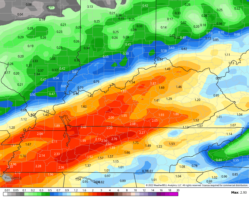
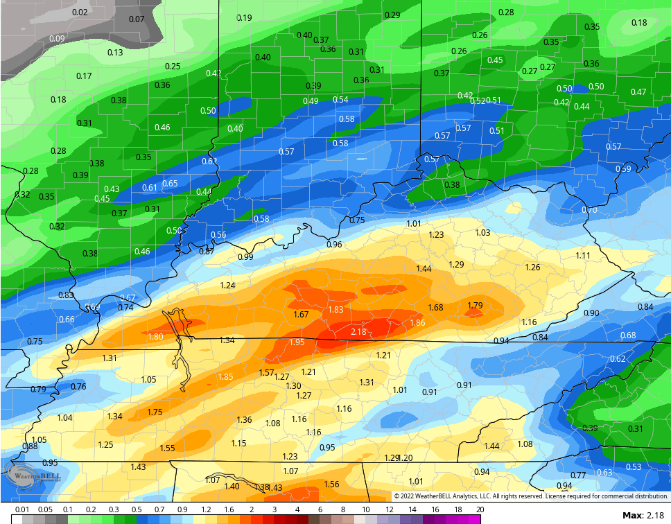
- Heavy rain is likely along this boundary with many areas picking up 1″-2″ with locally higher amounts.
- That rain will be falling on a deep snow pack and a frozen ground. That means the ground won’t really absorb the rains and this will increase the risk for, at least, local high water issues.
- There’s even the low chance for strong/severe storms in the far west this evening.
- Winds are a big player tonight and early Sunday with gusts reaching 40mph at times.
- Temps on Sunday tank behind the front and we may even see a few flakes by evening.
- A flash freeze is possible Sunday night as temps hit the teens.
Here’s the future radar from the HRRR from 7pm this evening through 7pm Sunday…
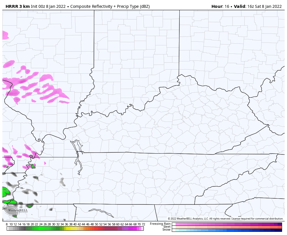
I’m wondering if the leading edge of that could start as a brief touch of frozen stuff?
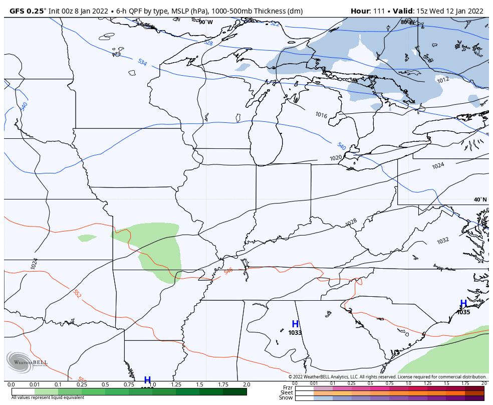
The rainfall numbers from the models…
NAM
GFS
The freeze up potential then comes quickly as arctic cold returns. Here’s the NAM temp animation from 7am Sunday through 7am Monday shows what I’m talking about…
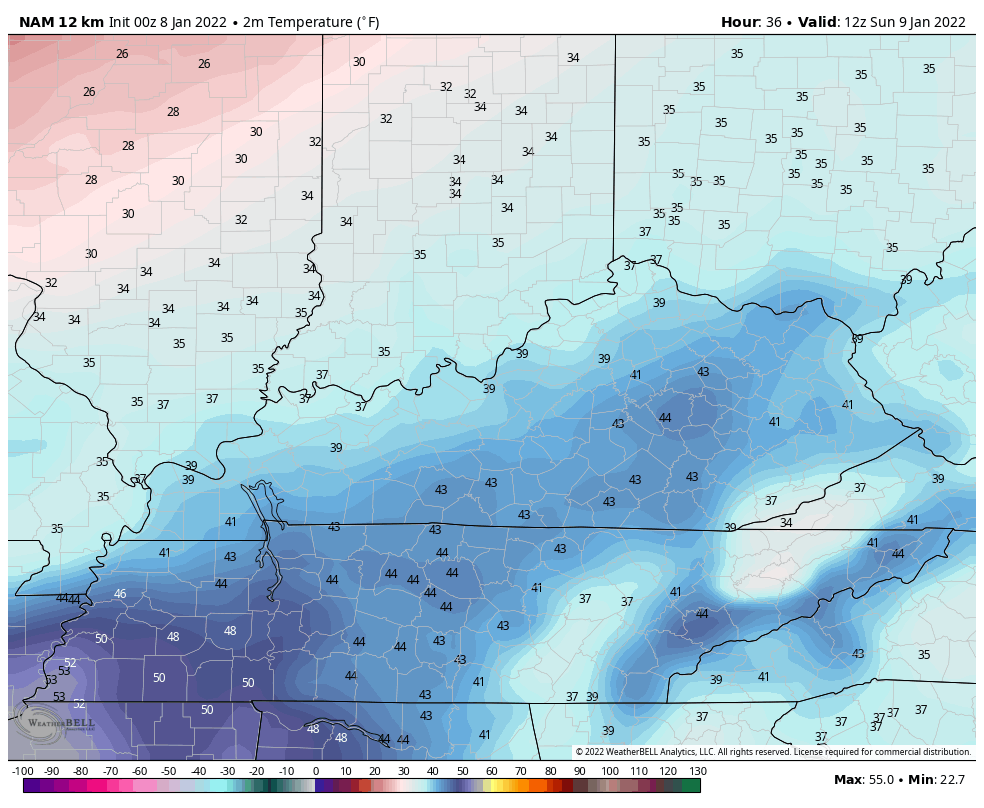
That will ice things up pretty quickly.
Temps stay really cold into the first half of the week, but things get a little murky right after that. We have two systems to track, but the timing is up in the air on those. We are finding some good agreement between the GFS and Canadian Models, though. Both have a weak rain and snow maker later Wednesday and early Thursday with another winter system later in the week or next weekend…
GFS
CANADIAN
The EURO doesn’t have the Wednesday system, but shows something by the weekend…
I’ve been showing how the pattern is likely to continue to average below normal with the potential for a super cold stretch later in the month. The latest GFS Extended Ensembles for the next 30 days show just that…
Updates will come your way later today. I leave you with your tracking tools for the day…

Have a great Saturday and take care.

Thanks Chris, looking like the Sunrise will be more colorful on the Snow than it was yesterday morning. We still have at least 7 inches of Snow on the ground. I agree, if the coming precipitation catches up with the current cold temperatures, there could be a period of Snow or Sleet before switching over to rain tonight.
Seems like all the models are agreeing on some type of Winter storm for mid week and especially next weekend. Long way off though.