Good Sunday to one and all. A major winter storm is moving across much of the region today and will bring significant amounts of snow and a little bit of ice. This is a system that will cause all kinds of problems through Monday.
Here are some thoughts:
- Odds strongly favor this being a major winter storm for much of central and eastern Kentucky with snowfall totals ranging from 2″-10″, depending on where you live.
- A wintry mix and snow starts across southern Kentucky and blossoms as it rolls northeastward through the day.
- This mix and light freezing rain will then quickly switch to a heavy, wet snowfall that can put down snow rates of 1″ or so per hour for a time.
- That snow will expand back toward the northwest into areas of central Kentucky this afternoon.
- Our prime snow making time is this afternoon and evening.
- Given the fact this is a wet snow, power issues may show up in some parts of the state.
- Road conditions will go downhill very quickly, and we may see another round of big travel issues.
- The snow tapers off across the northeast late tonight, but the next system quickly fills back in early Monday.
- Monday turns into a widespread light snow maker across central and eastern Kentucky and can drop another inch or two.
- Travel conditions through our MLK Day will be in bad shape across central and eastern Kentucky and lingering issues will likely show up into Tuesday.
- Winds are another factor with this setup and some gusts of 25-3mph may show up. That may plaster snows to the sides of buildings and trees.
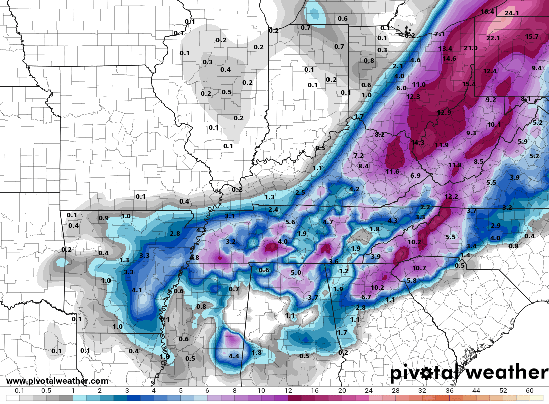
So where does all this set up? I’m rolling with the last snow map I put out earlier…
/cloudfront-us-east-1.images.arcpublishing.com/gray/Z5D5NONS6ZEQLNVHVPV5ZRHXEI.png)
There will be some locations where sleet and freezing rain cut deeper into snow totals. I think this may show up more across areas of southeastern Kentucky, so keep that in mind. Some of these areas may not make the low end of the forecast if the mix lasts longer than anticipated.
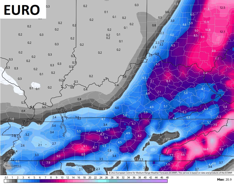
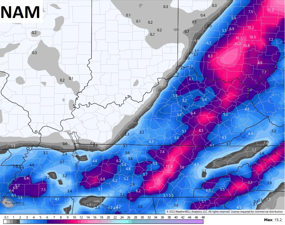
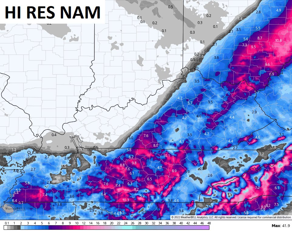
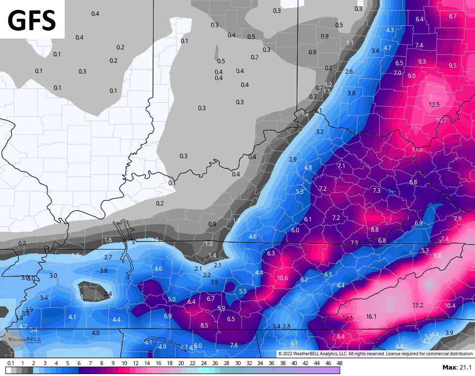
The latest forecast models have minor variations, but they all have an overall similar look…
RAP
Updates will come your way later today. Until then, I have you guys all hooked up with your radars and cams to track this winter storm across Kentucky. I will have updates through the day and on WKYT-TV.
LEXINGTON


LONDON


CORBIN

SOMERSET

PIKEVILLE

Mt. Parkway near Slade

MOREHEAD

JENKINS

PINE MOUNTAIN

MAYSVILLE

Have a great day and take care.

Thanks Chris, this is one storm I wish would just GO AWAY !
Still having problems with the log in, even after rebooting my router. This site won’t let me stay logged in, as it just keeps kicking me out and requires verification. I don’t know what else to do to solve the problem. When I first came on KWC there wasn’t any problems. It is just too SAD that the World has to be this way.
All I am getting out of this winter is high energy bills.
Right now the comment section is back to normal here on my end. I just hope it holds this time.
We are experiencing freezing rain at the present, whether it changes to Snow remains to be seen.
Could be a power knocker outer ?
Well if it does you will save on your electric bill.
I am kidding, I don’t want anybody to lose their electric.
moderate freezing rain in manchester, foing be alot more ice than predicted. NWS said a glaze to a teenth of a inch. already got that up my holler.
I just looked at satellite in South Carolina there are some waves in the clouds headed toward KY is this the heavy snow? So far here in Johnson Co. it’s 32 and rain.