Good afternoon, folks. Ice continues to be a problem in parts of the state as the next round of moisture works in. This will turn into another round of heavy rain for much of the area as a strong cold front finally moves through later tonight and early Friday.
Light freezing rain and sleet did in fact cause issues across parts of the region this morning. Areas of the west continue to deal with the freezing rain threat through the afternoon and you can see this showing up on some of the traffic cams out west…
PADUCAH

FORT CAMPBELL

For the rest of the state, temps continue to climb with rounds of heavy rain and some rumbles of thunder. This may put down enough rain to cause, at least, local high water issues.
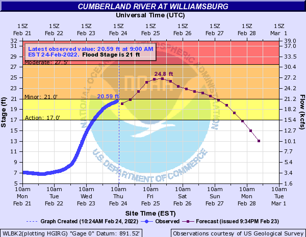
A Flood Warning is out for the Cumberland River with minor flooding now expected…
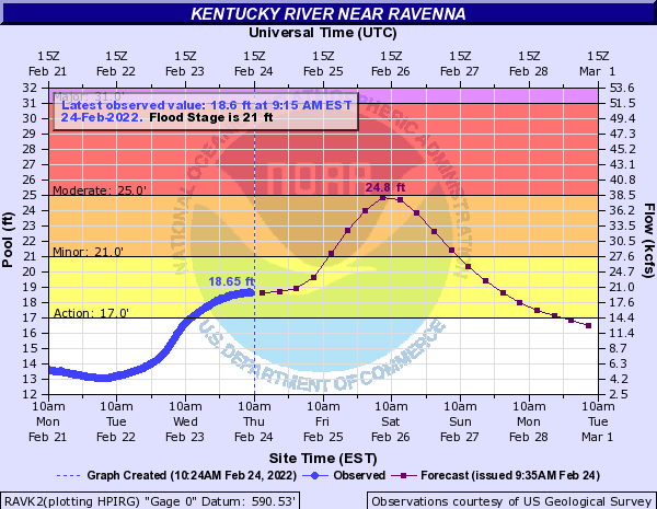
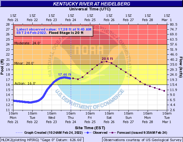
The Kentucky River is also expected to exceed flood stage in the coming days…
Here are your radars to track today’s storm system…

Cold winds blow for Friday and will likely fire up a few flurries or snow showers.
The weekend looks pretty ho hum with better weather for many, but we are still watching this third system for the possibility of a little moisture in the south and southeast…

Milder air blows in behind this to start the new week, but the GFS is trying to crash much colder air in here later in the week…

The EURO isn’t having any part of what the GFS is cooking…

Quite the difference, huh?
The EURO then gets even milder for the first weekend of March…

Enjoy the rest of the day and take care.
