Good evening, folks. We have a chilly rain rolling into the region later tonight and early Wednesday. This is the opening act for a big time blast of winter coming our way late Friday into Saturday. That’s likely to put snow on the ground as arctic air sweeps in.
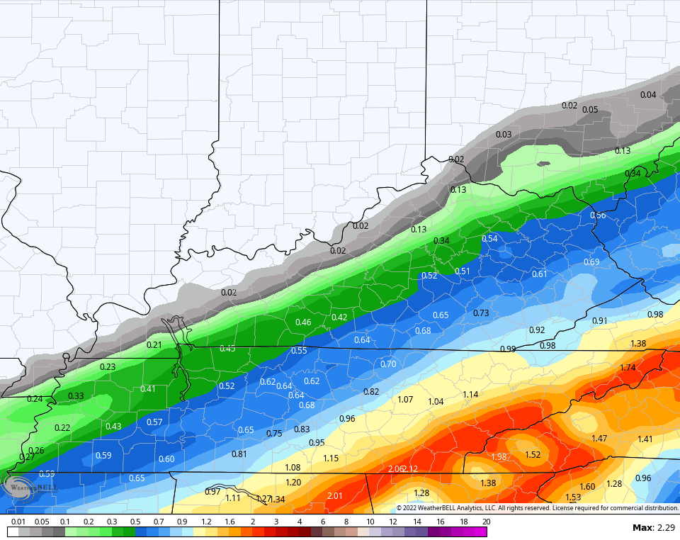
Before we get to that system, let’s talk briefly about the system moving in tonight. This is mainly a rain maker, but a bit of a mix or some light snow may show up across the north by early Wednesday. Rainfall numbers from this system may be up to an inch in the southeast…
Here are your radars to follow the action in from the southwest…
Skies brighten from west to east Wednesday afternoon, but it’s another colder than normal day.
Thursday is the pick weather day of the week with some sun and normal temps in the 50s.
As far as the weekend system is concerned, I have ZERO changes…
- A deep trough dives into the plains states and merges with some energy slipping in from the southwest.
- Those two will hook up to carve out a major trough into the eastern half of the country.
- Frigid air surges into this trough as an arctic front sweeps in.
- This arctic front shows up in western Kentucky Friday afternoon then sweeps eastward across the state through Friday night. At the same time, low pressure develops along this boundary and rolls northeastward.
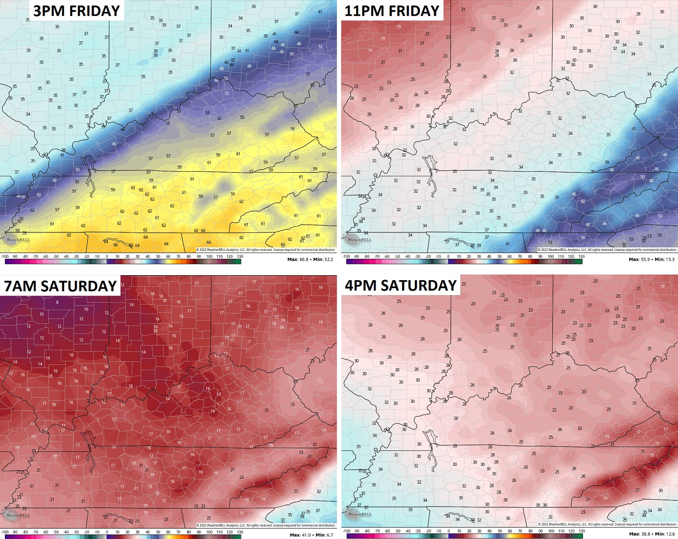
- Temps ahead of the front reach the 60s on Friday. Temps behind the front quickly fall below freezing and lows Friday night reach the upper teens to low 20s. Wow!
- A little bit of light rain will develop ahead of the front, but much of the moisture looks to be behind the boundary into the cold air. That means snow looks to be the predominate precipitation type.
- Can this turn into a full blown winter storm? Yes it can. The exact track and intensity of the low will be the determining factor in that.
- Whatever snows we get will taper off from west to east early Saturday but some snow showers may linger into the afternoon across central and eastern Kentucky.
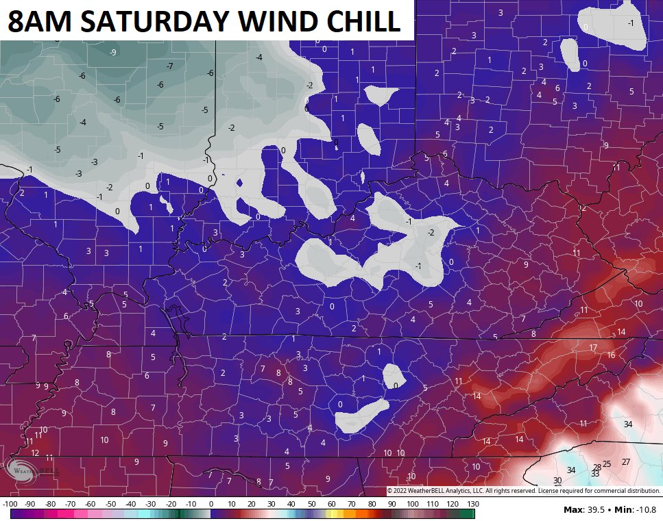
- This is also a very windy system and this could very well take our wind chills into the single digits with a chance of a zero or below.
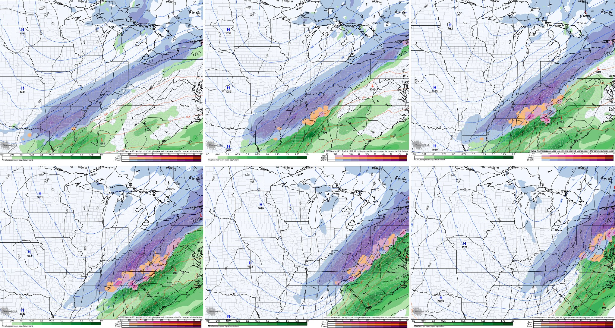
The new run of the EURO continues to show a healthy snowfall around here…
So does the GFS…
So does the Canadian…
Check out the temp crash…
Oh and those wind chills will leave a mark on Saturday morning…
Ugh.
The good news is I expect temps to rebound quickly next week and we may hit 70 by the end of the week. Woot!
Enjoy the evening and take care.


I say let it snow because all I will be doing is watching basketball inside my house. Also, gas is to expensive to be out doing meaninglessness activity.
I have plenty of bread an other food stipends. So bring it on.
For the past couple of days, the WPC has indicated that snowfall in the Bowling Green area would be light. I have no problem with a light coating whatsoever. A “cosmetic” snow will help to insulate some of the newly emerged shoots, when the temperature drops into the teen’s Saturday evening. But get beyond the weekend, and we’re looking at temperatures in the 70’s. Finally, full-on #TeamSpring weather!