Good Tuesday, folks ( for real this time). Things are much colder out there today, but this is nothing compared to what’s on the way later this week into the weekend. That’s when an honest to goodness blast of wintertime slams into our part of the world. #TeamSpring ain’t happy.
Before we get to the good stuff, we have some weather to track ahead of all that.
Our day starts with a few flakes flying across the eastern part of the state with temps around the freezing mark. Skies become partly sunny as most hit the 40s this afternoon.
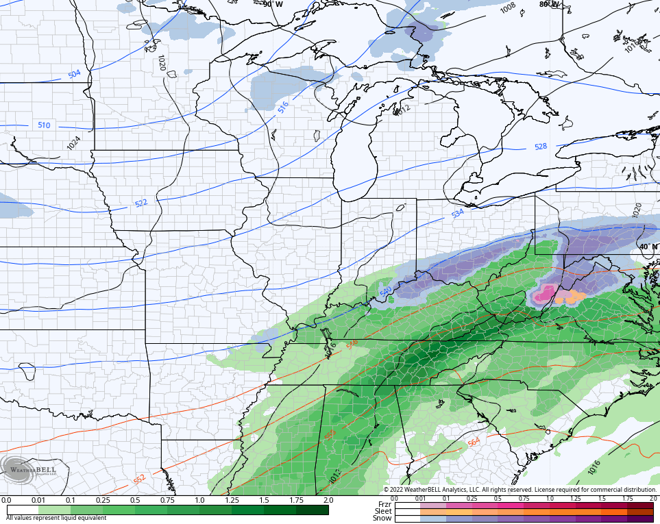
Clouds will quickly increase this evening ahead of low pressure moving toward the southern Appalachian Mountains Tuesday night and Wednesday. This brings rain across much of the state with the potential for a little light snow or a mix in the north. You can see that on the NAM…
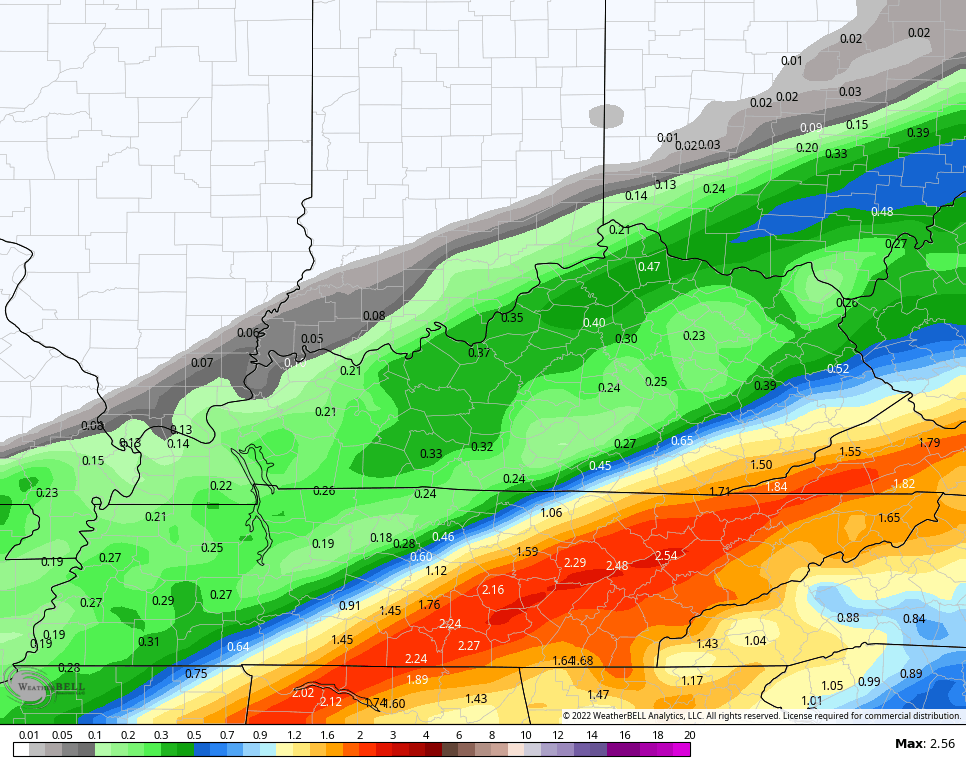
With this system trending a little stronger, the potential for heavy rain is now showing up greater across the southeastern part of the state. The NAM is spitting out 1″-2″ of rain…
We will need to be mindful of local high water issues in a few of those counties.
Skies clean up quickly from west to east Wednesday with highs going from the middle 40s east to middle 50s west.
Thursday looks like a really good day with some sun and highs about normal for the second week of March.
This is where things could get really interesting. Here’s a breakdown of how things may play out:
- A deep trough dives into the plains states and merges with some energy slipping in from the southwest.
- Those two will hook up to carve out a major trough into the eastern half of the country.
- Frigid air surges into this trough as an arctic front sweeps in.
- This arctic front shows up in western Kentucky Friday afternoon then sweeps eastward across the state through Friday night. At the same time, low pressure develops along this boundary and rolls northeastward.
- Temps ahead of the front reach the 60s on Friday. Temps behind the front quickly fall below freezing and lows Friday night reach the upper teens to low 20s. Wow!
- A little bit of light rain will develop ahead of the front, but much of the moisture looks to be behind the boundary into the cold air. That means snow looks to be the predominate precipitation type.
- Can this turn into a full blown winter storm? Yes it can. The exact track and intensity of the low will be the determining factor in that.
- Whatever snows we get will taper off from west to east early Saturday but some snow showers may linger into the afternoon across central and eastern Kentucky.
- This is also a very windy system and this could very well take our wind chills into the single digits with a chance of a zero or below.
The GFS has a big hitting system…
It then goes on to show the snow showers later Saturday…
The EURO is also a big hitter with some wind…
The Canadian isn’t as potent, but still has a nice system…
I will throw you updates later today. Make it a good one and take care.


Thanks Chris, ” I Hope It Snows Buckets ” Borrowing this Quote from the Late Great Meteorologist Marcia Yockey. This Person is the One that Sparked My interest in Meteorology way back when.
Rainfall according to the Kentucky Mesonet still stands at 1.39 inches in the last 48 hours, but I know that this is Incorrect as we had Standing Water in our Yard an Hour after it started. Go figure ???
Schroder, She was a dandy with that board and black marker. Good memories watching her funny at times as well.
She was Hilarious and very Brilliant when it Came to Forecasting Snowstorms. Always enjoyed Her Hand Drawn Weather Maps. Never went Out more than Three Days with Her Forecast.