Good Tuesday, folks. A massive heat wave continues to engulf our region and it has a few more days left in the tank before much better weather moves in. The pattern that follows that is still up in the air with more heat and normal set to battle it out around here.
Ok, let’s do this heat wave thing:
TODAY
- This looks like the core of the heat wave.
- Highs will be around 100 in the western half of the state with low and middle 90s central and east.
- Heat index values across the state will be between 100 and 110 degrees. Local heat index numbers may approach 115 in the west. Wow!
- There’s still a storm risk but most stay dry.
WEDNESDAY
- The numbers are likely to come down a few degrees from Tuesday.
- Highs of 95-100 in the west and 90-95 east.
- Heat index values will still be in the 100-110 category.
- There’s the chance for a storm or two to go up, especially in the south and east. That can cut into temps.
THURSDAY
- A cold front drops in from the northwest late in the day.
- Showers and storms will be around in scattered fashion.
- Highs ahead of this front will still be in the 90-95 degree range with a heat index around 100 or so.
FRIDAY
- Feels much better as we break the real deal heat as the front moves through.
- This brings a line of storms dropping in from north to south.
- The storms don’t look widespread, but a few could be strong or severe.
The temps behind this go well below normal for the weekend…
Highs in the 70s will be likely with low humidity levels settling back in. Shew!!!
Lows by Sunday morning may reach the 40s… Yes, the 40s…
That’s some of the good stuff!!
Temps should rebound next week, but the GFS wants to bring another pleasant blast after that…
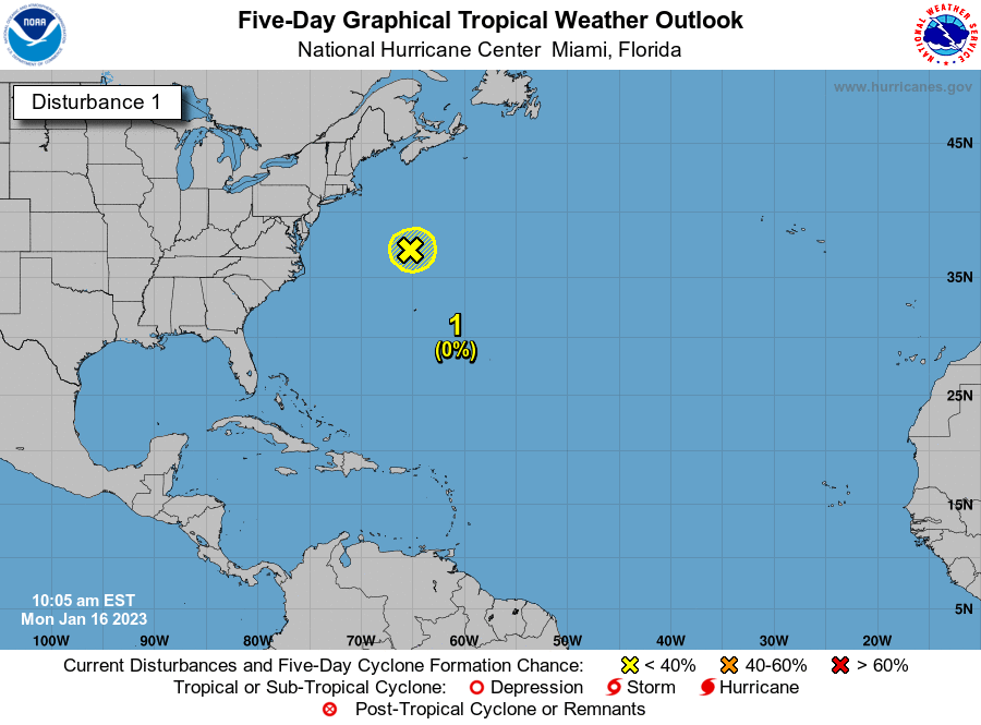
Of course, much of this period may be dictated by the tropics. I said last week to watch for development this week and the National Hurricane Center continues to up the odds for something popping…

As usual, I lave you with your toys to track any storm that pops up out there today…
Have a terrific Tuesday and take care.


Monday was brutally hot in the Bowling Green area, as it was at my PWS just south of town. At 12:30 pm CDT, I recorded a Heat Index of 119.4°, which was the highest value I had ever recorded since installing the station 4 years ago. The air temperature at the time was”only” 96.1°, but the dewpoint was 81,4°, which was the primary factor that pushed the heat index so high. The high temperature for the day was 99.3°, set at 4:35 pm. Residual moisture from the 4.45″ rainfall last week may have been partly responsible for the extremely high dewpoint value, but we’ve seen marked increases in dewpoints over the past 12 to 18 months, and that is likely to continue for the foreseeable future.
Here in Maple, the dew point is not expected to be below 74 degrees this afternoon under mostly Sunny skies.
One thing I can say that I don’t remember is ever having heat waves like this in June.. Yes, I know June can be a hot month…but it’s always been later in the summer..Unless I’m remembering wrong. I mean, right now at 5 in the morning it’s still 80
We had a very HOT June in 1977 after a very Cold and Snowy Winter in South Central Indiana.
Rainfall might become an issue in the future.
A lot of scattered rain in the forecast.
The long extended forecast doesn’t look promising. Of course drawn out weather forecasts are often wrong.
According to the Kentucky Mesonet our highest temperature for June so far has been 92.4 degrees which occurred yesterday under mostly cloudy skies. We will likely exceed that this afternoon.
Rainfall does look scarce next several days according to the Ventusky Weather Site.
Here is the link for the summary of the violent supercell thunderstorms that slammed through the Northern and Central parts of the Chicago area late Monday afternoon and early evening. Several tornado warnings were issued, but no tornadoes have been confirmed so far. O’Hare Airport reported an incredible wind gust of 84 MPH!
The storms missed the SW Suburbs (where I am located), just to the north and northeast.
https://weather.gov/lot/June13SupercellRecap
Thanks for sharing Mike and glad your okay.
The winds were brutal in some places yesterday in the mid-west. I think Ft. Wayne reported 95mph.
Here is an article and a couple of videos from a Chicago TV Station detailing all the damage from the storm.
https://abc7chicago.com/chicago-weather-forecast-tornado-warning-severe/11957499/
We still have several folks in the Cincinnati area without power after a MCS rolled through around 6:00PM local time yesterday. A 55MPH wind gust was recorded at CVG and it was on the SW edge of the system.