Good Thursday, everyone. A cold front is pushing to our south and it’s taking storms and the heat with it. Much better air is sweeping into the region today and will hang around into the start of the weekend with a more impressive push of cooler air early next week.
Let’s begin with what’s going on out there today. Temps are in the 80s with low humidity and mostly sunny skies.
Friday starts in the 50s and ends in the 80s with more pleasant air in place.
Our weekend features a return of the heat with lots of upper 80s and low 90s for Saturday. Humidity levels climb and make it feel hotter than that under a dry sky. This toasty weather takes us into Sunday as clouds increase with showers and storms showing up later in the day. This is along and ahead of a cold front dropping in from the northwest…
Some pretty good showers and storms may show up this time and that’s actually a good thing because we need the rain.
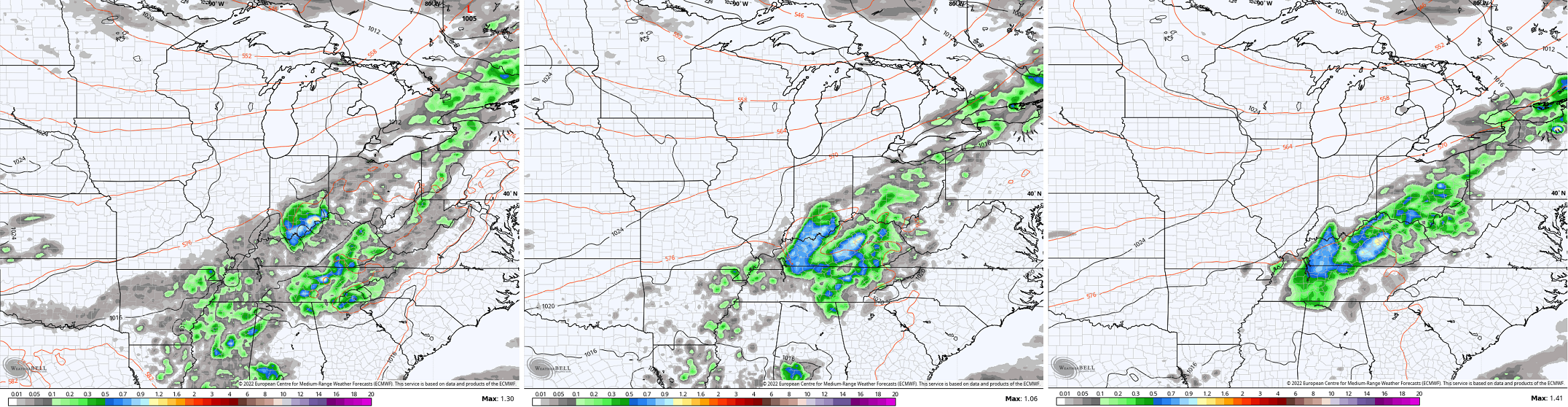
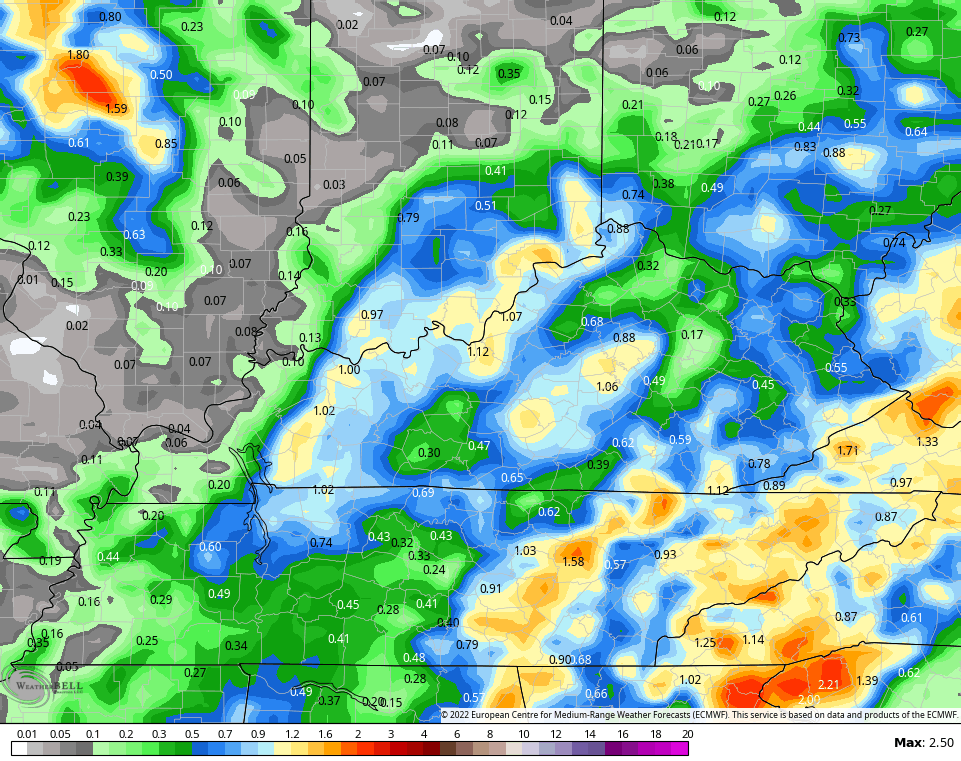
The EURO is showing 1″+ totals through early next week…
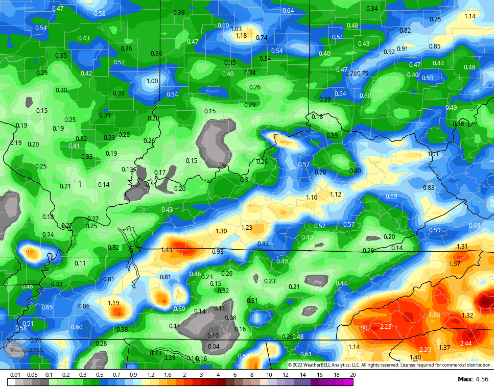
The GFS has a similar thought process
 Bring. It. On.
I warned you this was turning into a dry pattern and, unfortunately, mother nature is backing that up.
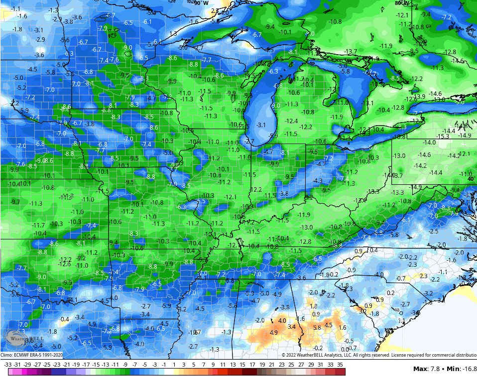
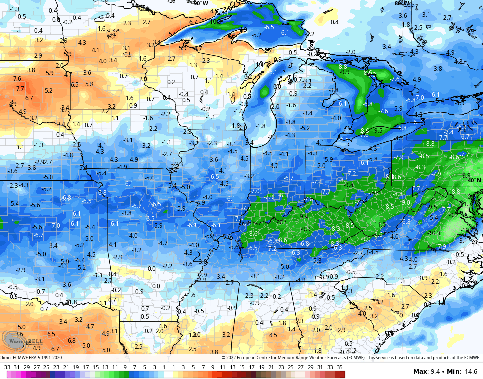
Temps behind the Sunday cold front really drop with very pleasant and below normal air early next week…
GFS
EURO
Yes, please!!
Guess what we are going to start doing over the next few weeks? Looking down the road to fall and… Winter. 😲🤯
Have a terrific Thursday and take care.

I’m ready.
Very little Rain fell yesterday here in Maple, but we will take what we can get.
Glad the weather models are agreeing on cooler temperatures for next week. Hopefully, there will be more widespread Rain this time around ?
Autumn and Winter are a long way off and a lot of changes will have to take place in the atmosphere if we are to have that Cold and Snowy Winter that is long overdue.