Good Friday to one and all. We are rolling into the final weekend of June with some really good weather out there today. Once into the weekend, we steam it up before we storm it up with cooler air waiting in the wings for early next week.
Temps today are generally in the 80s for many with sunshine and low humidity levels. Soak it up because the numbers will climb over the weekend. Highs are back into the upper 80s to low 90s for many as humidity levels increase.
There’s the threat for a shower or storm to bubble up on Saturday, but the best chance for showers and storms will sweep in late Sunday into Sunday night as a cold front enters the region…

Some of those storms late Sunday may be strong or severe and that’s something to watch out for as we get closer.
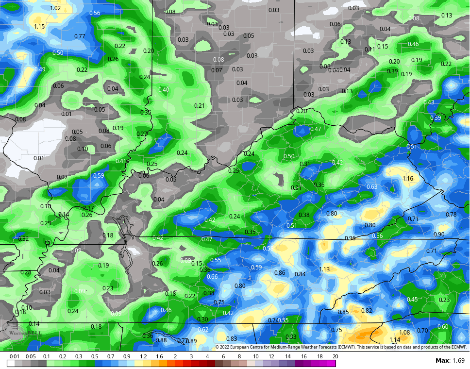
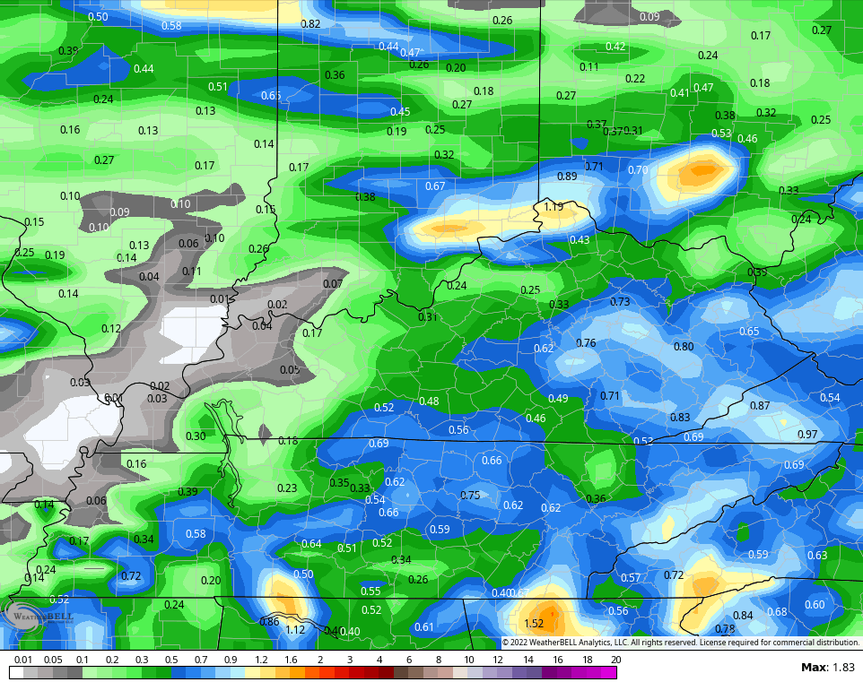
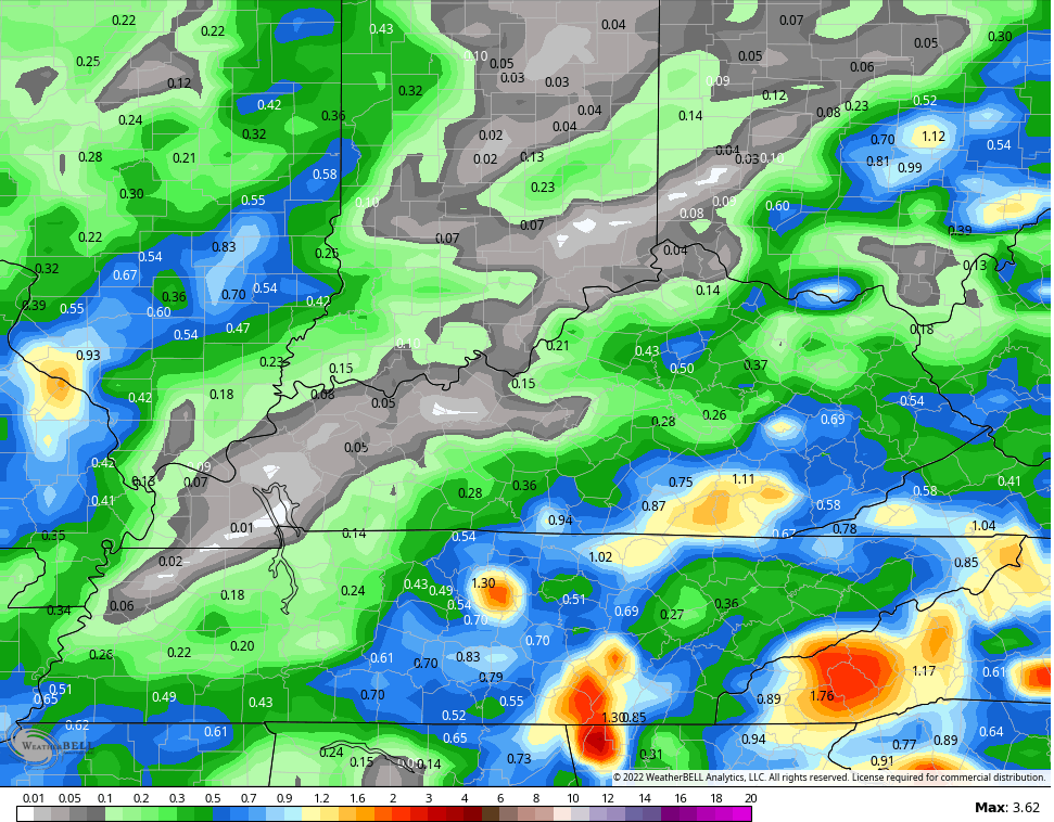
We need the rain and the models are spitting out some decent totals…
EURO
CANADIAN
GFS
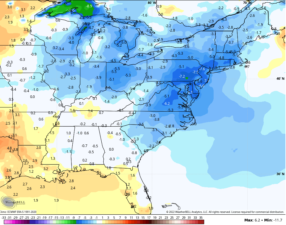
Temps behind this boundary come way down with 75-80 for many Monday and Tuesday. Check out the overnight lows settling in…

We’ve had plenty of hot days this month, but don’t discount the number of very pleasant days. It’s been interesting to watch these cold fronts push deep into the south keeping the heat from ever fully taking hold.
The pattern continues to skew drier than normal into early July, but the GFS is keeping the temps normal to a little below for the first 10 days of July…
With a dry ground, we will see about that.
Have a great Friday and take care.

I had about 20 minutes of rain Wednesday at my house. The Louisville Airport reported only a trace.
The rain chance for Sunday doesn’t look that promising for communities along the Ohio River.
I do like that there will be some cooler days from time to time.
We didn’t have any Rain at my house. Getting critical for the local Farming community. Maybe we will see an end to this “Moderate Drought” in the near future ?
I don’t want to see the formation of an Atlantic or Gulf Hurricane, but will hope for a Tropical Storm running up the Mississippi River into the Ohio Valley to bring widespread Rains to our region.
Looking forward to the cooler temperatures predicted for next week.
June has been an all or nothing month in terms of rain in central Warren County. The last measurable rain I recorded at my PWS was 4.45″ on June 6th, and not a drop since. Lack of rain has become critical, a situation that we haven’t seen around here since 2012, when drought was the word on everyone’s mind.
In this month of June we recorded a high of 94.6 degrees and only 2.76 inches of precipitation.
Shades of 1988 to 1990 and 2012. Crops looking stressed going into town this late morning.