Good Saturday, everyone. More humidity is creeping into the region and this is bringing the chance for showers and storms into the picture with the potential for some late Sunday strong storms. From there, we turn the temps down before going into a more active setup for early July.
Let’s start this party off with what’s going on out there today.
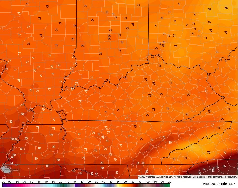
Temps range from the middle 80s to low 90s depending on where you are. There’s more humidity into the mix and that leads to a scattering of showers and storms going up. The best chance is across central and eastern Kentucky, especially the farther south you live. Here are your radars to follow along…

Sunday temps will be in similar territory with some scattered showers and storms going up. We could have a line of strong to severe storms moving in ahead of a cold front late Sunday into Sunday evening. Here’s the Sunday Severe Weather Outlook from the Storm Prediction Center…

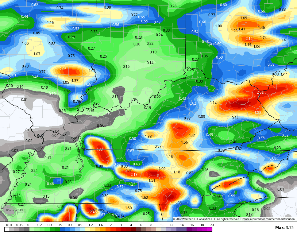
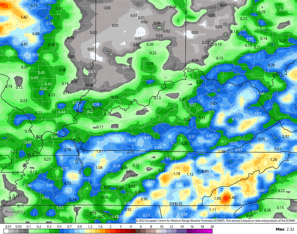
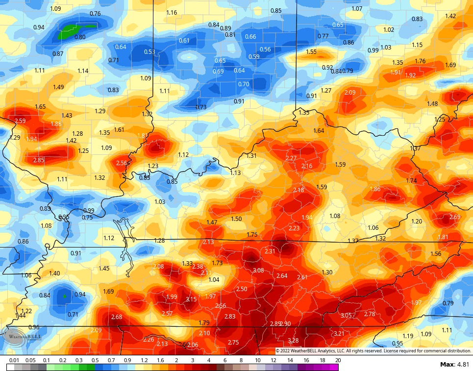
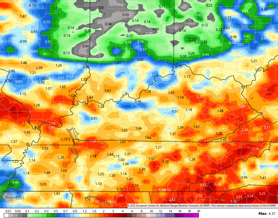
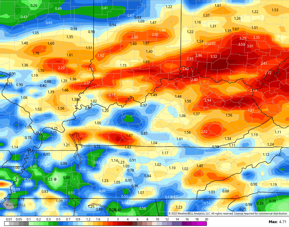
We need the rain from the system and the models have some areas getting a nice drink of water through Monday…
NAM
EURO
GFS
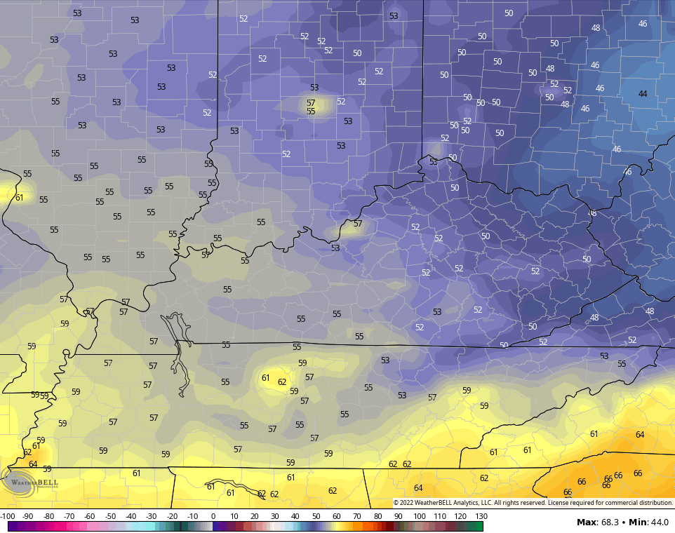
The rain does end quickly Monday morning with comfy air settling in. Check out the Monday afternoon temps on the NAM…
Lows by Tuesday morning are in the low and middle 50s with the chance for upper 40s in a few of the valleys…
That pleasant air hangs through Tuesday and Wednesday before returning to normal later in the week. That’s when we close the book on June and say howdy to July. The pattern into the 4th of July weekend looks more active with some showers and storms rumbling through.
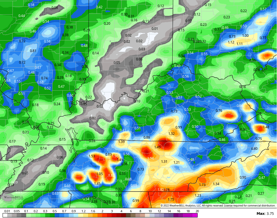
The rainfall numbers through July 3rd show this well…
GFS
EURO
CANADIAN
Yes, please!!!
Have a sensational Saturday and take care.

Richmond has missed out lately.
Same here on the south side of Lexington, Wednesday evening’s line fell apart at the Fayette County line. A few streets over had several minutes of rain while we counted 26 drops of water.
I’m extremely pessimistic about chances for meaningful rainfall in Central Warren County. We’ve had just a trace of rain since a single day rain total of 4.45″ fell on June 6th. Moreover, the air has been unusually dry for this time of year, hovering in the 45% range. Storms moving into an airmass such as this have a tendency to dissipate rather rapidly. as they did earlier this week. I agree with Schroeder that it may take a tropical storm to bust us out of this situation, but torrential rain falling on hard packed, bone dry soil can lead to localized flooding. We can’t seem to catch a break this Summer!!
The temperatures and the general weather with Sunny skies I can’t complain, but concerned about the lack of our normal precipitation going into July and August and maybe September and October ?
What concerns me more is the high potential for Wild Fires across the State and other States affected by the current Drought.
Field Crops like corn and Soybeans will not have the yields like we had in previous years. Hoping it won’t be like 2012 when plants burned up in the fields.
The current Weather Models seem to be agreeing on some decent Rains in the next few weeks. Cross your fingers on this one Folks.