Good Sunday, everyone. It’s another steamy day out there as a cold front gets set to roll across the state. This will bring a few strong storms for some areas, but everyone gets in on a much cooler setup for the next few days. I’ll look at that and take a gander into the 4th of July Weekend.
Temps today are back into the middle 80s to low 90s range with humidity adding to the numbers. Scattered showers and storms can go up at any time, but the greatest chance comes this afternoon and evening. That’s when a line of strong to severe storms may fire across areas of central and eastern Kentucky.
This is where the SPC has a low-end risk for severe storms…

I’ll have your tracking tools in a bit.
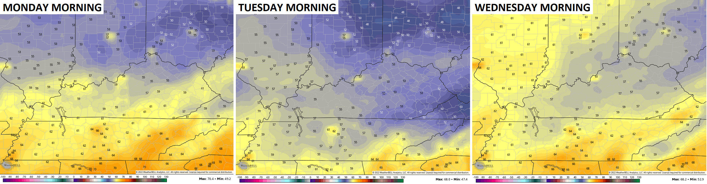
The shower and storm action ends early Monday in the south as the front slides south and east. Low humidity and highs in the 70s will team up for some sunshine to make for an awesome weather day. Similar temps will be noted on Tuesday before coming up a bit Wednesday.
3 straight mornings in the 50s are very possible once again…
Temps climb toward the 90 degree mark by the end of the week as we say bye to June and yo to July. This leads us into the 4th of July Weekend and it looks active with rounds of showers and storms around…

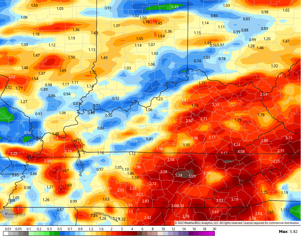
The GFS is spitting out some much needed rainfall numbers over the next week or so…
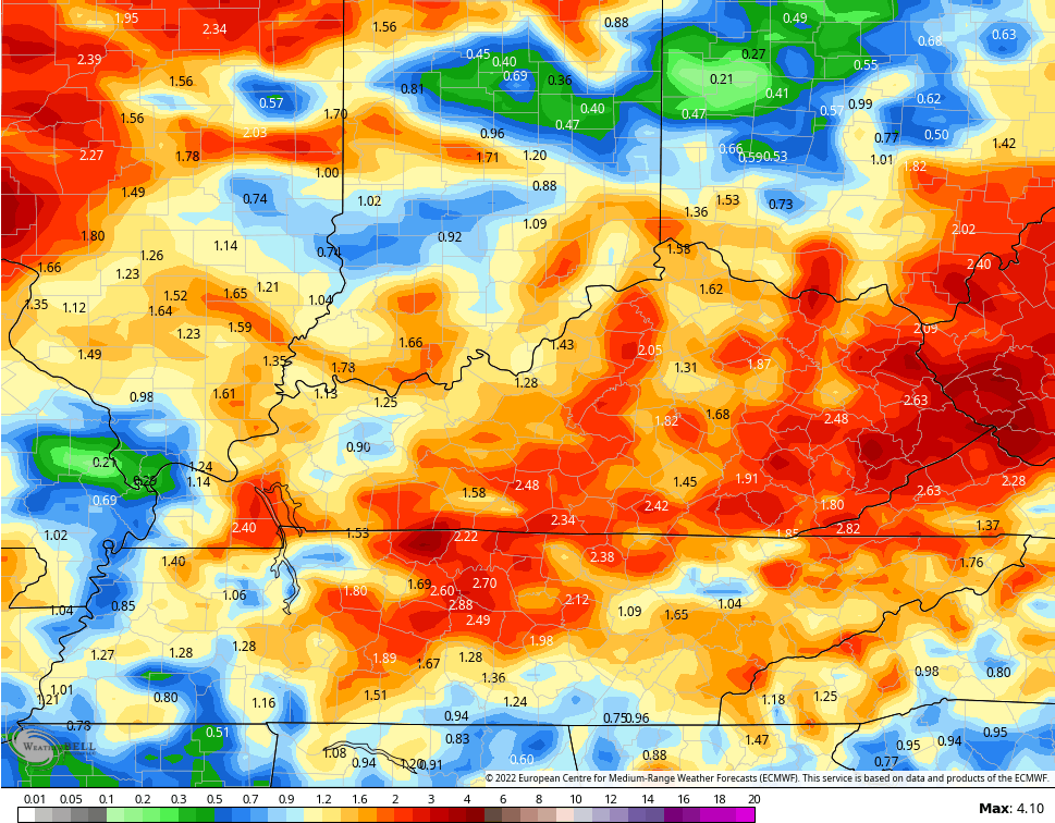
The EURO for the same time…
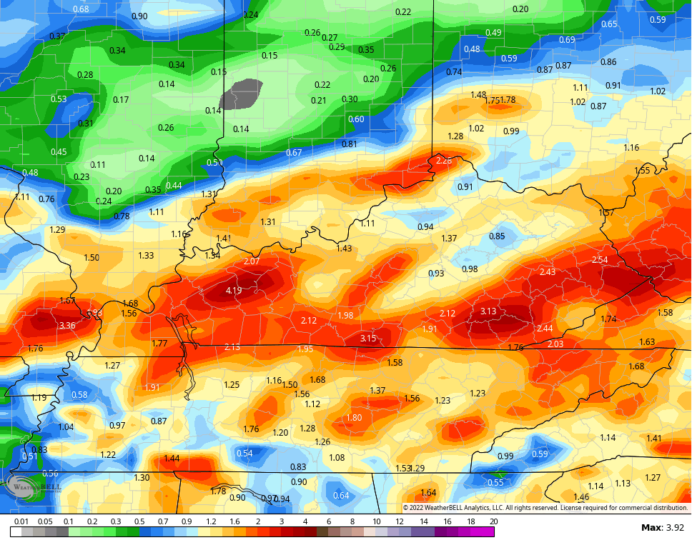
And the Canadian has a similar look…
Certainly looks much more busy than where we’ve been.
I leave you with your Sunday storm tracking toys…

Current watches

Possible Watch Areas

Have a great day and take care.

Thanks Chris, hoping for the rains/ showers later today and a break from the heat, even though it could be a lot miserable.
Looks like some decent rainfall is falling in parts of W.Ky.
Some kind of disturbance may be developing along the Northeast shore of the Gulf of Mexico. praying that it may be a Tropical Storm that could bring our area a soaking rain later in the week ? Fingers crossed.
https://weatherstreet.com/gulf-of-mexico-weather-satellite.htm
It looks like the umbrella is up over this side of Lexington again. Rain seems to dissipate just before it gets here.