Good Tuesday, folks. We have another awesome weather day taking shape across the region, but our temps are about to climb to close out the month. This can only mean the 4th of July holiday weekend is about upon us, and things are looking a little stormy.
Let’s go ahead and look ahead toward the big holiday period.
A cold front moves our way to start the new month on Friday. Scattered showers and thunderstorms look to fire up during the day with more rounds lurking through the 4th and even beyond. That front slows down and a few waves of low pressure rolls along this, enhancing the storm chances.
This GFS animation starts Friday and goes through July 6th…

That setup can bring some strong storms in here and may also put down beneficial, but heavy rains. Here’s the GFS rainfall forecast over the next week…
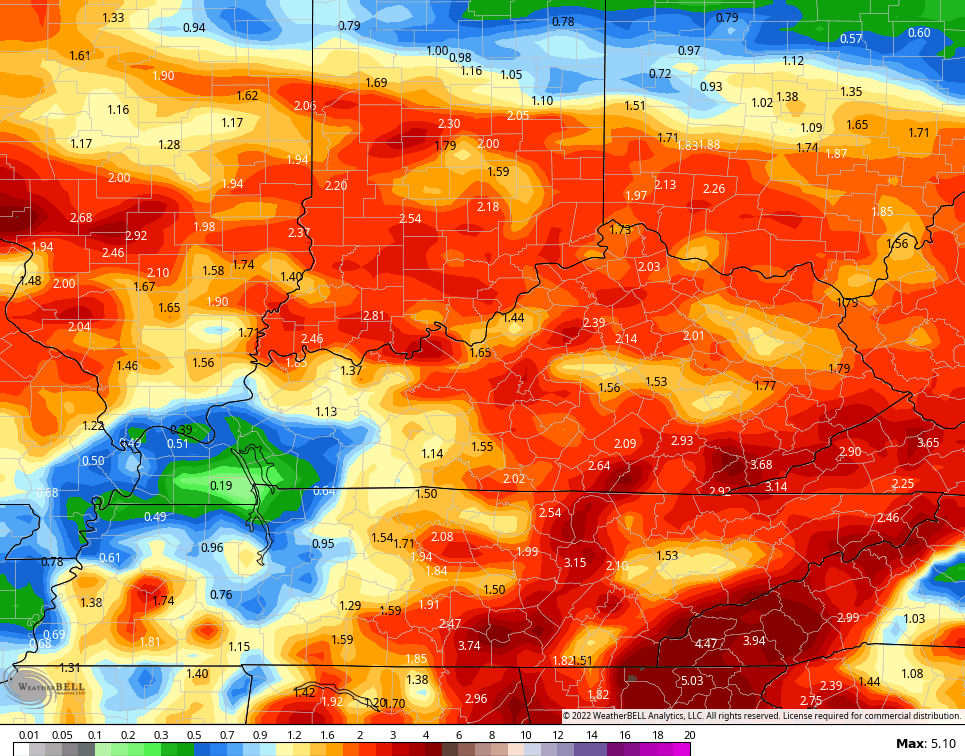
That may be a little overdone, but let’s be optimistic here! 😁
In terms of temps, this has been a fascinating June with heat and cool shots doing battle. It’s really rare to get as many cold fronts to drop through here and into the deep south. What does July hold? I suspect more of the same with heat and cool going back and forth on us.
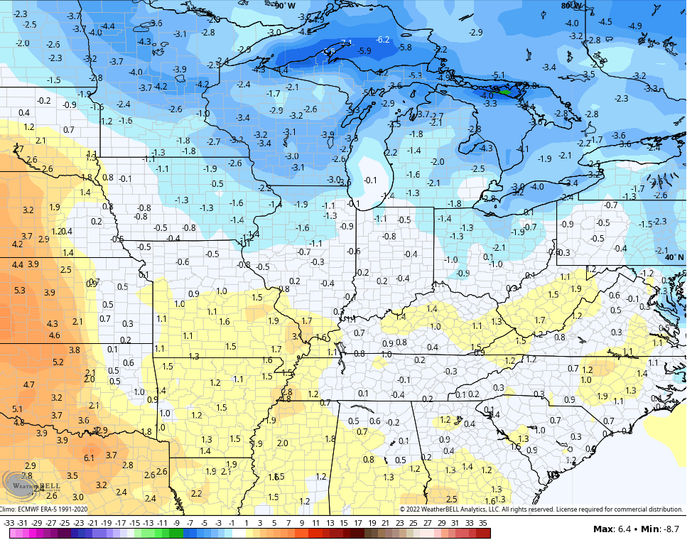
As far as the first 10 days of July are concerned, the GFS has a neutral temp look…
The EURO Ensembles have a toastier look…

The tropics continue to be super busy with the National Hurricane Center watching several systems…

Busy times ahead, folks.
Make it a terrific Tuesday and take care.

Thanks Chris, right, we haven’t had that many very uncomfortable days this month, but many dry days and hopefully that will change over the next few weeks. Optimistic that this will happen.
Nice to see some rain in the forecast. Hopefully the holiday weekend will not be a total washout.