Good Wednesday to one and all. It’s another steamy and stormy day across the Commonwealth as our nasty pattern rolls on. This setup has a few more days left in the tank before we change it up a bit once into the weekend.
Today will feature clusters of strong to severe storms dropping in here from the northwest. While this looks to impact much more of the state today, we’re likely to see some of the same issues we had in the east on Tuesday. Damaging winds, hail and local flash flooding issues will be possible.
The Storm Prediction Center has most of the region in the Slight Risk for severe storms today…

Temps out there today will be deep into the 90s again for the west, but only upper 80s and low 90s across the eastern half of the state.
Additional clusters of showers and storms will drop in for Thursday with another Marginal to Slight Risk for severe weather…

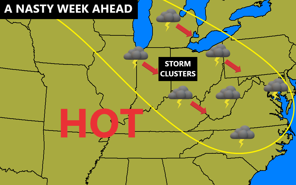
I think Friday will provide more of the same and this plays into the forecast we’ve had out since last week. I made this map Saturday to highlight the stormy setup of this week…
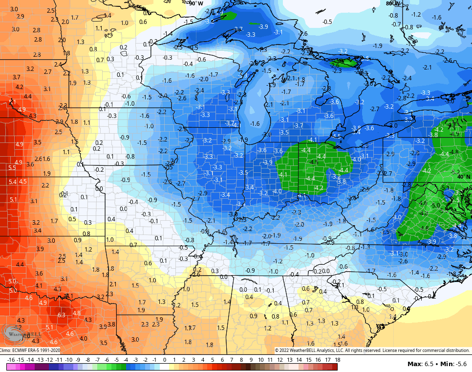
A cold front sweeps through on Saturday with a much better brand of air settling in for the weekend into Monday. The GFS Ensembles show a nice pocket of below normal numbers…
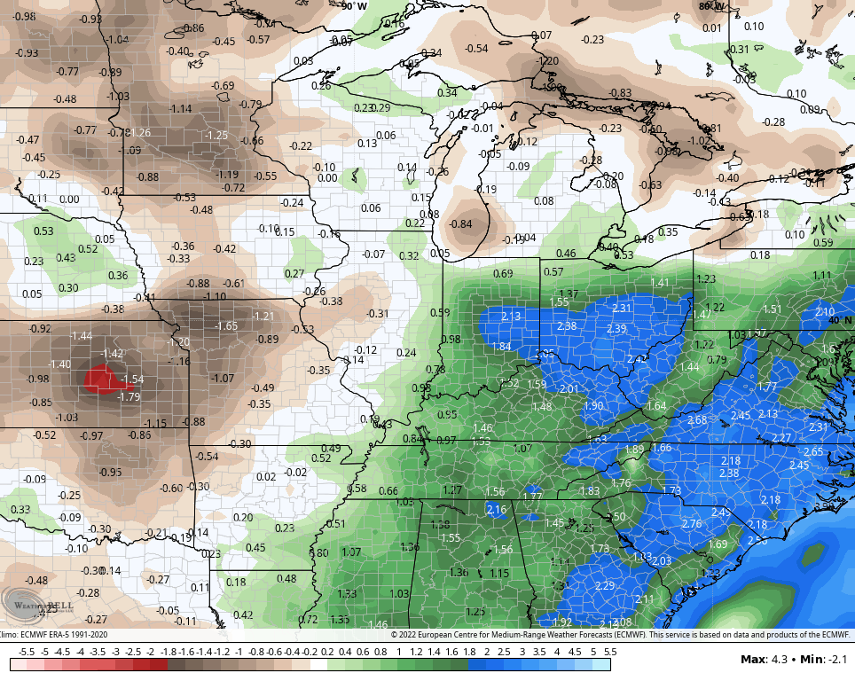
As we look even longer range via the EURO Weeklies, we find the pattern skewing wetter than normal from now through the middle of August…
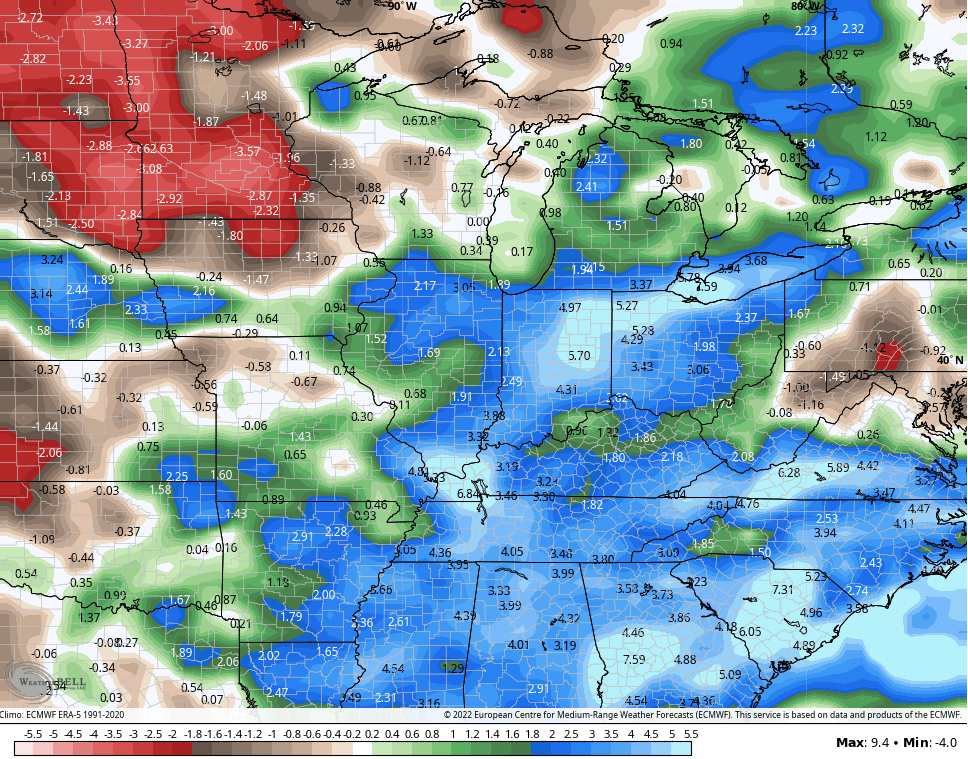
The control run of the Euro Weeklies are even more above normal…
This is exactly what happened during the same time back in 2012. Yes, that’s the year I said more than a month ago reminded me of the early summer pattern setting up. 😜
I will have the latest on WKYT-TV starting at 4pm so tune in as I track the severe threat and the heat wave. As always, I have you all set to track any severe weather out there today…

Current watches

Possible Watch Areas

Make it a great Wednesday and take care.

I hope to see some rain today.
Btw, it reach a 101 degrees in Louisville yesterday. LGE cut off my electric for scheduled routine maintenance. I had no AC for four hrs.
OMG that is brutal! I am sorry you had to go through that!
Saturday’s plan was to cut several acres of brush, but I’d rather have the rain and reschedule. Some of my early barometers for dry conditions are dropping leaves like it’s Fall.
This is a normal response due to drought stress for the Barometer Bush. If it Rains enough the plants may bloom. Surprised, that you have these plants growing in Kentucky. They are normally grown in the Southwest.
My local forecast calls for only 20% coverage of Rain Showers today and a high temperature near 100 degrees. Yesterday’s high temperature was 99 degrees. Warmest reading I’ve seen since I been living here in South Central Kentucky.
The models have not done well thus far with rainfall. I do hope for change soon at least that crops can get a drink.
Looks like a low yield for both Corn and Soybeans in my County ?
An Excessive Heat Warning is in effect until 9 PM EDT /8 PM CDT/ this evening.
Expect dangerously hot conditions with heat index values up to 111.
The warning includes portions of and south central Indiana and east central, north central, northwest and south central Kentucky. This includes Warren County and the Bowling Green area.
Here’s our forecast advisories : https://forecast.weather.gov/showsigwx.php?warnzone=KYZ065&warncounty=KYC217&firewxzone=KYZ065&local_place1=Campbellsville%20KY&product1=Heat+Advisory&lat=37.3475&lon=-85.3491
A line of rain in central IL&In. headed Southeast hope it sticks together.
In those lucky areas it’s raining the hot,humid air is rising and colliding with the cooler, drier air aloft. We may have those pockets of rising air here, but there is only a 20% chance of that happening this afternoon. Clouds are increasing now so maybe we will receive that much needed relief from this awful heat ?
You would think with all of this horrible heat /humidity/ high dewpoints that storms would be popping up all over the place. I’m trying to understand how the dewpoints and humidity are so HIGH with super dry ground.
Heat and Humidity and dewpoints rise each day under descending air ( high pressure. ) Ground is dry because of evaporation by lots of Sun.