Good Tuesday, folks. A full-blown heat wave has taken over the weather across the region and will take us through the rest of the week. This heat will be joined by clusters of strong to severe storms diving in from the northwest from time to time.
Heat takes center stage today with readings generally ranging from 95-100 degrees in much of the state. Heat index values may push 105-110 at times and that’s into the danger category, so slow down and take it easy if working outdoors.
The first threat for strong to severe storms shows up this afternoon and evening. We will be watching for storm clusters or a big complex of storms to develop to our northwest and drop into the region. The best chance for this is across the eastern half of the state.
This is where the Storm Prediction Center has the greatest threat for damaging wind producing storms…

Wednesday looks like a day similar to what we are seeing out there today. Heat index numbers may reach the danger category again as we continue to watch for big storms diving in from the northwest. The Storm Prediction Center is highlighting this area for possible severe storms…

Once again, it’s the damaging wind threat that will be the biggest player.
The stage is then set for additional rounds of showers and storms to drop in here through the end of the week and into Saturday. We should get a break by Sunday and Monday, but more storms fire early next week.
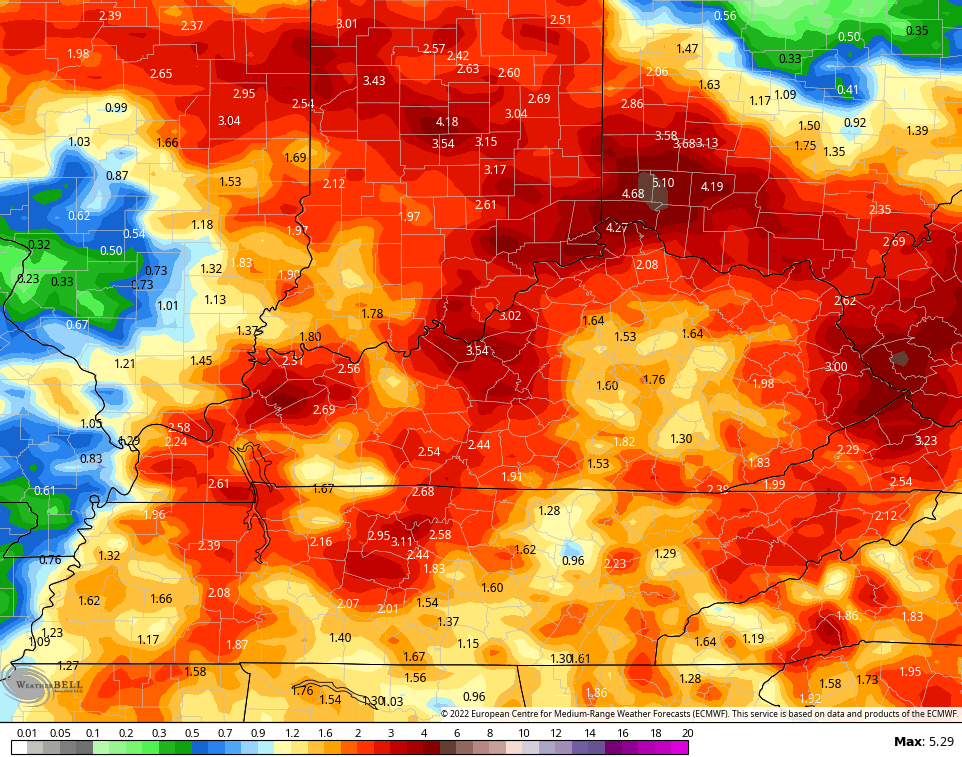
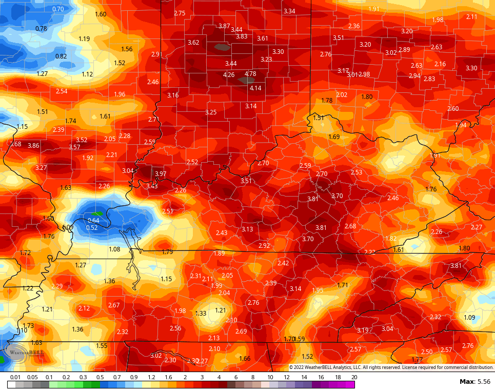
The forecast models continue to pick up on the heavy rain potential during this time…
EURO
GFS
This is the flash flood season in Kentucky and we need to be on guard for that potential folks.
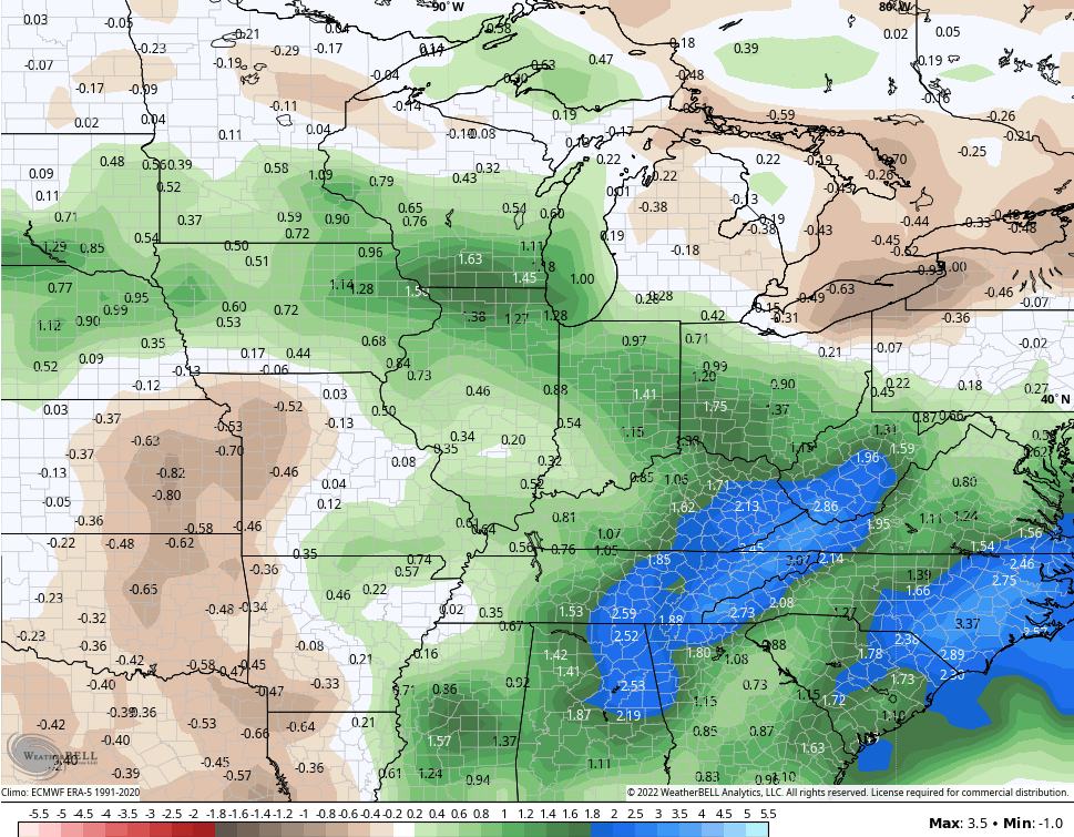
The GFS Ensembles continue to highlight a much wetter than normal pattern over the next two weeks…
I will have the latest on WKYT-TV starting at 4pm so tune in as I track the severe threat and the heat wave. As always, I have you all set to track any severe weather out there today…

Current watches

Possible Watch Areas

Make it a great Tuesday and take care.

Wake me when it’s fall…
These past several weeks haven’t panned out as hoped. Looks as though the Euro may have been on to something.
https://kyweathercenter.com/?p=53708
I could use a couple of inches of rain thru this week.
If you have to stay indoors it might as well rain.
The enhanced strength of the High Pressure Ridge now centered to our Southwest shows tendencies of translocating farther West and may bring the Ohio Valley some relief from the Heat by the week’s end ?
Rains we received last week in Taylor County have helped out with the crops in the area, but the plants are still enduring much stress going to mid Summer.
Another type correction : going into mid summer.
Latest Drought information across the Country from the NWS : https://www.weather.gov/media/lmk/climate/drought/Drought_briefing.pdf
that bluegra-s-s airport thermometer… I know it’s hot and dry out…but I dunno…it’s way up there. It showed 90 before 11 am…Now it’s 96…. Each day it’s like 4 degrees above the mesonet.
Just finished looking at our temperature on the Mesonet and it read 95 degrees. We had a puny rain shower earlier this afternoon and we’ll take every drop Mother Nature wants to give us.