Good Monday, everyone. Rounds of showers and storms continue to push across the region today, bringing high water concerns for some. This action kicks off a steamy week of temperatures as a surge of heat builds in from the southwest.
Waves of showers and storms have put down a lot of rain since Sunday and we have more to come today. While the focus shifts farther east and southeast through the day, we will still be on guard for local flash flooding issues to develop.
Here are your Monday radars to follow today’s action…

Today’s clouds and rain will keep temps in check.
Today’s rain will be a player in what happens with the heat of the next few days. With a wetter ground, this should help temper the temps to some extent. Of course, that will also add some to the humidity and heat index numbers.
Highs Tuesday range from the upper 80s central and east to 90-95 in the west. Temps surge into the 90s for the entire state on Wednesday with some upper 90s possible in the west.
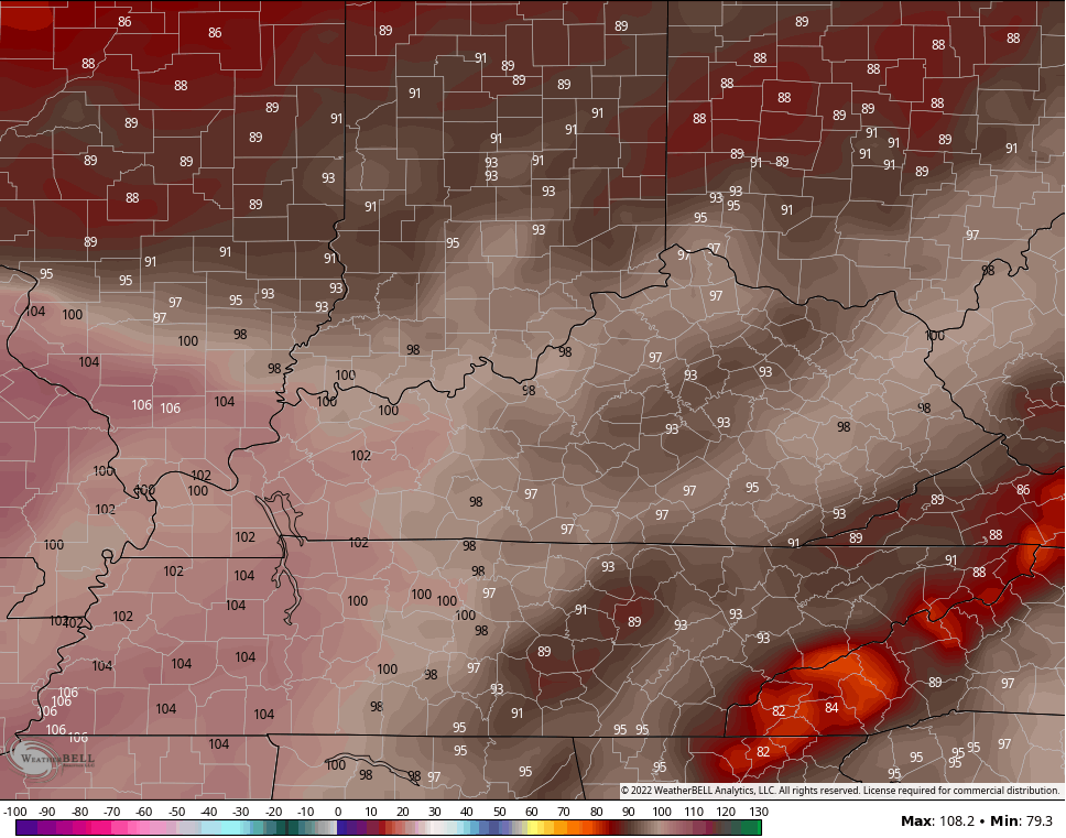
The GFS continues to be the hottest model of the bunch, but the numbers are coming down with each run. Here’s the model for Wednesday…
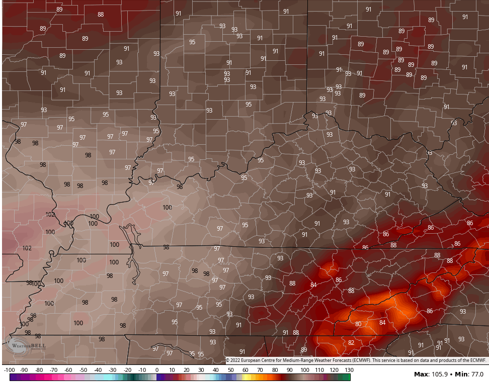
The EURO has a well-documented hot bias, but is below the GFS numbers for Wednesday…
 A cold front sparks some scattered showers and storms late Wednesday and early Thursday and should knock the numbers back down a bit.
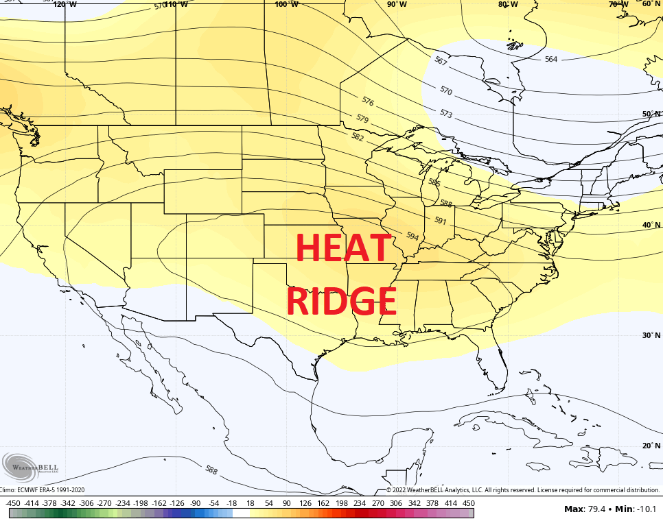
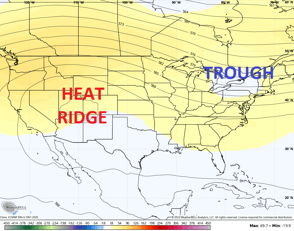
Another shot of heat makes a run at us this weekend as the heat ridge flexes again…
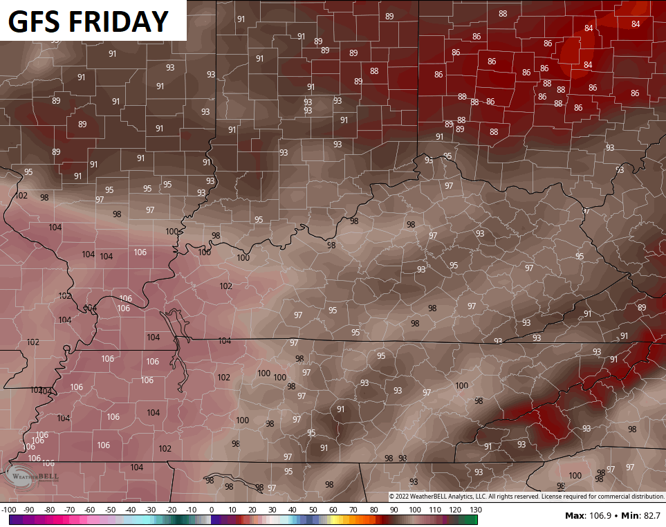
The GFS continues to be off the chain hot with widespread 100s…
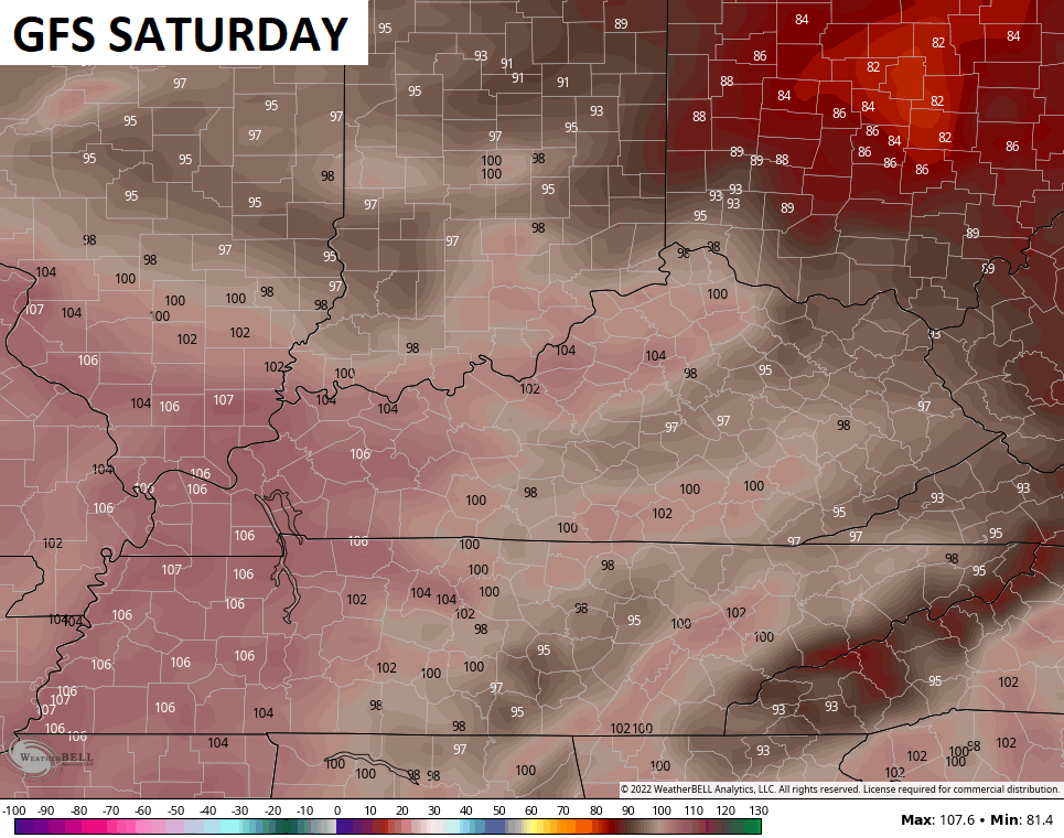
Again, the chances of the temps getting THAT hot are low.
The EURO numbers are cooler for both days…
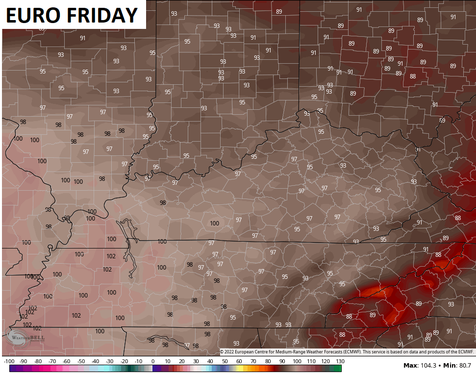
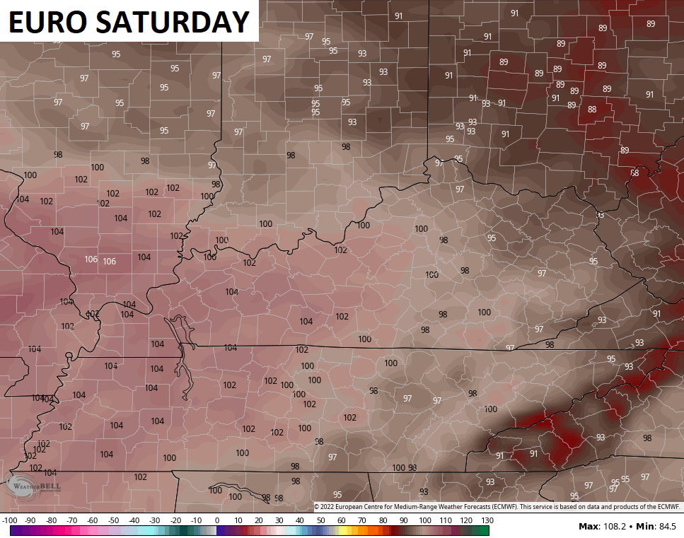
Obviously, cooler is a relative term as both days are hot, hot, hot. That said, the hot bias of the model has to be taken into consideration.
Moral of the heat story… It’s going to get hot and likely really hot for a few days. Seeing models forecast near all time record highs for various cities is just not likely to verify. They were doing the same thing a few weeks ago and they didn’t come close. Now, we have a wetter ground to work with.
The good news is that the heat ridge looks to migrate back toward the west later next week…
Make it a great Monday and take care.

We finally received 1.03 inches of rain in the past 48 hours. I’m hoping there is more to come before that hot evil ridge progresses eastward towards the Ohio Valley.
We should be able to get indications on how the Autumn and Winter may turn out late in the month of August.
Are there going to be changes in the Tropical Pacific regarding ENSO with the PDO going positive or remaining negative ?
Interesting that the EURO’s temps are actually lower than the GFS for Fri and Sat. Normally, they seem to be the higher of the two.
Take the European weather model and the American weather model and record their temperatures in the same location. Add the two temperatures together, divide by two and you will get a high temperature that’s more logical. LOL….