Good Sunday, folks. We continue to see an increase in showers and storms across the Commonwealth today as this action continues into Monday. A few of the storms may be strong and put down enough rain to cause local high water issues.
A wavy front is stalled across the region today with low pressure rolling along it into the Ohio Valley on Monday. Rounds of showers and storms will fire up during this time and roll from west/southwest to the east/northeast.
The potential is there for some of the storms to be strong or severe, but this doesn’t look widespread. Here’s the low-end Severe Weather Outlook from the Storm Prediction Center…

I’m also concerned about areas of very heavy rainfall that can cause flash flooding conditions to develop. Keep that in mind through Monday.
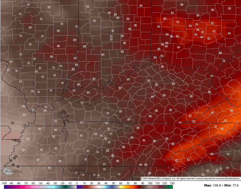
As the rain pulls away, our temps take off for Tuesday and Wednesday. Temps can get really toasty on Wednesday, and we continue to see the GFS as the hottest of the bunch, but that’s been a trend we’ve seen quite a bit of recently.
The GFS is showing temps deep into the 100s across western Kentucky with 100 in the east on Wednesday…
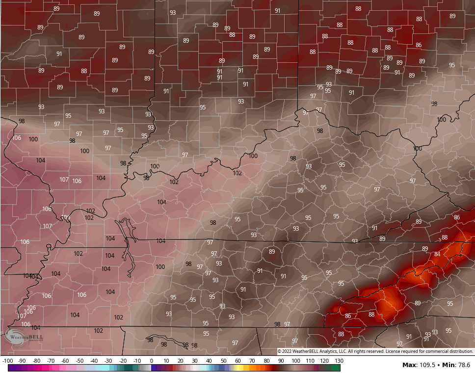
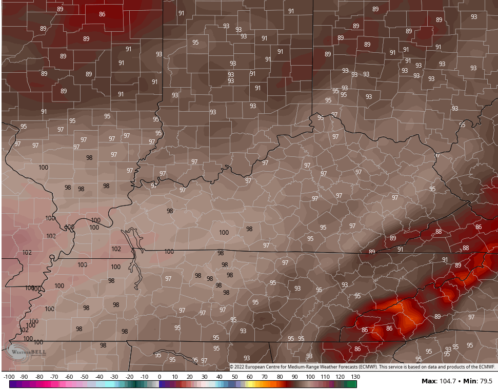
We know the EURO is extremely biased with heat, but it is under the GFS numbers…
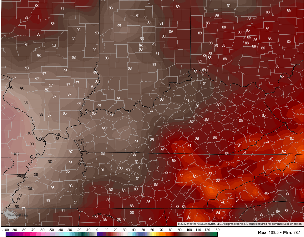
The Canadian is well below each of them…
Wednesday will be a hot and steamy day, but it takes a lot to get widespread 100 degree temps. That’s especially the case if we get soaking rains later today and Monday. If not, areas with a drier ground will be hotter than everyone else, by far.
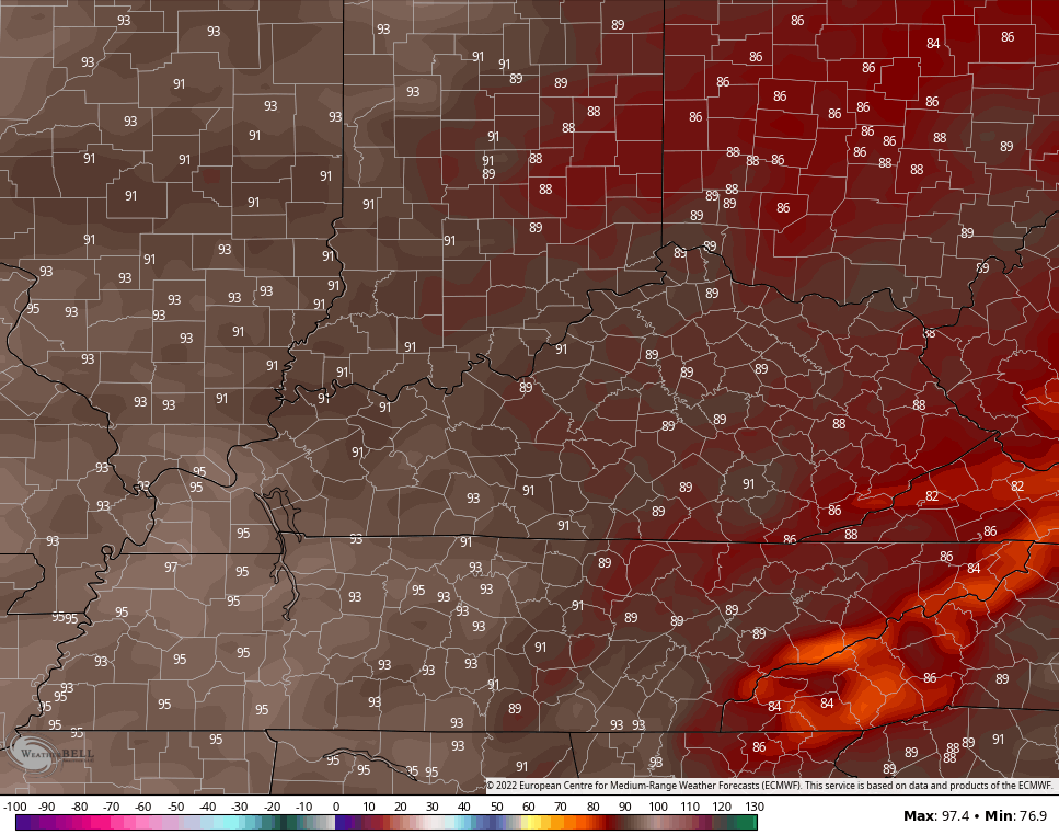
A cold front drops in with scattered showers and storms Wednesday and early Thursday. Temps come down behind this boundary, but not by a ton. We are closer to normal with upper 80s and low 90s for the end of the week.
Here are the Friday highs from the EURO…
The Cnadian…
Now look at the GFS for the exact same time…
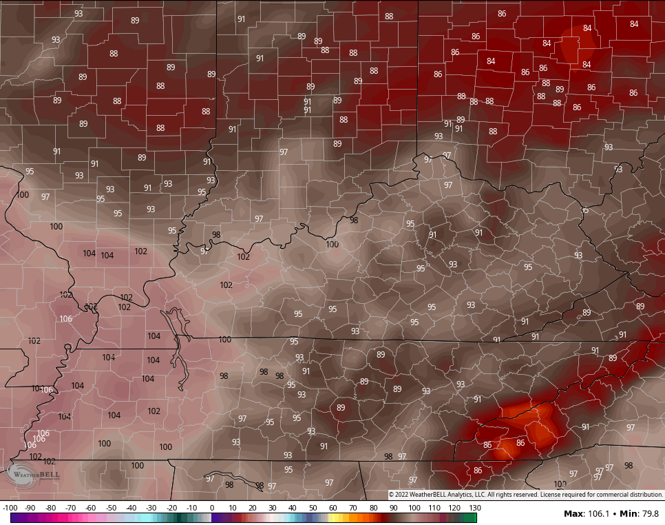
The GFS is on steroids, folks. Some of the extended runs have 120 degree temps in the plains for the following week… Something highly unlikely. It’s gonna get hot, folks, but be careful of models showing all time record heat.
I leave you with all your rain and storm tracking tools for the day…

Current watches

Possible Watch Areas

Have a good day and take care.

Enjoy the temps over the next couple of days before the extreme heat settles upon us.
Crazy summer so far.
Good soaking rain going since this morning here in western ky. Looks like it may last well lat afternoon the way the Rader looks
Not one drop of much needed rain in my county of Taylor. Still hoping and praying we receive at least an inch of rain later, but I think the ridge is holding the front to my North ? Glad the Farm Fields to my North and West are receiving a good soaking rain so the Agriculture Industry won’t be a total loss.