Good Saturday, everybody. We’ve made it to the weekend and we have showers and storms getting ready to increase as a system drops in from the northwest. This will be followed by some steam working in for the week ahead of us.
Let’s start things out with what’s going on out there today. Temps range from the middle 80s to low 90s across the Commonwealth. There’s the chance for scattered showers and storms to go up, but much of the day is likely dry. Here are your radars to follow whatever is out there today…

A slow-moving low then works into the region later Sunday and passes through here on Monday. Rounds of showers and storms appear likely with a leftover shower or storm into Tuesday. This shows up well on the EURO…

Rounds of showers and storms will kick in and we are likely to see some pretty good rains out of this. We will have to be on guard for local high water issues in this kind of setup.
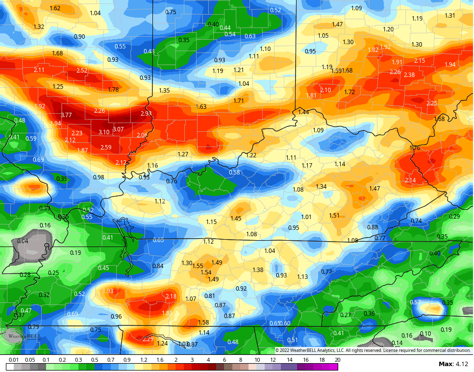
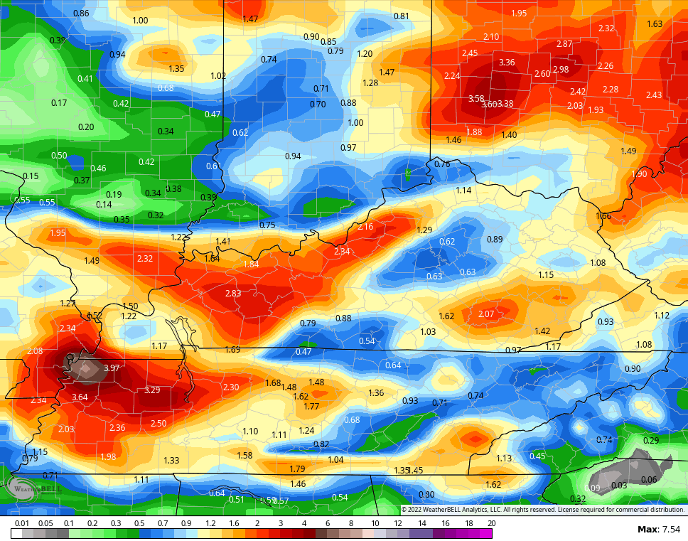
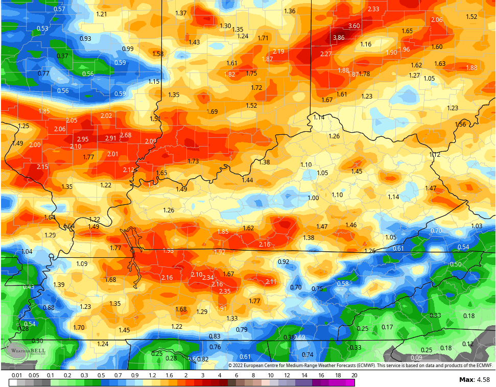
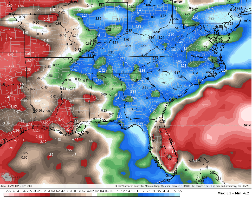
Here’s a check of the rainfall numbers from the forecast models…
NAM
GFS
CANADIAN
EURO
Temps surge into the 90s behind that departing system with Wednesday looking especially toasty. That’s ahead of another cold front that should knock the numbers down a bit for the end of the week.
Yesterday, we talked about how the ridge should flex on us next weekend before retreating to the western part of the country. That’s likely to hang there as we head into August and would open us up to more rain and storm action.
The EURO Weeklies show rainfall above normal through August 28th…
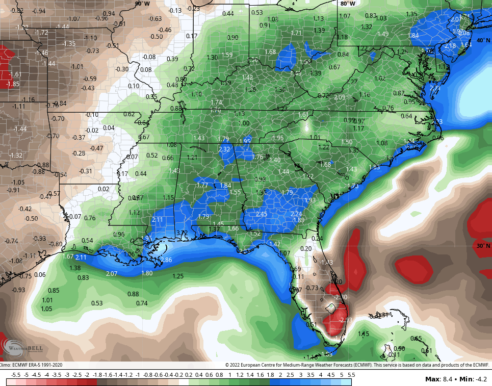
That’s an average of 51 members. The single run of the EURO Weeklies are even wetter…
Let’s wrap up summer on a wetter and cooler note then let’s get fall rolling!!! Who’s with me?!!!
Have a great Saturday an take care.

Next week’s heat wave will be more humid due to the fact that the ground will be more moist.
I hope the ridge does stay to the west.
Although west doesn’t need the extreme heat neither.
I haven’t heard anything about the Tropics so I presume nothing is shaking out in the Atlantic Ocean.
Thanks Chris, hoping and praying that this rain event forecast over the next few days is widespread and not just scattered showers ?
Ready for Autumn weather but, will it be wet and cooler or just the opposite ?
I would be very surprised if the Tropical Atlantic and the Caribbean stay inactive over the next few months.