Good Friday, folks. We’ve made it to the midway point of July and our summer pattern is going to try to flex again. Scattered storms and some steam is on the way for the weekend and into next week. Yes that’s a bit of a change from my last post. 🤷♂️
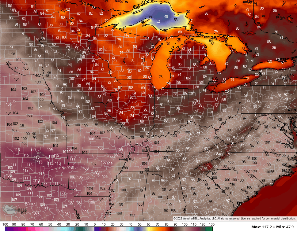
Temps today reach the upper 80s to low 90s for most areas with the west being the hottest, as usual. Humidity levels will still be held in check, so it’s going to be another comfy day in that regard.
There’s a very small threat for a shower or storm to go up, but most stay dry. Here are your radars to follow some popcorn…

Saturday features a small storm chance with temps back in the upper 80s and low 90s with isolated showers and storms. Storm chances will then increase Sunday into Monday…

That system now looks to zip through quicker and that leaves an opening for the plains heat to shoot in here for the middle of next week. All the models have really been ridiculously too hot with the medium range forecast numbers, but it’s worth noting the GFS is up there for Wednesday…
Another system tries to drop in from the northwest by the end of the week, but the GFS and EURO aren’t as strong with this. The Canadian still has a decent look…
Another blast of heat of may try to surge back in here behind that next weekend. Check out the heat ridge building on the EURO Ensembles…
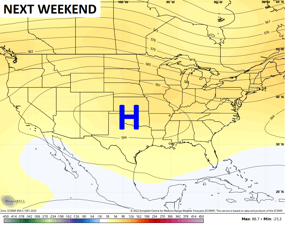
But… But… Watch what happens to that a few days later…
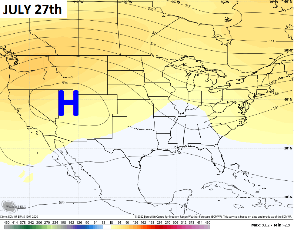
That heat ridge goes back to the west with a trough developing in the east.
Enjoy your day and take care.

It seems a though I remember more than a few years in which our summer dryness was offset by a timely bowling ball of tropical moisture from the Gulf. Except for the unfortunate damage to our coastal areas, that would be nice about now.
Thanks Chris, I agree, those high temperatures are ridiculous, especially in Eastern Kentucky and on East. Yesterday, late afternoon we received a rain shower that amounted to ‘ three drops on a brickbat. ‘
Not looking forward to the awful heat returning next week and hoping the model’s forecast pans out and the strong high pressure ridge moves back west so a trough may form in the Ohio Valley giving some relief.
Not unusual for the Tropics to be inactive even in a La Nina Summer.