Good Thursday to one and all. Our pleasant mid-July temperature pattern rolls on as another weak system drops in from the north. This can kick off a storm or two, but there’s a much better chance for storms to fire up this weekend into next week.
As usual, we begin with what’s going on today. As mentioned, there’s a small threat for a shower or storm to go up with the best chance in the central and east. Whatever is out there won’t be much, but it will show up on your friendly radars…

Friday looks mainly dry with mid and upper 80s central and east with low 90s in the west. Humidity is still pretty low, so things are comfy.
Some of the models are showing a cluster of storms dropping in from the northwest Friday night into Saturday morning. The EURO is one such model…

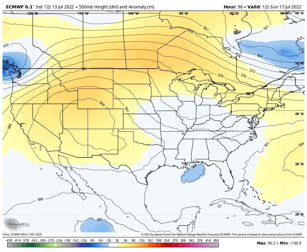
From here, we see a fairly amplified pattern taking shape this weekend through next week. Check out the upper level setup showing a few troughs cutting off around here…
There are worse patterns to have this time of year, folks. That one isn’t a hot one at all and is one that can deliver more clusters of showers and storms. Check out the animation from the EURO starting this Saturday and going through next week…

That’s another setup to bring more in the way of healthy rains to the Bluegrass State.
Enjoy your Thursday and take care.

Not bad at all, if it plays out.
Thanks Chris, my county of Taylor has only received 1.38 inches of precipitation so far in July according to the Kentucky Mesonet. Other counties around the State have received adequate moisture to help with Agricultural requirements. I hope this continues to be only a ‘ pocket drought’ and does not become a ‘widespread drought’ later in the Summer into Autumn ?
Temperatures over the past few weeks have been mostly normal for my area of Kentucky. I’m hoping the ridge of high pressure stays west of the Ohio Valley, but there are indications the ridge may’ nose’ it’s way east into our area according to the extended forecast.