Good Wednesday to one and all. It’s a very nice pattern settling in for the rest of the week with fairly pleasant temps rocking the region. The setup then changes by the weekend with the increasing potential for a stormy look this that may roll into next week.
There’s still the chance for a shower or storm across the far south and southeast early today. Your regional radars will find anything that’s leftover…

With a bit of a northwest flow aloft, there’s the chance for a stray shower or storm to go up tonight into Thursday…

The pattern after that will feature a better shot at storms by the time we make it into the weekend and into early next week. Tropical moisture from the Gulf creeps in and interacts with a few systems dropping in from the northwest. The end result would be periods of showers and thunderstorms. Check out

Some of that moisture seeps in from the tropical disturbance along the Gulf Coast…

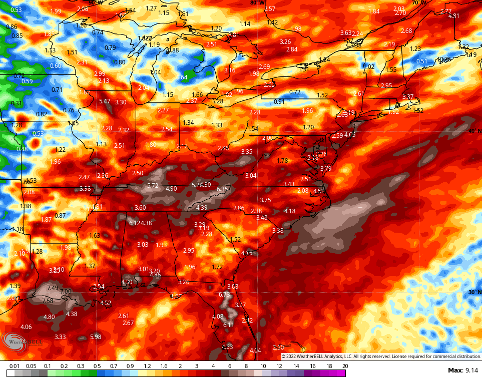
The GFS is really enthusiastic with rainfall amounts over the next 2 weeks…
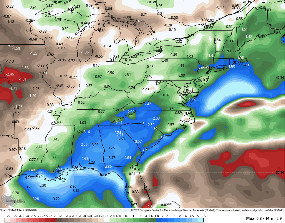
That’s a wetter than normal look we also see coming from the EURO Weeklies. This goes through August 25th…
Have a happy Wednesday and take care.

Thanks Chris, glad to see the American and European Weather Models agreeing on drought breaking rainfall over the next few weeks. Now, we’ll to wait and pray that Mother Nature delivers ?
In the above comment, omit ( to ) in the last sentence.