Good Tuesday, everyone. We have a cold front rolling across the state today and it’s bringing a few showers and storms with it as a fresh brand of comfy air blows in for the rest of the week. The weekend looks to offer something else up as storms look to increase.
Today’s front doesn’t have much moisture with it, but it can produce a broken line of showers and storms from north to south. There is a small chance for some of these storms to be on the strong side, especially in the east and southeast.
The Storm Prediction Center has a low-end risk for areas to the east…

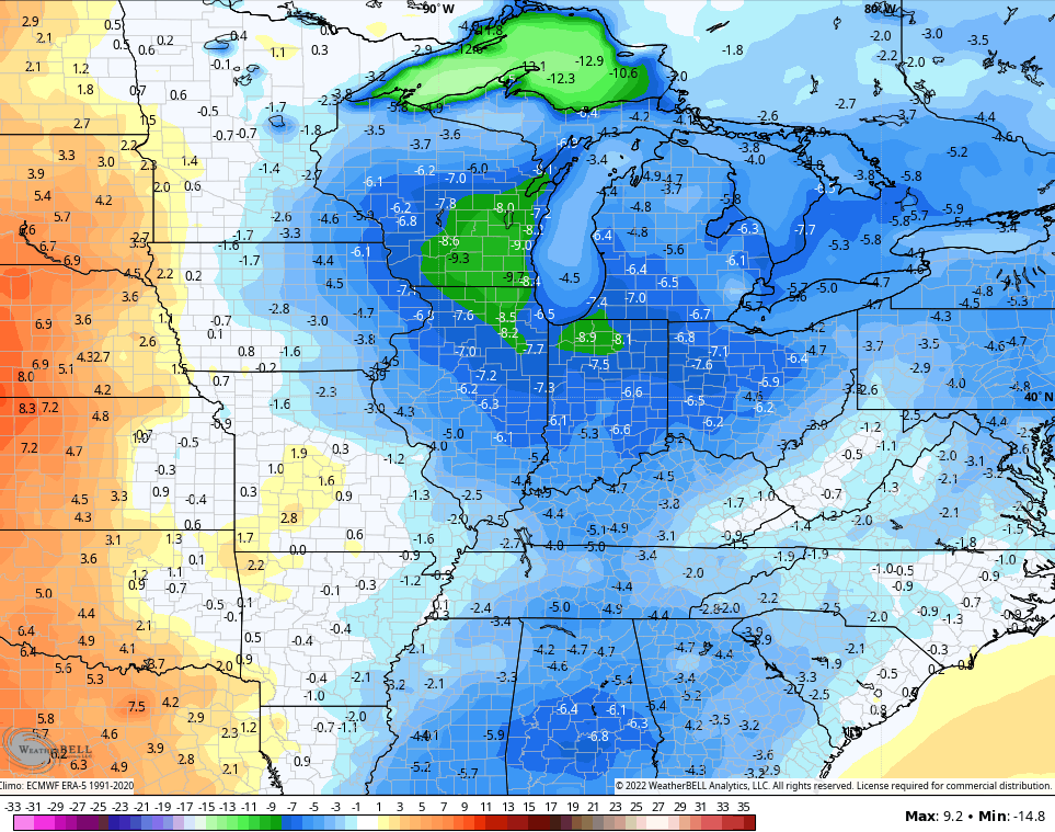
Temps will run cooler than normal behind this front with fairly nice weather through the end of the week. Check out the next 5 days of cooler than normal…
At the same time, a system along the Gulf Coast has a chance to develop into something tropical…

The EURO is most bullish on the development and lifts it across the deep south and toward the Carolinas. We may get a little bit of offshoot moisture from this to interact with a system dropping in from the northwest this weekend and early next week…

The GFS has a similar thought process without being as wrapped up with the tropical system…

You can see how both models bring the potential for decent showers and storms into our part of the world.
This setup also acts to keep more of a trough into the eastern half of the country from the weekend into next week. That would keep the serious heat well to our west…
GFS

CANADIAN

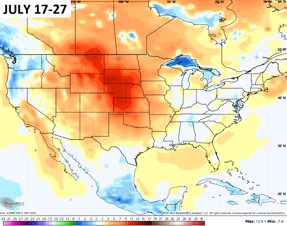
The GFS Ensembles have also really backed off on the heat. Check out the 10 day averages relative to normal…
Y’all know the drill, I leave you with your storm tracking toys for the day…

Current watches

Possible Watch Areas

Have a terrific Tuesday and take care.

Good to see that the heat is going to have to wait.