
Good Tuesday to one and all. We have a very chilly air mass in place for the closing days of September and we now have a full blown Green Thumb ALERT tonight and Wednesday morning. Patchy frost is possible for much of the region as temps reach the 30s.
As we are tracking the patchy frost potential, Hurricane Ian is getting close to a Florida landfall on Wednesday. What’s left of that may very well impact our weather by Friday or into the weekend.
Let’s begin with today’s chilly temps. Highs are only in the 60s with a mix of sun and a few fair weather clouds drifting in. With clearing skies and winds slowing down tonight, temps will drop into the middle and upper 30s for many areas…

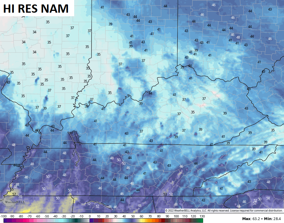
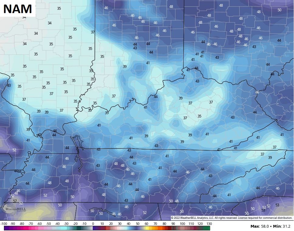
That sets the stage for another chilly day on Wednesday as highs are back into the 60s.
Thursday starts with another threat for patchy frost and temps in the upper 30s and low 40s. Highs are generally in the 65-70 degree range for another fantastic fall day.
Hurricane Ian continues to spin in the eastern Gulf of Mexico and has a date with Florida…

This thing as deepened rapidly over the past 24 hours or so, but may weaken some before it comes ashore.
This is an updating map from the National Hurricane Center that shows the current status and track forecast for Ian…

Here’s a look at the latest spaghetti plots from the Hurricane Models…

The latest track from the individual runs that make up the GFS Ensembles…

While the remnants of Ian may very well impact our weather, the exact inland track of the storm is the determining factor of that. It may be another day or so before we can fully figure that one out.
Have a terrific Tuesday and take care.

No mention of Frost in my local forecast tomorrow morning, but can’t say it won’t happen in the low lying areas. If I had some tender tropical plants or late garden plants like green tomatoes it would be a good idea to bring the tropical plants in for protection and pick the green tomatoes and put them in the frying pan.
Hurricane Ian is a’ Monster’ of a storm ( category 3 ) with a perfectly defined eye and is expected to make landfall somewhere in South Central Florida. Hurricane warnings are out for dangerous Storm Surge. Tornadoes always a possibility in isolated areas of the Sunshine State.
Too early to tell how the remnants of Ian will affect our weather here in Kentucky. Could be just a wind shift to the Northeast or scattered areas of rain especially in Southeastern parts of the state of Kentucky. My local forecast is calling for only a 40 % chance of coverage for Saturday. We really need Rain badly in my area. The driest I’ve seen it here for a longtime. The Wildfire danger is becoming very very serious for my county of Taylor.
Even though Ian is passing over Western Cuba, it should maintain its strength and will continue to build intensity when the eye is once more over open water. That’s because the waters surrounding Cuba into the Gulf of Mexico are some of the warmest on our planet, 85° to 90°F. Only the Persian Gulf and the southern Red Sea are warmer.
I have also attached an interesting view of Ian, utilizing MIMIC (Morphed Integrated Microwave Imagery), which shows its progression over a 24 hour period.
https://tropic.ssec.wisc.edu/real-time/mimtc/2022_09L/web/basicGifDisplay.html
It is one of the tools available on NOAA’s Tropical Cyclones site:
http://tropic.ssec.wisc.edu/
Schroeder, I wanted to share a different type of radar view for Ian, which uses Morphed Integrated Microwave Imaging (MIMIC). The most recent version show the storm approaching the SW Cuban coast, and you can really see how the bands tighten up as 5he storm intensifies:
https://tropic.ssec.wisc.edu/real-time/mimtc/2022_09L/web/displayGifsBy12hr_05.html
MIMIC is part of the Tropical Cyclone page from the University of Wisconsin:
http://tropic.ssec.wisc.edu/
If Ian loses any steam over Cuba, it should puck right back up and we could possibly see additional intensification, since the water temperatures between Cuba and the Florida west coast are some of the warmest on the planet. Only the Persian Gulf and the southern Red Sea are warmer. I believe Category 4 is a real possibility, but it’s likely to come ashore between Naples and Tampa as a Category 3, which could still pack a 15-20 ft storm surge.
Thanks for sharing your radar findings, very interesting Joe. Just got off the phone with my older Sister and her Husband. I called them because they live about 60 miles South of Sarasota, Florida and I told them they would have to evacuate due to their location. They live only about 10 minutes from the Gulf. They told me they had just put up the Hurricane Shutters and they will be heading inland to wait out the Storm. I’m hoping and praying they will both be safe.