Good Monday to one and all. We have an early season frost threat taking shape this week as another big blast of fall engulfs the region. At the same time, it’s all eyes on the Gulf of Mexico where Hurricane Ian is making headlines. What’s left of Ian may impact our weather by Friday and into the coming weekend.
Let’s start with the crisp air surging in here today. Winds are gusty with temps ranging from the upper 60s to low 70s for most of the region.
Even chillier air moves in for Tuesday, Wednesday and Thursday. Highs in the 60s will be common with overnight lows making a run into the mid and upper 30s for some by Wednesday and Thursday.
Here are the forecast lows for Wednesday…


As this is happening, Ian is in the process of going from a Tropical Storm to a Hurricane as it approaches the western tip of Cuba. This storm is moving into a region very favorable for rapid intensification today through Tuesday.
Here’s the updating satellite view of Ian as it strengthens…

Ian should become a Major Hurricane of Cat 3 or greater status through the middle of the week, but may try to weaken some before it moves ashore somewhere in Florida. This is an updating map from the National Hurricane Center that shows the current status and track forecast for Ian…

Here’s a look at the latest spaghetti plots from the Hurricane Models…

The latest track from the individual runs that make up the GFS Ensembles…

The operational models are still showing the usual differences with their respective tracks, but they continue to bring some rain from Ian in here by Friday and taking us through the weekend. The EURO is the farthest west with the inland track…

The Canadian is pretty close to that same inland track into our region…

The GFS is the farthest east, but still brings rain into eastern Kentucky…

Obviously, Ian having a direct impact on our weather isn’t set in stone or even close, but you can see the chance is certainly there.
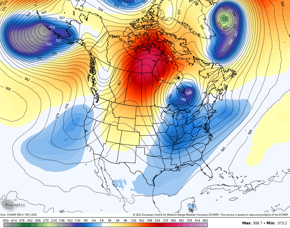
Regardless, another deep trough likely digs in as Ian leaves the stage…
Have a great Monday and take care.

What a strange movement for hurricane remnants…Usually when we get remnants it’s when the hurricane hits TX/LA and curves back up to the Ohio Valley.
I like the euro it has been dry at my house over the last 30 days.