Good Sunday to one and all. It’s a super windy day across the region as another strong cold front works through here. This is bringing scattered storms and another blast of chilly air for the week ahead. It’s one that has a chance to produce some patchy frost.
While all that is happening, a hurricane is likely to be threatening the eastern Gulf Coast states and it has a chance to impact our weather.
Let’s start with today’s front and roll forward. Winds are cranking to 30-35mph at times with this system. Temps spike deep into the 70s and may hit 80 in the west and south before the front arrives. There isn’t a ton of moisture with this, but it is just enough to produce scattered showers and storms. Here are your radars to follow along…

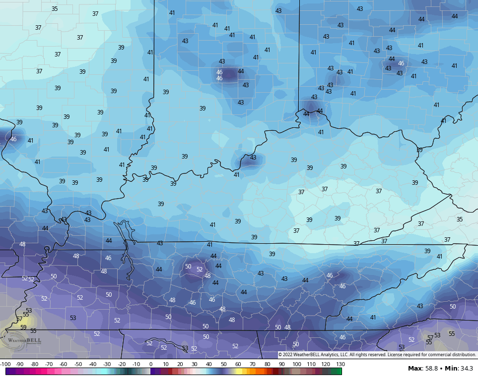
Temps in the coming days will come way down with highs in the 60s on more than one occasion. Lows by Wednesday and Thursday mornings can drop into the 30s if skies are clear…
Tropical Storm Ian continues to strengthen in the Caribbean and will become a hurricane by Monday. The track on this continues to trend farther west…

That’s something we’ve been seeing with the operational models for a while now. The farther west this gets in the eastern Gulf, the better chance it has to impact our weather later in the week or next weekend.
The GFS and Canadian share a similar line of thinking…
GFS

CANADIAN

The EURO has been way too far east but is starting to shift things farther west…

The overnight run of the Hurricane Models have also shifted farther west…
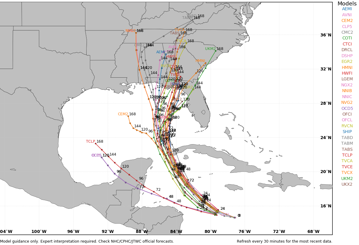
As you can see, the potential is there for Ian to impact Kentucky We will have to wait and see just how much of an impact that is.
Have a great Sunday and take care.

Again if the models is correct looks like my area will be sparse fron Ian rainfall. Time will tell
I was happy to pick up some rain this morning.
It has been quasi- dry over the past 30 days