Good Saturday, everyone. We have another fall storm system rolling across the region this weekend and it’s going to unleash another blast of chill for the final week of September. That may even bring an early season frost threat with it. All this happens as the tropics run wild and we will get you updated on what’s going on there.
Ok, let’s start things out with what happened yesterday. I threw out the potential for some upper 30s to show up on Friday morning and that’s exactly what happened…
We had our first upper 30s of the season on this first morning of fall! Check out the top 10 coldest numbers from the Kentucky Mesonet. #kywx pic.twitter.com/dFMwGNiKGI
— Chris Bailey (@Kentuckyweather) September 23, 2022
It’s nowhere near as cold this morning as clouds keep temps into the 50s for many. These clouds are also spitting out a few showers or storms, but this isn’t terribly widespread. Here are your radars to follow along…

The threat for showers and storms will increase a bit overnight into Sunday as another fall system sweeps through here. Once again, this isn’t terribly widespread.
The air coming in behind this for next week is even chillier than what we just had and may even give us the chance for patchy frost by the middle of the week. Check out these forecast lows…
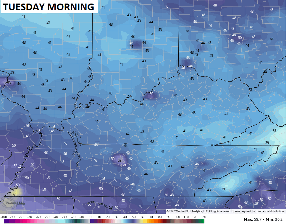
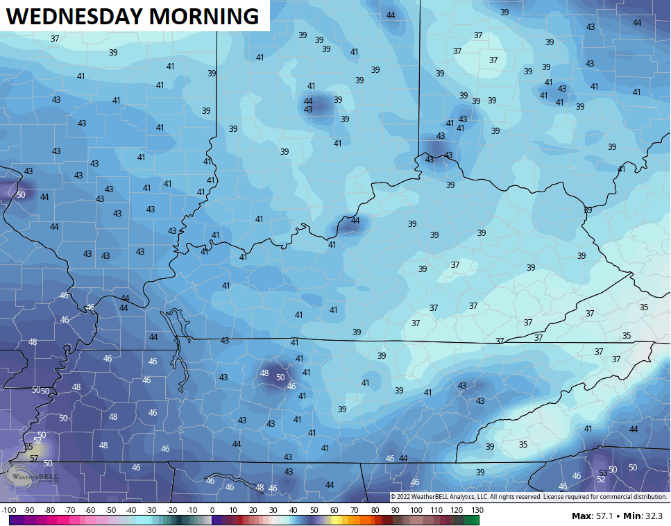
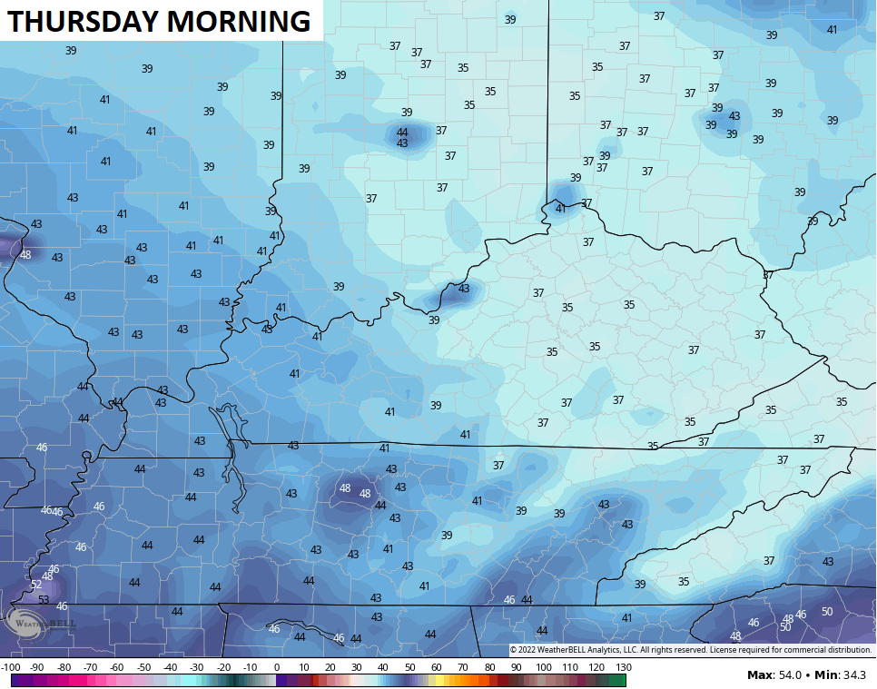
Highs will run in the 60s for many during this time.
Let’s take a little trip to the tropics because things are absolutely nuts. Hurricane Fiona is slamming into Nova Scotia today and is likely making history as the strongest storm on record for Canada…

Don’t forget to use the interactive radar and zoom in on Fiona. You will also be able to see live storm chaser cams in the path of the powerful hurricane.
A Tropical Storm is developing in the Caribbean and will move across the western tip of Cuba and into the eastern Gulf of Mexico early next week. A major hurricane is likely to impact the Gulf Coast of Florida. Here’s the official track from the National Hurricane Center…

The various operational models continue to show the usual variance from run to run and model to model…
GFS

CANADIAN

EURO

Make it a wonderful Saturday and take care.

All the rain from the Hurricane in the Caribbean is forecasted to be east of I-75.
I tried using the interactive radar shortly after noon Eastern Time to zoom in on the hurricane slamming Nova Scotia, but it showed absolutely nothing – no precipitation, no storm chase cams, just the temperatures.
For some reason it’s not picking up radar images from outside of the continental U.S. My radar app shows that Fiona is northeast of Prince Edward Island, moving into the Gulf of St. Lawrence.
It was forecast to be 81 today, it ended up 89 in my world here in far western ky. Some day we will break this drought it’s matter of time.