Good Saturday to one and all. We have a cold front working across the state today and this is bringing the chance for a few showers and storms through Sunday. The big news continues to be the blast of cold coming in behind it. That air may challenge record lows in much of the region.
Let’s start things off with today’s weather and then look ahead.
Quite the temp gradient will be noted from north to south today as winds continue to gust up. Temps may not get out of the upper 50s in the far north while the far south hits the low 70s. Areas in between will also be in between in terms of temps.
Most are dry today, but there is the smallest chance for a shower or storm, especially in the south. Here are your regional radars to follow along…

As our cold front drops in on Sunday, we will have a better chance for some showers and storms. The best chance continues to be across the southern half of the state and the models are in good agreement on this…
NAM

EURO
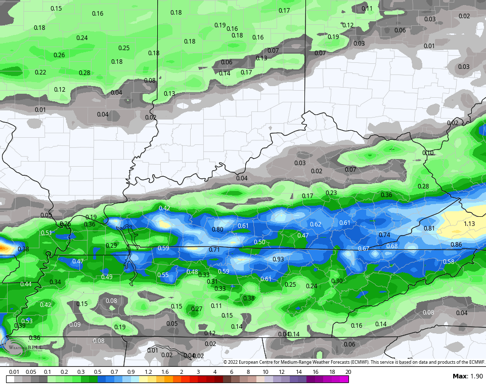
CANADIAN

The GFS is, as always, the most progressive of the bunch and barely has any rain…

As I’ve said, the GFS has some severe biases.
This cold front unleashes a MAJOR cold blast that could challenge all kinds of records around here through the middle of the week. It may also throw snowflakes as close by as the high ground of the Appalachian Mountains. The NAM tries to bring a snowflake into northern Kentucky Tuesday morning…

EURO

CANADIAN

It cannot be overstated on just how crazy it is to see that kind of pattern in the middle of October.
As mentioned, temps may very well set some records by Tuesday into Wednesday mornings with lows deep into the low and middle 20s…

For historical perspective, 20 degrees is the coldest October temperature on record and those records date back to the 1870s. That 20 degree temp happened in late October 1976. In the past 50+ years, Lexington has only recorded 5 October days with 25 degrees or colder and 2 of those were from 1976. The others were 2008, 1981 and 1972.
Now, in order to get this cold you will need clear skies. Any cloud cover would keep temps would be more in the mid and upper 20s.
Regardless, wind chill numbers will be absolutely frigid…
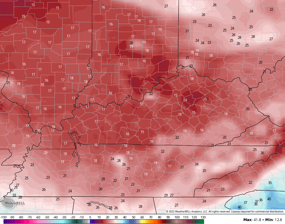
WHEW… that’s brutal for this time of year, kiddos.
Make it a sensational Saturday and take care.

What’s even CRAZIER is a powerful front bringing possibly all-time records has little or no moisture with it. It’s bone dry.
I think we have a better chance to see a snowflake than a raindrop.
Looks dry the next 14 days, but sooner or later the rains or snows will make their presents. Keep that snow shovel handy. Looks like a repeat of 1976-77. Longest, coldest Winter in my lifetime.
That’s the way it was in October 1976. I remember this because I lost my Azalea buds in my nursery by the record cold. I had very little sells in the late Spring 1977. I checked out the hPa 500 7 day and shows this very persistent pattern continuing.