Good Saturday, folks. We have some big time winds blowing across the region today as a strong low pressure wraps up to our northwest. This is part of a setup is growing more active as we get set to make the transition into a more winter looking pattern for the second half of the month.
Let’s start things out with the headlines of today’s active weather:
- Winds will increase from west to east today and should top 40mph for most areas. Some locations may gust to 50mph will be possible. That may cause local wind damage.
- Temps will spike into the 70s for central and eastern Kentucky.
- Showers and a few storms will be rolling across western Kentucky this morning. That line diminishes some as it moves into central Kentucky this afternoon and early evening. That line won’t hit the east until the evening or into the wee hours of the morning.
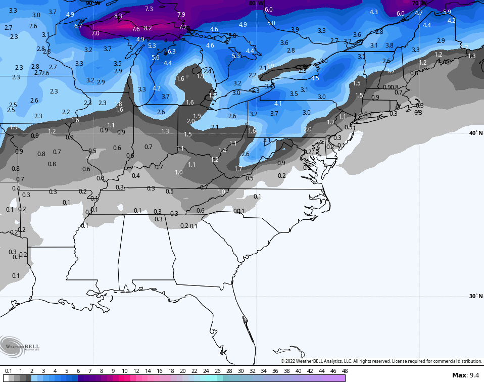
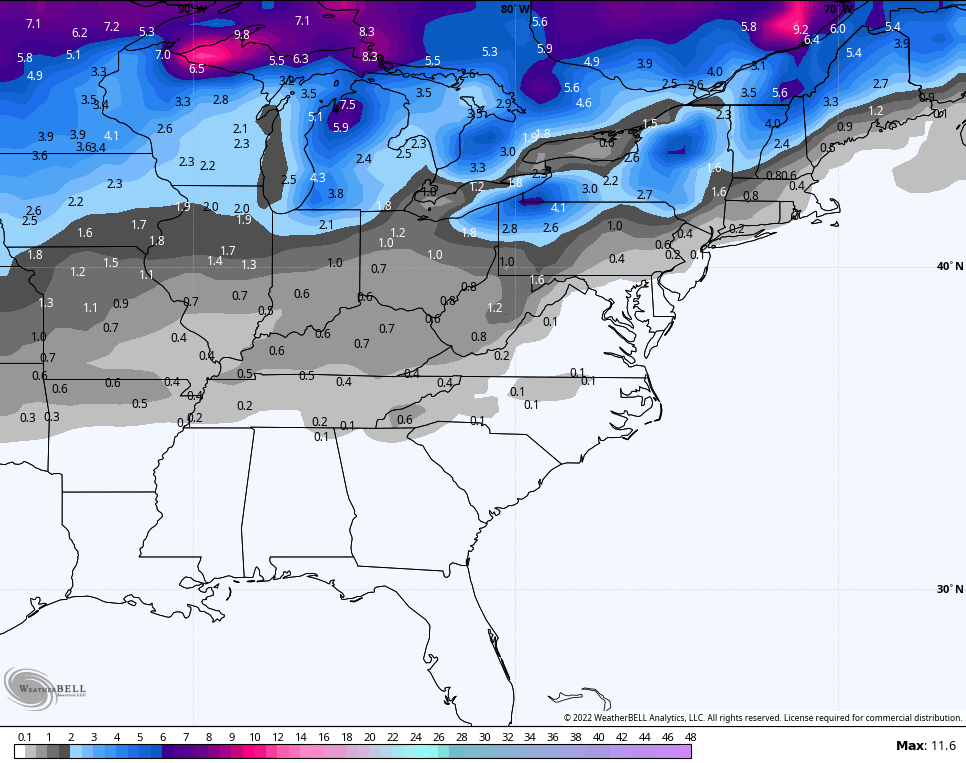
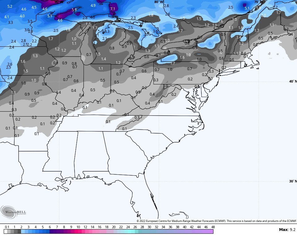
Here are your radars to track this impressive looking line of showers and storms across our part of the world…

A few leftover showers and storms will be noted for Sunday and Monday as temps stay fairly mild. The numbers drop some for Tuesday into Wednesday as high pressure builds to our north and northeast.
All eyes at that point are on two features… A wintertime trough slowly rolling east across the country and a slow-moving system off the southeastern seaboard. The NHC continues to give this system a decent shot at developing into something tropical…

That system works toward the coast by Wednesday and Thursday then backs toward the northwest. At the same time, we have that trough and system coming from the west and this will try to pick up this storm to some extent. Regardless, very cold air looks to sweep in here by next weekend and there’s an outside shot for some flakes.
The Canadian has been showing that chance for a while and continues to do so…

The GFS is now climbing onboard with the flake chance…

The Ensembles are all in on this rapid switch to cold. Look at this 5 day map from the GFS Ensembles showing how far below normal things go…
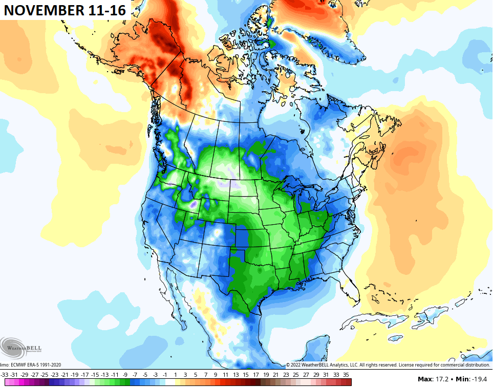
The Canadian Ensembles agree…

The EURO Ensembles have a warm bias, but they’re also showing widespread cold during this same time…

Obviously, the cold isn’t limited to that 5 day window, but I’m using that as an illustration of what’s to come.
Those same ensembles are also showing the threat for some flake chances over the next few weeks…
GFS ENSEMBLES
CANADIAN ENSEMBLES
EUROPEAN ENSEMBLES
I will throw you another update later today, so check back.
Make it a great Saturday and take care.

Thanks Chris, A Strong Interrupted Line of Showers in Western Kentucky this Morning. Looks like a ” Wall of Water ” heading into the Central part of the State, but as you Stated it will Weaken somewhat as it moves East. I like that the High Pressure to our East is keeping Severe Weather out of our Area. Hoping this Pattern Flips soon and we return to Cold Fronts moving way South with Increasing Chances of Decent Rains and Snows later this Month. Just in Time for a Festive Thanksgiving Day.
Sure hope that line of showers holds together, although there are already signs of weakening as it moves into dryer air in Logan County. The humidity at my PWS is currently 70%, which is 17% lower than it was at the same time yesterday morning. I don’t understand why the burn ban in Warren County was lifted yesterday, after we received less than ½” of rain two days ago. The trees in my neighborhood have already lost most of their leaves, building up a ready supply of crisp, dry kindling. Considering that wind gusts of +50 mph are forecasted today in the County, lifting the ban seems a bit foolish,
Burn Ban is still in effect for Taylor County. Last Sunday we received 0.41 inches of Rain. The line of Showers is weakening as expected, but I’m still hopeful. Leaves are falling rapidly and they are prime for burning. Maybe what Rain we receive will wet them down enough for a short time.
Compared to what has been on the radar(0) lately, I will take it. The front has a decent amount of moisture.
Beggars cannot be choosy.
The line of showers has just cleared the Bowling Green area, and my PWS indicates that we received a whopping 0.09″ of rain. Pretty much as expected. The winds did help to separate the remaining leaves from my trees, which is interesting, since this is the earliest date on which all my leaves have fallen in at least 10 years.
Just a few sprinkles here in Maple. Line of showers from this morning really weaken more than I expected. A little more rain may be in my area shortly. This was the earliest leaf drop in several years. When the wind calms down I’ll have to do some raking around the house.
The only thing that’s fallen in SE Lexington today is leaves. Not a drop of rain.
Yell it only sprinkle at my home In Louisville.
Major disappointment.