Good evening, folks. It’s a wild setup taking shape with rain from a former hurricane rolling in tonight and Friday and some light snow coming in behind that for Saturday. This takes us into a rather wintry setup through Thanksgiving week.
Let’s break all this down for you:
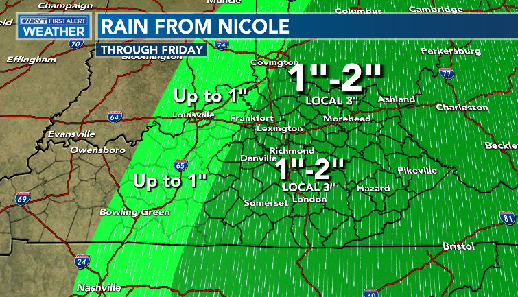
- Rain develops tonight across central and eastern Kentucky and continues into Friday.
- Spiraling bands of heavy rain will impact this area before slowly ending from west to east Friday afternoon and evening.
- 1″-3″ of rain will be noted for much of this region with a quick drop off to lighter amounts the farther west you get.
- Local high water issues can’t be ruled out as the majority of this rain happens in under 6 hours.
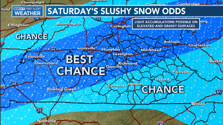
- Cold air crashes in behind this departing system Friday night as another wave of low pressure rolls in from the southwest.
- Light rain and light snow streak through here and there’s even the chance for some very light, slushy accumulations for a time. Wow!
- Northwest winds kick in behind this and that can spit out some flurries or snow showers into Saturday night and Sunday morning.
Here’s what I’m thinking with the rainfall…
I’m making my first snow odds map of the season for this one…
Will this get to First Call criteria? Maybe.
Let’s watch how the models are developing this swath of light snow…
The NAM is pretty aggressive…

The GFS is on board with a healthy band of snow…

The Canadian is similar…

The EURO is a little weaker and farther south…

Another system rolls in with rain and/or snow for Tuesday and early Wednesday. Some models show another system right behind that for next Friday.
Here’s the GFS…

EURO

CANADIAN

It’s beginning a lot like 🎄🎅.
I may throw you a late evening update, so check back. I leave you with your rain tracking tools of the evening…

Enjoy the evening and take care.

Weather history made today in the Chicago area… the high temperature of 76 degrees at Chicago’s O’Hare Airport broke the all-time record high for the date of 75 set in 2020.