Good afternoon, folks. Snow showers and flurries are flying across Kentucky as a weak system zips through the Ohio Valley. This continues to be part of a very cold and wintry pattern across the country.
Those snow showers and flurries out there this afternoon can put down some hit and run light accumulations. There’s even the chance for a snow squall or two showing up, especially in the north. Here are your flake trackers for the afternoon…

Temps continue to run on the very cold side this afternoon and into Thursday with 35-40 being common during the afternoon hours. Another system moves in with some flakes early Friday. That unleashes even colder air for the weekend as temps hit the teens to start and highs that struggle to 30-35 for the afternoon hours.
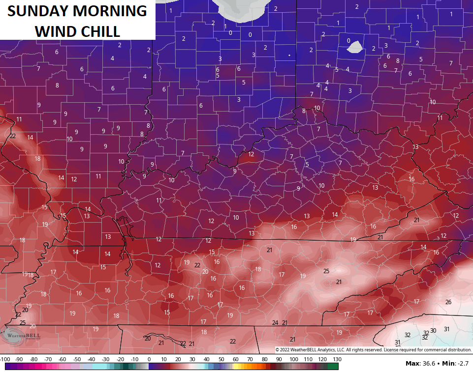
Winds will make it feel MUCH colder, with Sunday morning likely the coldest of the bunch…
Temps moderate early next week, but it’s nothing that’s close to being mild. A shower or two may show up as early as Tuesday with a weak system moving in, but the main system waits until Thanksgiving and Black Friday to arrive.
For a few days now, I’ve talked about how we are likely to get a rain maker with a storm system moving in around the holiday and how that may end as some flakes over the holiday weekend. The operational models continue to flip around with each run and that should continue for a while, but the GFS did spit out a scenario close to my thoughts…

The new Canadian has a similar idea…

Forecast the pattern and the signals, not the models! But, if the forecast fails, blame the models. 😜🤣
I’ll see you guys back here for the evening update. Have a good one and take care.
