Good Thursday, folks. It’s another true blue wintertime day in the Commonwealth as this January pattern rolls on. I have another band of light snow to track before even colder air surges in for the weekend. Thanksgiving week looks to feature changes that include a big storm system.
Let’s start this out with a bit of a warning. We may very well have slick spots out there this morning, especially on bridges and overpasses. Overnight snow showers and squalls put down light accumulations in much of central and eastern Kentucky. One or two snow showers or flurries will hang around early today. Here are your radars to follow along…

The next cold front arrives late tonight and early Friday, and will have a band of light snow or snow showers with it. The Hi Res NAM shows this very well…

That may also put down some very light accumulations for a few spots and may do that around the morning rush hour. That’s something to keep in mind.
The cold coming in behind that is impressive! Lows over the weekend may drop deep into the teens with single digit wind chills possible for some. Look at what the GFS is cooking up for lows and wind chills…
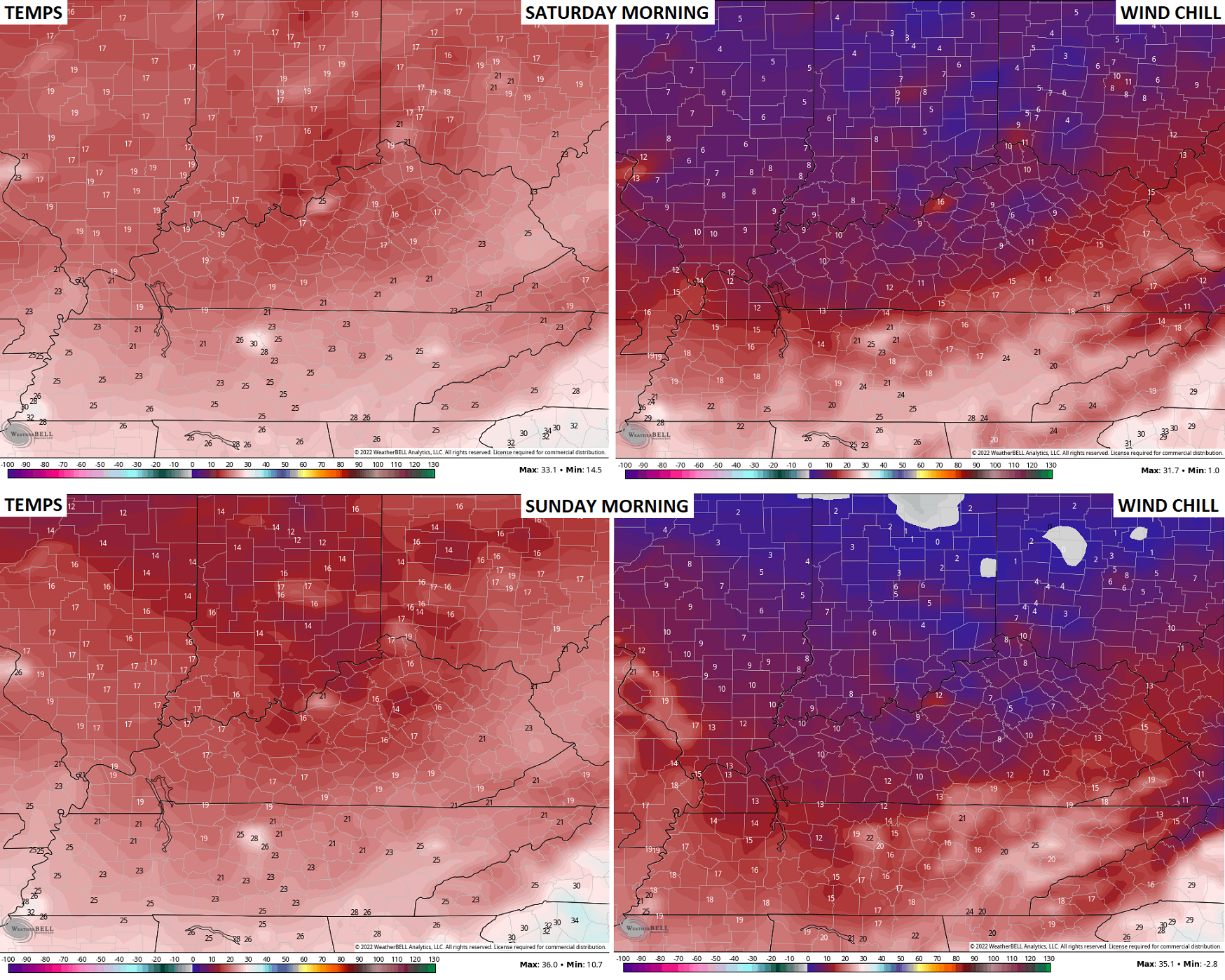
Whoa! I warned you guys it was going to get cold in November, but this is ridiculous!
All this cold going across the Great Lakes is likely to produce historic lake effect snows. Check out the HRRR snow map coming off Erie and into the Buffalo, New York area through Friday evening…
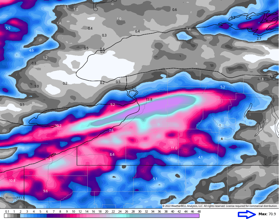
That has a max of right at 71″ of snow! What the holy what?? Surely that’s way overdone… Right?
Temps do rebound some early next week as weak ridging shows up. The pattern is still one that can fire up a major storm across the eastern part of the country. This setup probably has a little more potential than I gave it credit for as we do have the chance to get a phased storm system out of this. If that happens… Things could get rather interesting.
With a lot of moving parts in the upper levels, the operational models are having timing and strength issues with this storm system. I still maintain we have a rain maker to start the long Thanksgiving Weekend, with the potential for some flakes deeper into the weekend as temps crash.
We will continue to see some VERY wild model swings in the coming days, so accept no one model solution.
Here’s the latest GFS…

The Winter Forecast comes your way tonight at 6pm on WKYT-TV. Y’all ready?? 🥶❄️
I will have updates later today, so check back. Have a great Thursday and take care.

Thanks Chris, Looking forward to your Winter forecast this evening. That Arctic Air coming looks to be the coldest of the season so far. I just wish we would get more active in the way of Snowstorms when the coldest air is in place instead of left over Snow flurries as the storms exit. This would make for great conversation, and all the Snow Lovers out there would be happy. Maybe this Snow scenario will happen later, but here in Taylor County we still haven’t received our first Snowflake this season ! However, I will take the Rains anytime to end this ongoing drought before the Spring planting season 2023 arrives.